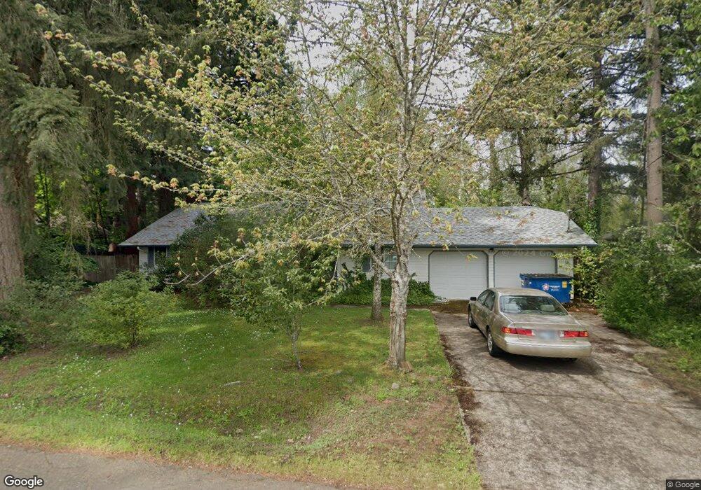
1270 SW Timian St Corvallis, OR 97333
Southwest Corvallis NeighborhoodEstimated Value: $538,000 - $572,000
3
Beds
2
Baths
1,619
Sq Ft
$344/Sq Ft
Est. Value
About This Home
This home is located at 1270 SW Timian St, Corvallis, OR 97333 and is currently estimated at $557,451, approximately $344 per square foot. 1270 SW Timian St is a home located in Benton County with nearby schools including Adams Elementary School, Linus Pauling Middle School, and Corvallis High School.
Ownership History
Date
Name
Owned For
Owner Type
Purchase Details
Closed on
Jul 26, 1996
Bought by
Bakalinsky Irene
Current Estimated Value
Purchase Details
Closed on
Dec 29, 1993
Bought by
Bakalinsky Irene
Purchase Details
Closed on
May 21, 1993
Bought by
Bakalinsky Irene
Purchase Details
Closed on
Jan 29, 1992
Bought by
Bakalinsky Irene
Purchase Details
Closed on
Mar 8, 1990
Bought by
Bakalinsky Irene
Create a Home Valuation Report for This Property
The Home Valuation Report is an in-depth analysis detailing your home's value as well as a comparison with similar homes in the area
Home Values in the Area
Average Home Value in this Area
Purchase History
| Date | Buyer | Sale Price | Title Company |
|---|---|---|---|
| Bakalinsky Irene | $171,500 | -- | |
| Bakalinsky Irene | $139,900 | -- | |
| Bakalinsky Irene | $19,000 | -- | |
| Bakalinsky Irene | $19,000 | -- | |
| Bakalinsky Irene | $16,000 | -- |
Source: Public Records
Tax History Compared to Growth
Tax History
| Year | Tax Paid | Tax Assessment Tax Assessment Total Assessment is a certain percentage of the fair market value that is determined by local assessors to be the total taxable value of land and additions on the property. | Land | Improvement |
|---|---|---|---|---|
| 2025 | $6,277 | $336,585 | -- | -- |
| 2024 | $6,277 | $326,782 | -- | -- |
| 2023 | $5,911 | $317,264 | $0 | $0 |
| 2022 | $5,738 | $308,023 | $0 | $0 |
| 2021 | $5,433 | $299,051 | $0 | $0 |
| 2020 | $5,457 | $290,341 | $0 | $0 |
| 2019 | $4,831 | $281,884 | $0 | $0 |
| 2018 | $4,875 | $273,674 | $0 | $0 |
| 2017 | $4,349 | $265,703 | $0 | $0 |
| 2016 | $4,286 | $257,964 | $0 | $0 |
| 2015 | $4,167 | $250,450 | $0 | $0 |
| 2014 | $4,115 | $243,922 | $0 | $0 |
| 2012 | -- | $229,919 | $0 | $0 |
Source: Public Records
Map
Nearby Homes
- 1140 SW Sylvia St
- 1124 SW Sylvia St
- 1050 SW Timian St
- Parcel #142681 SW Gerold St
- 0 SW Gerold St
- 1123 SW Sylvia St
- 1045 SW 53rd St
- 4149 SW Research Way
- 5318 SW Touchstone Place
- 4651 SW 47th Place
- 615 SW 56th St
- 5636 SW Avena Place
- 6034 SW Grand Oaks Dr
- 5935 SW Philomath Bl
- 4900 SW Hollyhock Cir
- 5961 SW Balsam Dr
- 1080 SW 35th St
- 4942 SW Hollyhock Cir
- 5300 SW Whitby Ave
- 2520 SW Whiteside Dr
- 1340 SW Timian St
- 1230 SW Timian St
- 4835 SW Philomath Bl
- 1255 SW Timian St
- 1235 SW Timian St
- 1335 SW Timian St
- 1356 SW Timian St
- 1210 SW Timian St
- 1225 SW Timian St
- 1375 SW Timian St
- 4830 SW Dresden Ave
- 1355 SW Timian St
- 1162 SW Sylvia St
- 1164 SW Sylvia St
- 1158 SW Sylvia St
- 4850 SW Dresden Ave
- 1380 SW Timian St
- 4835 SW Philomath Blvd
- 1154 SW Sylvia St
- 1182 SW Sylvia St