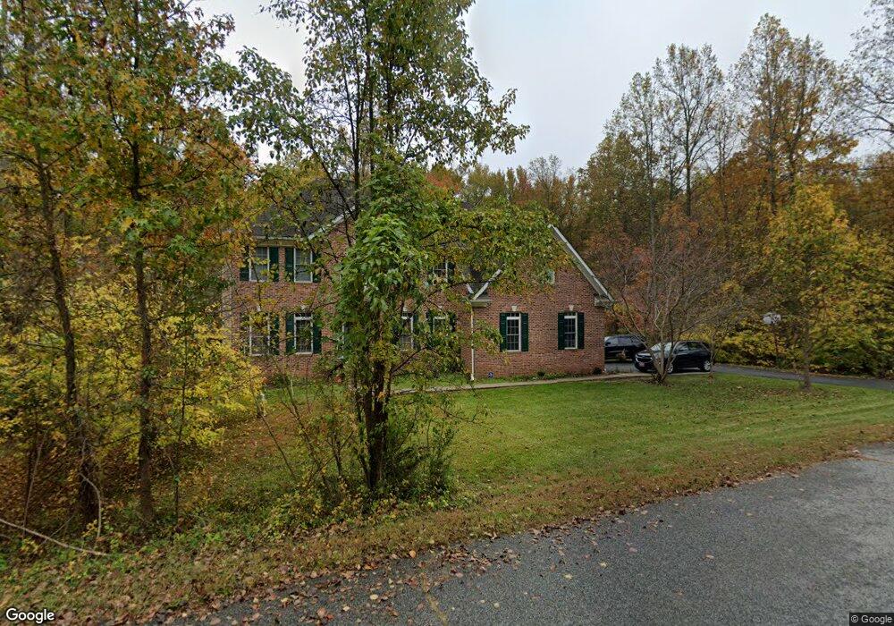
12701 Fletchertown Rd Bowie, MD 20720
Northridge NeighborhoodEstimated Value: $679,000 - $904,000
--
Bed
4
Baths
3,884
Sq Ft
$209/Sq Ft
Est. Value
About This Home
This home is located at 12701 Fletchertown Rd, Bowie, MD 20720 and is currently estimated at $810,199, approximately $208 per square foot. 12701 Fletchertown Rd is a home located in Prince George's County with nearby schools including High Bridge Elementary School, Samuel Ogle Middle School, and Bowie High School.
Ownership History
Date
Name
Owned For
Owner Type
Purchase Details
Closed on
Dec 12, 2006
Sold by
Jones Edwin F
Bought by
Jones Edwin F
Current Estimated Value
Home Financials for this Owner
Home Financials are based on the most recent Mortgage that was taken out on this home.
Original Mortgage
$550,000
Outstanding Balance
$332,232
Interest Rate
6.59%
Mortgage Type
Stand Alone Refi Refinance Of Original Loan
Estimated Equity
$477,967
Purchase Details
Closed on
Sep 7, 2006
Sold by
Jones Edwin F
Bought by
Jones Edwin F
Home Financials for this Owner
Home Financials are based on the most recent Mortgage that was taken out on this home.
Original Mortgage
$550,000
Interest Rate
6.59%
Mortgage Type
New Conventional
Purchase Details
Closed on
Nov 9, 2005
Sold by
Maddox Tow
Bought by
Jones Edwin F
Create a Home Valuation Report for This Property
The Home Valuation Report is an in-depth analysis detailing your home's value as well as a comparison with similar homes in the area
Home Values in the Area
Average Home Value in this Area
Purchase History
| Date | Buyer | Sale Price | Title Company |
|---|---|---|---|
| Jones Edwin F | -- | -- | |
| Jones Edwin F | -- | -- | |
| Jones Edwin F | $150,000 | -- |
Source: Public Records
Mortgage History
| Date | Status | Borrower | Loan Amount |
|---|---|---|---|
| Open | Jones Edwin F | $550,000 | |
| Previous Owner | Jones Edwin F | $550,000 |
Source: Public Records
Tax History Compared to Growth
Tax History
| Year | Tax Paid | Tax Assessment Tax Assessment Total Assessment is a certain percentage of the fair market value that is determined by local assessors to be the total taxable value of land and additions on the property. | Land | Improvement |
|---|---|---|---|---|
| 2025 | $10,354 | $805,300 | $107,300 | $698,000 |
| 2024 | $10,354 | $755,067 | $0 | $0 |
| 2023 | $9,869 | $704,833 | $0 | $0 |
| 2022 | $8,942 | $654,600 | $104,500 | $550,100 |
| 2021 | $1,305 | $629,933 | $0 | $0 |
| 2020 | $8,982 | $605,267 | $0 | $0 |
| 2019 | $9,754 | $580,600 | $102,600 | $478,000 |
| 2018 | $8,195 | $535,800 | $0 | $0 |
| 2017 | $8,036 | $491,000 | $0 | $0 |
| 2016 | -- | $446,200 | $0 | $0 |
| 2015 | $6,742 | $419,500 | $0 | $0 |
| 2014 | $6,742 | $392,800 | $0 | $0 |
Source: Public Records
Map
Nearby Homes
- 12907 Fletchertown Rd
- 12921 Fletchertown Rd
- 12943 Fletchertown Rd
- 12205 Quick Fox Ln
- 12500 Thompson Rd
- 7701 Quaint Ct
- 12302 Quintette Ln
- 12231 Shafer Ln
- 8244 Quill Point Dr
- 12340 Quiet Owl Ln
- 12207 Quadrille Ln
- 12909 Mayflower Place
- 6908 Greenwood Dr
- 7501 Hillmeade Rd
- 6601 Homestake Dr S
- 7509 Hillmeade Rd
- 000 000 High Bridge
- 7711 Hillmeade Rd
- 8106 Triple Crown Rd
- 11531 Prospect Hill
- 12705 Fletchertown Rd
- 12616 Quaking Branch Ct
- 12614 Quaking Branch Ct
- 12620 Quaking Branch Ct
- 12700 Fletchertown Rd
- 12702 Fletchertown Rd
- 12622 Quaking Branch Ct
- 12602 Fletchertown Rd
- 12618 Quaking Branch Ct
- 12600 Fletchertown Rd
- 12624 Quaking Branch Ct
- 12612 Quaking Branch Ct
- 12710 Fletchertown Rd
- 12608 Quaking Branch Ct
- 12610 Quaking Branch Ct
- 12606 Fletchertown Rd
- 12606 Quaking Branch Ct
- 8341 Quill Point Dr
- 12626 Quaking Branch Ct
- 8339 Quill Point Dr