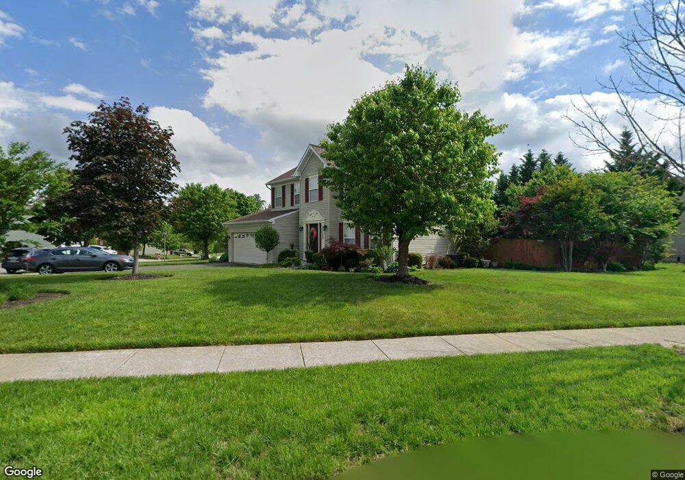
12702 Dunkirk Dr Upper Marlboro, MD 20772
Estimated Value: $514,905 - $582,000
Studio
3
Baths
2,068
Sq Ft
$270/Sq Ft
Est. Value
About This Home
This home is located at 12702 Dunkirk Dr, Upper Marlboro, MD 20772 and is currently estimated at $558,226, approximately $269 per square foot. 12702 Dunkirk Dr is a home located in Prince George's County with nearby schools including Barack Obama Elementary School, James Madison Middle School, and Dr. Henry A. Wise Jr. High School.
Ownership History
Date
Name
Owned For
Owner Type
Purchase Details
Closed on
Jan 4, 2005
Sold by
Ownsend Swan
Bought by
Townsend Gregory W Etal
Current Estimated Value
Home Financials for this Owner
Home Financials are based on the most recent Mortgage that was taken out on this home.
Original Mortgage
$267,750
Outstanding Balance
$145,607
Interest Rate
8.65%
Mortgage Type
Adjustable Rate Mortgage/ARM
Estimated Equity
$412,619
Purchase Details
Closed on
Oct 20, 2003
Sold by
Ownsend Swan
Bought by
Townsend Gregory W Etal
Home Financials for this Owner
Home Financials are based on the most recent Mortgage that was taken out on this home.
Original Mortgage
$267,750
Interest Rate
8.65%
Mortgage Type
Adjustable Rate Mortgage/ARM
Purchase Details
Closed on
Feb 10, 2000
Sold by
Richmond American Homes Of Md Inc
Bought by
Swan and Townsend Valorie A Etal
Create a Home Valuation Report for This Property
The Home Valuation Report is an in-depth analysis detailing your home's value as well as a comparison with similar homes in the area
Home Values in the Area
Average Home Value in this Area
Purchase History
| Date | Buyer | Sale Price | Title Company |
|---|---|---|---|
| Townsend Gregory W Etal | -- | -- | |
| Townsend Gregory W Etal | -- | -- | |
| Swan | $210,000 | -- |
Source: Public Records
Mortgage History
| Date | Status | Borrower | Loan Amount |
|---|---|---|---|
| Open | Townsend Gregory W Etal | $267,750 | |
| Previous Owner | Townsend Gregory W Etal | $267,750 |
Source: Public Records
Tax History
| Year | Tax Paid | Tax Assessment Tax Assessment Total Assessment is a certain percentage of the fair market value that is determined by local assessors to be the total taxable value of land and additions on the property. | Land | Improvement |
|---|---|---|---|---|
| 2025 | $5,364 | $429,200 | $127,000 | $302,200 |
| 2024 | $5,364 | $395,967 | -- | -- |
| 2023 | $5,112 | $362,733 | $0 | $0 |
| 2022 | $4,811 | $329,500 | $102,000 | $227,500 |
| 2021 | $5,669 | $319,933 | $0 | $0 |
| 2020 | $5,596 | $310,367 | $0 | $0 |
| 2019 | $5,498 | $300,800 | $101,000 | $199,800 |
| 2018 | $5,357 | $287,367 | $0 | $0 |
| 2017 | $5,242 | $273,933 | $0 | $0 |
| 2016 | -- | $260,500 | $0 | $0 |
| 2015 | $4,866 | $260,500 | $0 | $0 |
| 2014 | $4,866 | $260,500 | $0 | $0 |
Source: Public Records
Map
Nearby Homes
- 13192 Ripon Place
- 4317 Stockport Way
- 4655 Penzance Place
- 4411 Beckenham Place
- 13542 Lord Baltimore Place
- 14000 Lord Marlborough Place
- 4482 Lord Loudoun Ct
- 13825 King Frederick Way
- 5105 Mapleshade Ln
- 5101 Back Stretch Blvd
- 5209 Mount Airy Ln
- 12803 Old Marlboro Pike
- 13500 Old Marlboro Pike
- 13900 Farnsworth Ln Unit 4301
- 12707 Old Marlboro Pike
- 11508 Pegasus Ct
- 14100 Farnsworth Ln
- 14134 Reverend Rainsford Ct
- 13805 Fareham Ln
- 4204 Rolling Paddock Dr
- 12930 Dunkirk Dr
- 12704 Dunkirk Dr
- 4500 Myles Ct
- 12624 Dunkirk Dr
- 12703 Dunkirk Dr
- 12928 Dunkirk Dr
- 12706 Dunkirk Dr
- 12935 Dunkirk Dr
- 12705 Dunkirk Dr
- 12933 Dunkirk Dr
- 4501 Myles Ct
- 4502 Myles Ct
- 12708 Dunkirk Dr
- 4301 Arabella Ct
- 12926 Dunkirk Dr
- 12707 Dunkirk Dr
- 12931 Dunkirk Dr
- 12622 Dunkirk Dr
- 4503 Myles Ct
- 12623 Dunkirk Dr
Your Personal Tour Guide
Ask me questions while you tour the home.