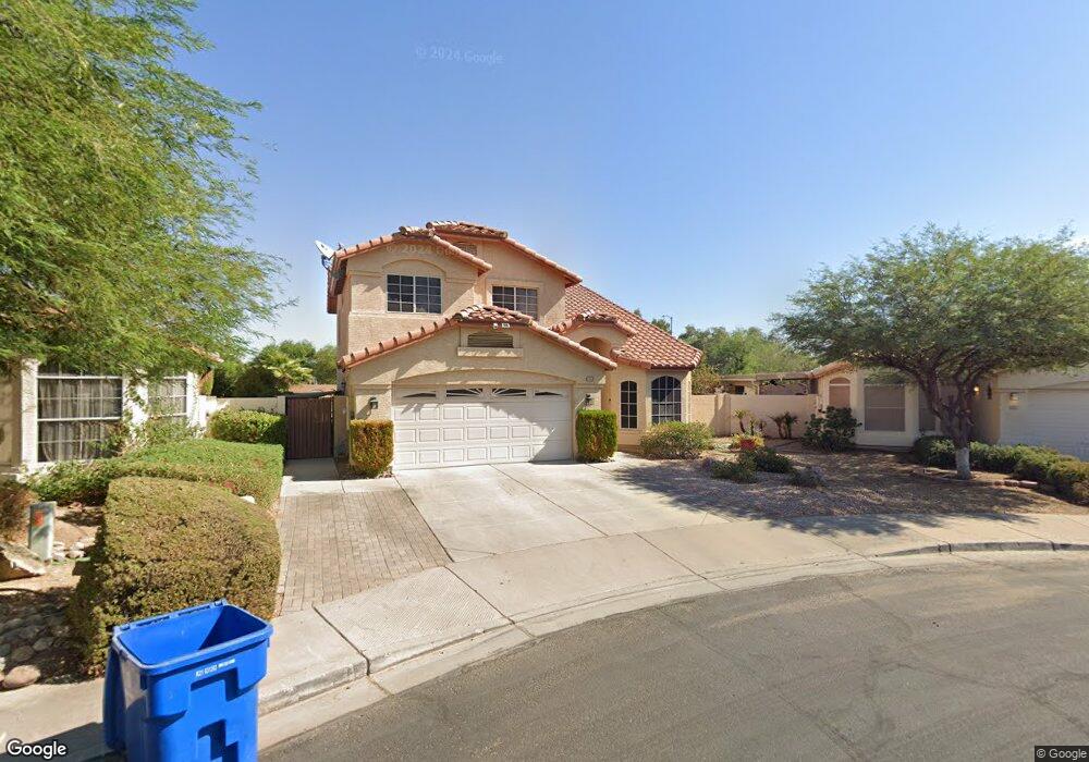
12702 W Alvarado Rd Avondale, AZ 85392
Rancho Santa Fe NeighborhoodEstimated Value: $370,069 - $452,000
4
Beds
3
Baths
2,038
Sq Ft
$204/Sq Ft
Est. Value
About This Home
This home is located at 12702 W Alvarado Rd, Avondale, AZ 85392 and is currently estimated at $415,517, approximately $203 per square foot. 12702 W Alvarado Rd is a home located in Maricopa County with nearby schools including Rancho Santa Fe Elementary School, Wigwam Creek Middle School, and Agua Fria High School.
Ownership History
Date
Name
Owned For
Owner Type
Purchase Details
Closed on
May 9, 2003
Sold by
Franklin Larry and Franklin Kelly A
Bought by
Carrillo Carlos M and Carrillo Alma L
Current Estimated Value
Home Financials for this Owner
Home Financials are based on the most recent Mortgage that was taken out on this home.
Original Mortgage
$152,000
Outstanding Balance
$66,303
Interest Rate
5.84%
Mortgage Type
FHA
Estimated Equity
$349,214
Purchase Details
Closed on
May 22, 1998
Sold by
Continental Homes Inc
Bought by
Franklin Larry and Franklin Kelly A
Home Financials for this Owner
Home Financials are based on the most recent Mortgage that was taken out on this home.
Original Mortgage
$105,750
Interest Rate
7.13%
Mortgage Type
New Conventional
Purchase Details
Closed on
Feb 6, 1998
Sold by
Chi Construction Company
Bought by
Continental Homes Inc
Create a Home Valuation Report for This Property
The Home Valuation Report is an in-depth analysis detailing your home's value as well as a comparison with similar homes in the area
Home Values in the Area
Average Home Value in this Area
Purchase History
| Date | Buyer | Sale Price | Title Company |
|---|---|---|---|
| Carrillo Carlos M | $160,000 | Arizona Title Agency Inc | |
| Franklin Larry | $132,225 | First American Title | |
| Continental Homes Inc | -- | First American Title |
Source: Public Records
Mortgage History
| Date | Status | Borrower | Loan Amount |
|---|---|---|---|
| Open | Carrillo Carlos M | $152,000 | |
| Previous Owner | Franklin Larry | $105,750 |
Source: Public Records
Tax History Compared to Growth
Tax History
| Year | Tax Paid | Tax Assessment Tax Assessment Total Assessment is a certain percentage of the fair market value that is determined by local assessors to be the total taxable value of land and additions on the property. | Land | Improvement |
|---|---|---|---|---|
| 2025 | $1,397 | $15,992 | -- | -- |
| 2024 | $1,346 | $15,230 | -- | -- |
| 2023 | $1,346 | $29,230 | $5,840 | $23,390 |
| 2022 | $1,307 | $22,920 | $4,580 | $18,340 |
| 2021 | $1,366 | $21,520 | $4,300 | $17,220 |
| 2020 | $1,322 | $20,250 | $4,050 | $16,200 |
| 2019 | $1,305 | $17,960 | $3,590 | $14,370 |
| 2018 | $1,286 | $17,150 | $3,430 | $13,720 |
| 2017 | $1,194 | $15,610 | $3,120 | $12,490 |
| 2016 | $1,149 | $14,600 | $2,920 | $11,680 |
| 2015 | $1,087 | $13,660 | $2,730 | $10,930 |
Source: Public Records
Map
Nearby Homes
- 2004 N 125th Ave
- 2024 N 125th Ave
- 2022 N 124th Dr
- 2120 N 125th Ave
- 1825 N 128th Ave
- 12425 W Encanto Blvd
- 2409 N 125th Dr
- 12403 W Monte Vista Rd
- 1858 N 128th Dr
- 12938 W Alvarado Rd
- 12913 W Wilshire Dr
- 12543 W Roanoke Ave
- 12547 W Edgemont Ave
- 12429 W Roanoke Ave
- 13145 W Cambridge Ave
- 12316 W Sheridan St
- 10001 W Verde Ln
- 13160 W Windsor Ave
- 2615 N 123rd Dr
- 3010 N 129th Dr
- 12706 W Alvarado Rd
- 2037 N 127th Ave
- 12710 W Alvarado Rd
- 2033 N 127th Ave
- 12714 W Alvarado Rd
- 2026 N 127th Ave
- 2029 N 127th Ave
- 2025 N 127th Ave
- 2022 N 127th Ave
- 2021 N 127th Ave
- 2105 N 127th Ave
- 2018 N 127th Ave
- 12723 W Alvarado Rd
- 12722 W Alvarado Rd
- 2017 N 127th Ave
- 12578 W Palm Ln
- 2014 N 127th Ave
- 12726 W Alvarado Rd
- 2109 N 127th Ave
- 12727 W Alvarado Rd