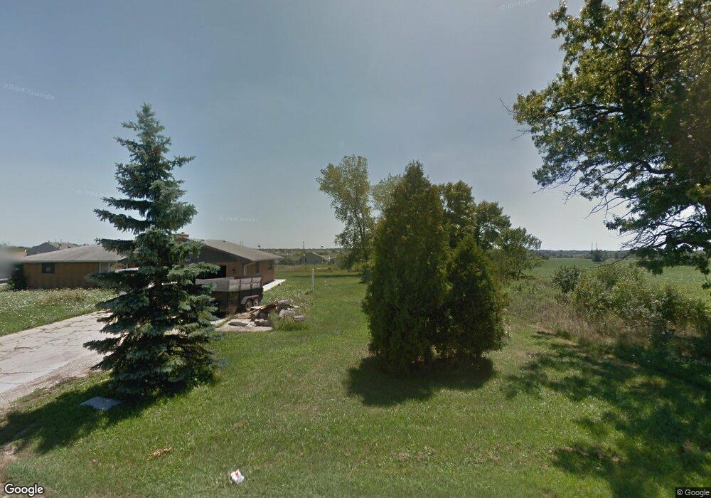
12703 W 9th St Zion, IL 60099
West Zion NeighborhoodEstimated Value: $86,869 - $387,000
Studio
--
Bath
--
Sq Ft
53,579
Sq Ft
About This Home
This home is located at 12703 W 9th St, Zion, IL 60099 and is currently estimated at $281,717. 12703 W 9th St is a home located in Lake County with nearby schools including Newport Elementary School, Beach Park Middle School, and Zion-Benton Township High School.
Ownership History
Date
Name
Owned For
Owner Type
Purchase Details
Closed on
Oct 6, 2011
Sold by
Deutsche Bank National Trust Company
Bought by
Arnst Lyle
Current Estimated Value
Purchase Details
Closed on
Jul 28, 2010
Sold by
Zaluski Mark
Bought by
Deutsche Bank National Trust Company
Purchase Details
Closed on
Nov 19, 2004
Sold by
Tonozzi Dominic
Bought by
Zaluski Mark and Zaluski Kasjana
Home Financials for this Owner
Home Financials are based on the most recent Mortgage that was taken out on this home.
Original Mortgage
$229,500
Interest Rate
5.86%
Mortgage Type
Unknown
Create a Home Valuation Report for This Property
The Home Valuation Report is an in-depth analysis detailing your home's value as well as a comparison with similar homes in the area
Home Values in the Area
Average Home Value in this Area
Purchase History
| Date | Buyer | Sale Price | Title Company |
|---|---|---|---|
| Arnst Lyle | $74,500 | None Available | |
| Deutsche Bank National Trust Company | -- | None Available | |
| Zaluski Mark | $255,000 | First American Title |
Source: Public Records
Mortgage History
| Date | Status | Borrower | Loan Amount |
|---|---|---|---|
| Previous Owner | Zaluski Mark | $229,500 |
Source: Public Records
Tax History
| Year | Tax Paid | Tax Assessment Tax Assessment Total Assessment is a certain percentage of the fair market value that is determined by local assessors to be the total taxable value of land and additions on the property. | Land | Improvement |
|---|---|---|---|---|
| 2024 | $1,886 | $19,611 | $15,099 | $4,512 |
| 2023 | $1,973 | $18,932 | $14,576 | $4,356 |
| 2022 | $1,973 | $19,492 | $14,158 | $5,334 |
| 2021 | $1,479 | $13,798 | $13,798 | $0 |
| 2020 | $1,451 | $13,167 | $13,167 | $0 |
| 2019 | $1,452 | $12,492 | $12,492 | $0 |
| 2018 | $1,839 | $15,219 | $15,219 | $0 |
| 2017 | $1,843 | $14,317 | $14,317 | $0 |
| 2016 | $1,790 | $13,630 | $13,630 | $0 |
| 2015 | $1,750 | $12,500 | $12,500 | $0 |
| 2014 | $954 | $7,306 | $7,306 | $0 |
| 2012 | $950 | $7,592 | $7,592 | $0 |
Source: Public Records
Map
Nearby Homes
- 908 Countrywood Dr
- 4108 Douglas Dr
- 1210 Lorelei Dr
- 1305 Reed Rd
- 3816 Tickseed Dr
- 3903 9th St
- 4014 Ridge Rd
- 3805 Parkway Ln
- 11778 W 12th St
- 4539 Illinois 173
- 43411 Lynn Dale Dr
- 210 Oak Ln
- 42771 N Delany Rd
- 1405 Lewis Ave
- 42333 N Theodore Ct
- 41616 N Delany Rd
- 41616 N Delaney Rd
- 440 Megan Place
- 1703 Horeb Ave
- 4109 Sarah Dr
- 901 Pheasant Run
- 12711 W 9th St
- 903 Pheasant Run
- 905 Pheasant Run
- 906 Countrywood Dr
- 904 Countrywood Dr
- 907 Pheasant Run
- 902 Countrywood Dr
- 900 Countrywood Dr
- 910 Countrywood Dr
- 900 Pheasant Run
- 1000 Cardinal Dr
- 1001 Cardinal Dr
- 1002 Cardinal Dr
- 907 Countrywood Dr
- 905 Countrywood Dr
- 911 Countrywood Dr
- 909 Countrywood Dr
- 903 Countrywood Dr
Your Personal Tour Guide
Ask me questions while you tour the home.