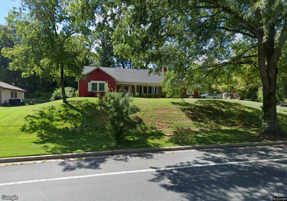
12704 Cedarbrook Ln Laurel, MD 20708
South Laurel NeighborhoodEstimated Value: $573,000 - $654,000
Studio
3
Baths
2,810
Sq Ft
$219/Sq Ft
Est. Value
About This Home
This home is located at 12704 Cedarbrook Ln, Laurel, MD 20708 and is currently estimated at $616,761, approximately $219 per square foot. 12704 Cedarbrook Ln is a home located in Prince George's County with nearby schools including Deerfield Run Elementary School, Dwight D. Eisenhower Middle School, and Laurel High School.
Ownership History
Date
Name
Owned For
Owner Type
Purchase Details
Closed on
Jun 6, 2005
Sold by
Cort Wilbur I
Bought by
Cort Wilbur I
Current Estimated Value
Home Financials for this Owner
Home Financials are based on the most recent Mortgage that was taken out on this home.
Original Mortgage
$205,000
Outstanding Balance
$107,643
Interest Rate
5.95%
Mortgage Type
New Conventional
Estimated Equity
$509,118
Purchase Details
Closed on
Jun 24, 2002
Sold by
Cort Wilbur I
Bought by
Cort Wilbur I
Purchase Details
Closed on
May 12, 1997
Sold by
Becker Burton C
Bought by
Cort Wilbur I and Cort Meleen C
Create a Home Valuation Report for This Property
The Home Valuation Report is an in-depth analysis detailing your home's value as well as a comparison with similar homes in the area
Home Values in the Area
Average Home Value in this Area
Purchase History
| Date | Buyer | Sale Price | Title Company |
|---|---|---|---|
| Cort Wilbur I | -- | -- | |
| Cort Wilbur I | -- | -- | |
| Cort Wilbur I | $174,000 | -- |
Source: Public Records
Mortgage History
| Date | Status | Borrower | Loan Amount |
|---|---|---|---|
| Open | Cort Wilbur I | $205,000 |
Source: Public Records
Tax History Compared to Growth
Tax History
| Year | Tax Paid | Tax Assessment Tax Assessment Total Assessment is a certain percentage of the fair market value that is determined by local assessors to be the total taxable value of land and additions on the property. | Land | Improvement |
|---|---|---|---|---|
| 2025 | $5,909 | $532,200 | $127,300 | $404,900 |
| 2024 | $5,909 | $492,367 | -- | -- |
| 2023 | $5,032 | $452,533 | $0 | $0 |
| 2022 | $5,286 | $412,700 | $102,300 | $310,400 |
| 2021 | $5,091 | $400,667 | $0 | $0 |
| 2020 | $5,005 | $388,633 | $0 | $0 |
| 2019 | $4,893 | $376,600 | $101,100 | $275,500 |
| 2018 | $4,673 | $347,300 | $0 | $0 |
| 2017 | $4,478 | $318,000 | $0 | $0 |
| 2016 | -- | $288,700 | $0 | $0 |
| 2015 | $3,892 | $288,700 | $0 | $0 |
| 2014 | $3,892 | $288,700 | $0 | $0 |
Source: Public Records
Map
Nearby Homes
- 12703 Cedarbrook Ln
- 8908 Eastbourne Ln
- 12600 Cedarbrook Ln
- 9312 Montpelier Dr
- 8491 Imperial Dr
- 8604 Imperial Dr
- 8493 Snowden Oaks Place
- 12201 Mount Pleasant Dr
- 12210 Valerie Ln
- 12513 Laurel Bowie Rd
- 12306 Shadetree Ln
- 8415 Snowden Oaks Place
- 0 Larchdale Rd Unit MDPG2054450
- 9303 Ispahan Loop
- 12114 Running Bull Way
- 12124 Running Bull Way
- 12128 Running Bull Way
- 12107 Spirit Ave
- 12105 Spirit Ave
- 12103 Spirit Ave
- 9005 Eastbourne Ln
- 9008 Eastbourne Ln
- 9006 Eastbourne Ln
- 12705 Cedarbrook Ln
- 12700 Cedarbrook Ln
- 12707 Cedarbrook Ln
- 9004 Eastbourne Ln
- 8912 Royal Ridge Ln
- 12804 Cedarbrook Ln
- 12801 Cedarbrook Ln
- 9002 Eastbourne Ln
- 9001 Eastbourne Ln
- 8910 Royal Ridge Ln
- 12701 Cedarbrook Ln
- 9005 Montpelier Dr
- 9003 Montpelier Dr
- 9001 Montpelier Dr
- 9000 Eastbourne Ln
- 9007 Montpelier Dr
- 12614 Cedarbrook Ln