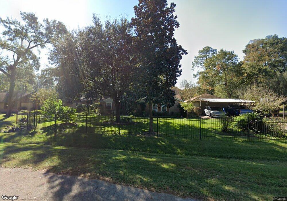
12707 High Sea Dr Tomball, TX 77377
Estimated Value: $305,640 - $460,000
3
Beds
2
Baths
1,896
Sq Ft
$187/Sq Ft
Est. Value
About This Home
This home is located at 12707 High Sea Dr, Tomball, TX 77377 and is currently estimated at $354,660, approximately $187 per square foot. 12707 High Sea Dr is a home located in Harris County with nearby schools including Lakewood Elementary School, Willow Wood Junior High School, and Northpointe Intermediate School.
Ownership History
Date
Name
Owned For
Owner Type
Purchase Details
Closed on
Jun 3, 2005
Sold by
Manthei David Dean and Manthei Lelslie Rae
Bought by
White Robert C and White Velma
Current Estimated Value
Home Financials for this Owner
Home Financials are based on the most recent Mortgage that was taken out on this home.
Original Mortgage
$105,560
Outstanding Balance
$59,909
Interest Rate
7.14%
Mortgage Type
Fannie Mae Freddie Mac
Estimated Equity
$294,751
Purchase Details
Closed on
Sep 9, 2002
Sold by
Manthei David Dean and Manthei Leslie Rae
Bought by
Manthei David Dean and Manthei Leslie Rae
Create a Home Valuation Report for This Property
The Home Valuation Report is an in-depth analysis detailing your home's value as well as a comparison with similar homes in the area
Home Values in the Area
Average Home Value in this Area
Purchase History
| Date | Buyer | Sale Price | Title Company |
|---|---|---|---|
| White Robert C | -- | Guardian Fidelity | |
| Manthei David Dean | -- | -- |
Source: Public Records
Mortgage History
| Date | Status | Borrower | Loan Amount |
|---|---|---|---|
| Open | White Robert C | $105,560 |
Source: Public Records
Tax History Compared to Growth
Tax History
| Year | Tax Paid | Tax Assessment Tax Assessment Total Assessment is a certain percentage of the fair market value that is determined by local assessors to be the total taxable value of land and additions on the property. | Land | Improvement |
|---|---|---|---|---|
| 2025 | $3,987 | $279,866 | $54,788 | $225,078 |
| 2024 | $3,987 | $283,636 | $54,788 | $228,848 |
| 2023 | $3,987 | $283,636 | $54,788 | $228,848 |
| 2022 | $5,048 | $270,691 | $54,788 | $215,903 |
| 2021 | $4,773 | $230,093 | $44,827 | $185,266 |
| 2020 | $4,578 | $219,128 | $44,827 | $174,301 |
| 2019 | $4,297 | $219,128 | $44,827 | $174,301 |
| 2018 | $2,024 | $176,022 | $33,869 | $142,153 |
| 2017 | $3,898 | $176,022 | $33,869 | $142,153 |
| 2016 | $3,898 | $176,022 | $33,869 | $142,153 |
| 2015 | $3,036 | $176,022 | $33,869 | $142,153 |
| 2014 | $3,036 | $154,000 | $25,900 | $128,100 |
Source: Public Records
Map
Nearby Homes
- 16723 Chewton Glen St
- 12943 Spring Cypress Rd
- 12810 Wondering Forest Dr
- 14311 Lakepointe Bend Ln
- 12515 Pavilion Ct
- 16610 Avenfield Rd
- 12502 Pavilion Ct
- 17302 Holsberry Ct
- 13210 Chriswood Dr
- 13206 Chriswood Dr
- 13307 Cypress Pond Dr
- 12427 Pedder Way Dr
- 12730 Holsberry Ct
- 12502 Wealdstone Dr
- 12411 Exbury Ct
- 12319 Hamsfield Ct
- 13503 Copeland Oaks Blvd
- 13330 Cypress Palms Ct
- 12422 Hammersmith Dr
- 12407 Wealdstone Dr
- 12711 High Sea Dr
- 12702 Island Dr
- 12702 Island Dr Unit A
- 12710 Island Dr
- 12719 High Sea Dr
- 12702 High Sea Dr
- 12715 High Sea Dr
- 12615 High Sea Dr
- 12614 High Sea Dr
- 12614 Island Dr
- 12925 Spring Cypress Rd
- 12611 High Sea Dr
- 12707 Island Dr
- 12615 Island Dr
- 12711 Island Dr
- 12929 Spring Cypress Rd
- 12615 Pirate Cove Dr
- 12701 Spring Cypress Rd
- 12610 Island Dr
- 12703 Island Dr