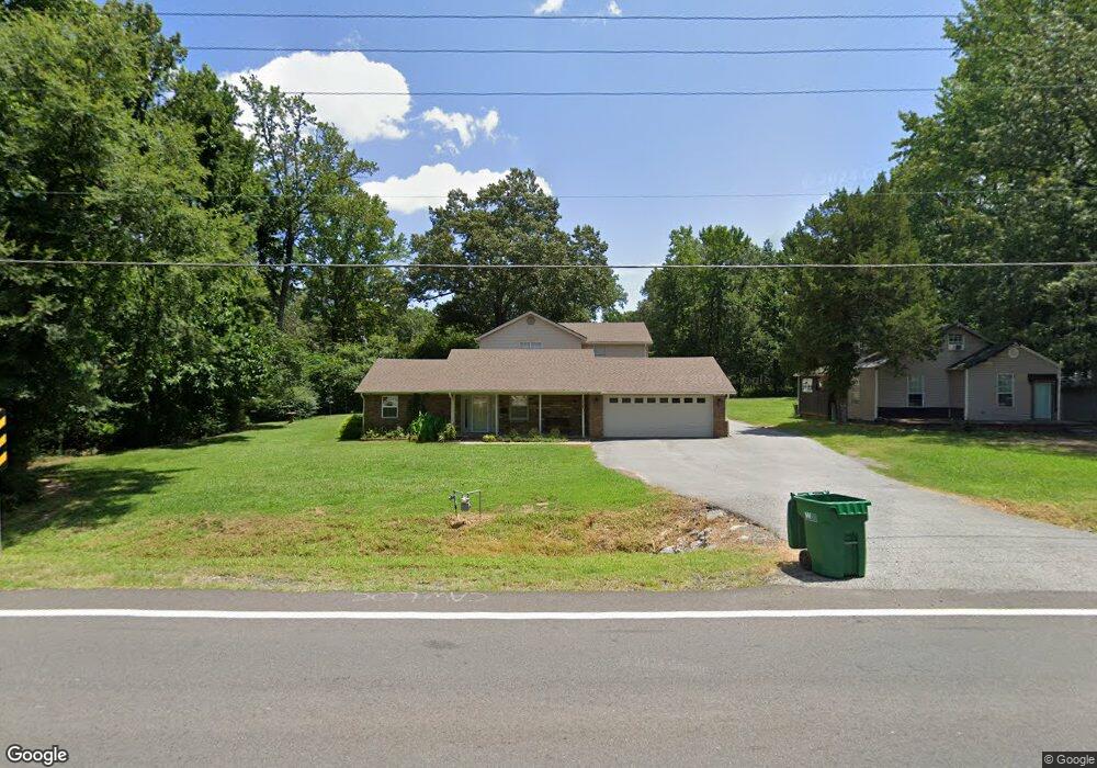
12708 Mac Arthur Dr North Little Rock, AR 72118
Oak Grove NeighborhoodEstimated Value: $239,617 - $462,000
--
Bed
1
Bath
3,456
Sq Ft
$96/Sq Ft
Est. Value
About This Home
This home is located at 12708 Mac Arthur Dr, North Little Rock, AR 72118 and is currently estimated at $330,154, approximately $95 per square foot. 12708 Mac Arthur Dr is a home located in Pulaski County with nearby schools including Oak Grove Elementary School, Maumelle Middle School, and Maumelle High School.
Ownership History
Date
Name
Owned For
Owner Type
Purchase Details
Closed on
Dec 6, 2024
Sold by
Prater Family Revocable Trust and Prater Barry Wayne
Bought by
Gould Scott and Gould Ruth
Current Estimated Value
Purchase Details
Closed on
Mar 6, 2002
Sold by
Bleakley Mary Lois
Bought by
Williams Dan W and Williams Lisa A
Home Financials for this Owner
Home Financials are based on the most recent Mortgage that was taken out on this home.
Original Mortgage
$47,000
Interest Rate
6.93%
Purchase Details
Closed on
Dec 8, 1997
Sold by
Bleakley Mary Lois
Bought by
Williams Harris Lester W and Williams Harris Belle
Home Financials for this Owner
Home Financials are based on the most recent Mortgage that was taken out on this home.
Original Mortgage
$23,000
Interest Rate
6%
Mortgage Type
Seller Take Back
Create a Home Valuation Report for This Property
The Home Valuation Report is an in-depth analysis detailing your home's value as well as a comparison with similar homes in the area
Home Values in the Area
Average Home Value in this Area
Purchase History
| Date | Buyer | Sale Price | Title Company |
|---|---|---|---|
| Gould Scott | $95,000 | First National Title | |
| Gould Scott | $95,000 | First National Title | |
| Williams Dan W | $47,000 | -- | |
| Williams Harris Lester W | $25,000 | -- |
Source: Public Records
Mortgage History
| Date | Status | Borrower | Loan Amount |
|---|---|---|---|
| Previous Owner | Williams Dan W | $47,000 | |
| Previous Owner | Williams Harris Lester W | $23,000 |
Source: Public Records
Tax History Compared to Growth
Tax History
| Year | Tax Paid | Tax Assessment Tax Assessment Total Assessment is a certain percentage of the fair market value that is determined by local assessors to be the total taxable value of land and additions on the property. | Land | Improvement |
|---|---|---|---|---|
| 2025 | $2,856 | $56,219 | $3,180 | $53,039 |
| 2024 | $2,856 | $56,219 | $3,180 | $53,039 |
| 2023 | $2,856 | $56,219 | $3,180 | $53,039 |
| 2022 | $3,006 | $56,219 | $3,180 | $53,039 |
| 2021 | $1,680 | $30,610 | $2,450 | $28,160 |
| 2020 | $1,305 | $30,610 | $2,450 | $28,160 |
| 2019 | $1,305 | $30,610 | $2,450 | $28,160 |
| 2018 | $1,330 | $30,610 | $2,450 | $28,160 |
| 2017 | $1,305 | $30,610 | $2,450 | $28,160 |
| 2016 | $1,444 | $33,340 | $1,200 | $32,140 |
| 2015 | $1,694 | $33,340 | $1,200 | $32,140 |
| 2014 | $1,694 | $33,340 | $1,200 | $32,140 |
Source: Public Records
Map
Nearby Homes
- 00 Interstate 40
- 11806 Veronica Rd
- 0 Macarthur Unit 25004179
- 7110 Forest Dale Dr
- 7804 Marche Lateral Rd
- 62 Lucia Ln
- 5502 E Partridge Ln
- 71 Corniche Cove
- 70 Corniche Cove
- 69 Corniche Cove
- 105 Corniche Ln
- 123 Natural Trail
- 121 Natural Trail
- 1501 Milligan Dr
- 516 Corondelet Ln
- 514 Corondelet Ln
- 520 Corondelet Ln
- 320 Devoe Bend Dr
- 603 Corondelet Ln
- 7932 Macarthur Dr
- 12704 Mac Arthur Dr
- 12612 Mac Arthur Dr
- 12612 Macarthur Dr
- 12714 Mac Arthur Dr
- 12705 Mac Arthur Dr
- 12609 Mac Arthur Dr
- 12609 Macarthur Dr
- 12609 Macarthur Dr
- 12806 Mac Arthur Dr
- 12513 Mac Arthur Dr
- 7009 Oat Ln
- 12814 Mac Arthur Dr
- 12820 Mac Arthur Dr
- 12512 Mac Arthur Dr
- 6808 Rye Ln
- 12423 Mac Arthur Dr
- 12818 Mac Arthur Dr
- 12713 Mac Arthur Dr
- 535 Enchanted Valley Ln
- 6920 Holtdale Ln