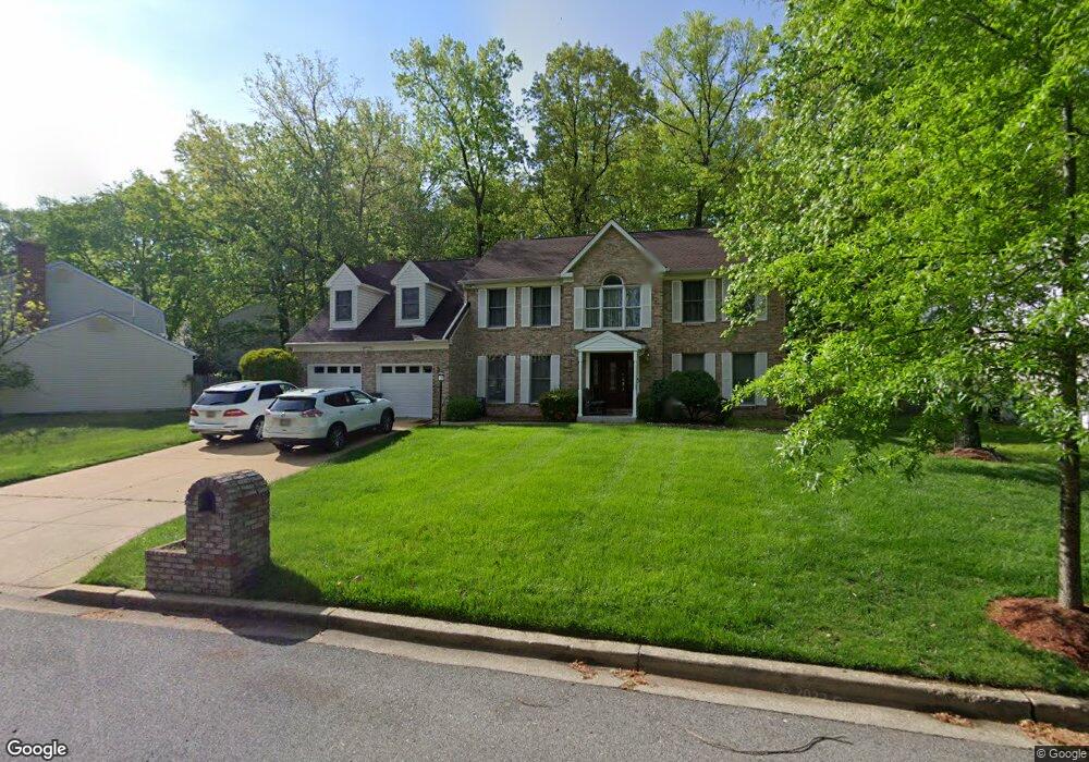
12708 Macduff Dr Fort Washington, MD 20744
Estimated Value: $546,632 - $616,000
--
Bed
3
Baths
2,756
Sq Ft
$211/Sq Ft
Est. Value
About This Home
This home is located at 12708 Macduff Dr, Fort Washington, MD 20744 and is currently estimated at $582,658, approximately $211 per square foot. 12708 Macduff Dr is a home located in Prince George's County with nearby schools including Potomac Landing Elementary School, Accokeek Academy, and Friendly High School.
Ownership History
Date
Name
Owned For
Owner Type
Purchase Details
Closed on
Feb 21, 2020
Sold by
Macabulos Edgardo N and Macabulos Lorna C
Bought by
Macabulos Lorna C and Macabulos Edgardo C
Current Estimated Value
Home Financials for this Owner
Home Financials are based on the most recent Mortgage that was taken out on this home.
Original Mortgage
$220,000
Outstanding Balance
$193,281
Interest Rate
3.2%
Mortgage Type
New Conventional
Estimated Equity
$389,377
Purchase Details
Closed on
Nov 22, 1988
Sold by
Cote Raymond C J
Bought by
Macabulos Edgardo N and Macabulos Lorna C
Create a Home Valuation Report for This Property
The Home Valuation Report is an in-depth analysis detailing your home's value as well as a comparison with similar homes in the area
Home Values in the Area
Average Home Value in this Area
Purchase History
| Date | Buyer | Sale Price | Title Company |
|---|---|---|---|
| Macabulos Lorna C | -- | Brennan Title Company | |
| Macabulos Edgardo N | $35,000 | -- |
Source: Public Records
Mortgage History
| Date | Status | Borrower | Loan Amount |
|---|---|---|---|
| Open | Macabulos Lorna C | $220,000 |
Source: Public Records
Tax History Compared to Growth
Tax History
| Year | Tax Paid | Tax Assessment Tax Assessment Total Assessment is a certain percentage of the fair market value that is determined by local assessors to be the total taxable value of land and additions on the property. | Land | Improvement |
|---|---|---|---|---|
| 2025 | $6,178 | $483,333 | -- | -- |
| 2024 | $6,178 | $449,600 | $126,400 | $323,200 |
| 2023 | $5,948 | $412,133 | $0 | $0 |
| 2022 | $5,658 | $374,667 | $0 | $0 |
| 2021 | $5,331 | $337,200 | $125,700 | $211,500 |
| 2020 | $5,274 | $332,067 | $0 | $0 |
| 2019 | $5,186 | $326,933 | $0 | $0 |
| 2018 | $5,069 | $321,800 | $100,700 | $221,100 |
| 2017 | $4,990 | $317,800 | $0 | $0 |
| 2016 | -- | $313,800 | $0 | $0 |
| 2015 | $4,757 | $309,800 | $0 | $0 |
| 2014 | $4,757 | $309,800 | $0 | $0 |
Source: Public Records
Map
Nearby Homes
- 12618 Prestwick Dr
- 200 Bonhill Dr
- 202 Bonhill Dr
- 12800 Asbury Dr
- 12700 Parkton St
- 500 Bonhill Dr
- 12817 Glasgow Ct
- 500 Holly Rd
- 504 Holly Rd
- 13305 Old Fort Rd
- 12417 Parkton St
- 502 Castleray Cir
- 13030 Old Fort Rd
- 518 W Tantallon Dr
- 513 Holly Rd
- 0 Holly Rd Unit MDPG2160552
- 509 Troon Cir
- 411 Rexburg Ave
- 12306 Dendron Place
- 12901 Canoe Ct
- 12706 Macduff Dr
- 12710 Macduff Dr
- 12802 Durness Cir
- 12803 Falkirk Cir
- 12709 Macduff Dr
- 12707 Macduff Dr
- 12711 Macduff Dr
- 12804 Durness Cir
- 12909 Asbury Dr
- 12703 Macduff Dr
- 12911 Asbury Dr
- 12804 Falkirk Cir
- 12702 Macduff Dr
- 12714 Macduff Dr
- 12907 Asbury Dr
- 12913 Asbury Dr
- 12715 Macduff Dr
- 12802 Falkirk Cir
- 107 Saint Andrews Dr E
- 12803 Durness Cir