Estimated Value: $759,130
--
Bed
--
Bath
2,344
Sq Ft
$324/Sq Ft
Est. Value
About This Home
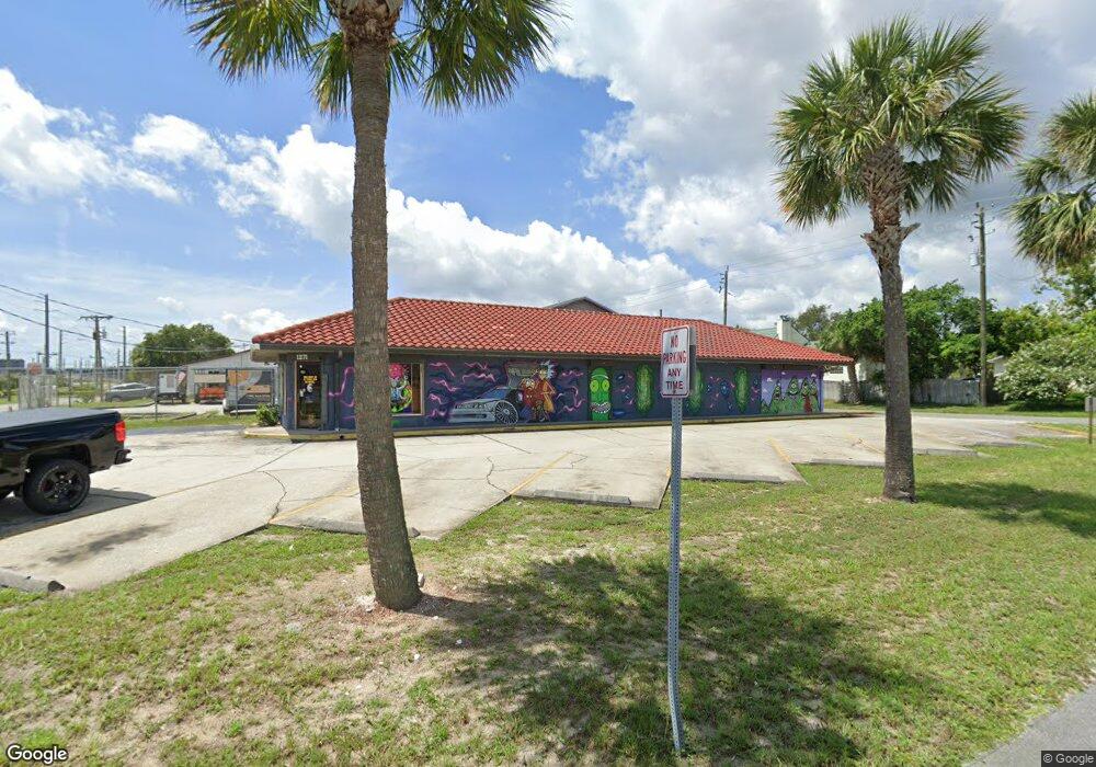
This home is located at 1271 Aron St, Cocoa, FL 32927 and is currently estimated at $759,130, approximately $323 per square foot. 1271 Aron St is a home located in Brevard County with nearby schools including Atlantis Elementary School, Space Coast Junior/Senior High School, and East Atlantic Prep of Brevard County.
Ownership History
Date
Name
Owned For
Owner Type
Purchase Details
Closed on
Dec 18, 2013
Sold by
Port St John Liquors Llc
Bought by
Keerthi Krishna Llc
Current Estimated Value
Home Financials for this Owner
Home Financials are based on the most recent Mortgage that was taken out on this home.
Original Mortgage
$206,250
Outstanding Balance
$154,036
Interest Rate
4.19%
Mortgage Type
Commercial
Estimated Equity
$605,094
Purchase Details
Closed on
Nov 3, 1993
Sold by
Messer Jimmy J
Bought by
Messer Jimmy J and Messer Sandra J
Create a Home Valuation Report for This Property
The Home Valuation Report is an in-depth analysis detailing your home's value as well as a comparison with similar homes in the area
Home Values in the Area
Average Home Value in this Area
Purchase History
| Date | Buyer | Sale Price | Title Company |
|---|---|---|---|
| Keerthi Krishna Llc | $275,000 | Attorney | |
| Messer Jimmy J | $5,000 | -- |
Source: Public Records
Mortgage History
| Date | Status | Borrower | Loan Amount |
|---|---|---|---|
| Open | Keerthi Krishna Llc | $206,250 |
Source: Public Records
Tax History Compared to Growth
Tax History
| Year | Tax Paid | Tax Assessment Tax Assessment Total Assessment is a certain percentage of the fair market value that is determined by local assessors to be the total taxable value of land and additions on the property. | Land | Improvement |
|---|---|---|---|---|
| 2025 | $5,824 | $395,360 | -- | -- |
| 2024 | $5,280 | $379,990 | -- | -- |
| 2023 | $5,280 | $314,600 | $52,880 | $261,720 |
| 2022 | $4,846 | $292,740 | $0 | $0 |
| 2021 | $4,975 | $284,640 | $52,880 | $231,760 |
| 2020 | $4,779 | $292,820 | $52,880 | $239,940 |
| 2019 | $4,301 | $238,220 | $52,880 | $185,340 |
| 2018 | $4,355 | $235,510 | $52,880 | $182,630 |
| 2017 | $4,556 | $240,000 | $0 | $240,000 |
| 2016 | $4,726 | $240,000 | $0 | $0 |
| 2015 | $4,527 | $220,000 | $37,690 | $182,310 |
| 2014 | $4,592 | $220,000 | $37,690 | $182,310 |
Source: Public Records
Map
Nearby Homes
- 6340 U S Route 1
- 6340 N Highway 1
- 1164 Aron St
- 672 Altura Dr
- 6900 N Highway 1 Unit 6307
- 522 Clearview Dr
- 1108 Vineland St
- 641 Lindsay Ave
- 780 Alcazar Ave
- 7000 N Highway 1 Unit 104
- 7000 N Highway 1 Unit Gg-205
- 7000 N Highway 1 Unit GG103
- 7020 U S 1 Unit Ee-202
- 0 Fay Blvd Unit 1011912
- 453 Camel Cir
- 1015 Hibiscus St
- 7030 N Highway 1 Unit 101
- 7030 N Highway 1 Unit DD102
- 6575 Dallas Ave
- 7060 N Highway 1 Unit AA206
- 760 West Ave
- 724 West Ave Unit 724
- 1271 Vineland St
- 1261 Aron St
- 1261 Vineland St
- * Route 1
- 4650 Route 1
- 700 West Ave Unit 716
- 700 West Ave Unit 716-71
- 700 West Ave Unit 726
- 704 West Ave Unit 726
- 700 West Ave Unit 716-718
- 700 West Ave Unit 700
- 722 West Ave
- 1260 Aron St
- 0 Route 1 Unit 1038350
- 0 Route 1 Unit 1037489
- 0 Route 1 Unit MFRO6182271
- 0 Route 1 Unit MFRO6182262
- 0 Route 1 Unit 105 MFRO4713097