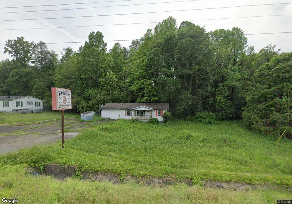
1271 Canton Hwy Cumming, GA 30040
1
Bed
3
Baths
1,248
Sq Ft
0.88
Acres
About This Home
This home is located at 1271 Canton Hwy, Cumming, GA 30040. 1271 Canton Hwy is a home located in Forsyth County with nearby schools including Cumming Elementary School, Otwell Middle School, and Forsyth Central High School.
Ownership History
Date
Name
Owned For
Owner Type
Purchase Details
Closed on
Dec 29, 2011
Sold by
Branch Banking And Trust
Bought by
Hem Llc
Purchase Details
Closed on
Jun 3, 2009
Sold by
Bathaei Nahid T
Bought by
F & B Construction Inc
Purchase Details
Closed on
Dec 14, 2006
Sold by
F & B Const Inc
Bought by
Bathaei Nahid
Purchase Details
Closed on
Feb 21, 2006
Sold by
Harman Props Inc
Bought by
F & B Const Inc
Home Financials for this Owner
Home Financials are based on the most recent Mortgage that was taken out on this home.
Original Mortgage
$172,123
Interest Rate
6.08%
Mortgage Type
Commercial
Create a Home Valuation Report for This Property
The Home Valuation Report is an in-depth analysis detailing your home's value as well as a comparison with similar homes in the area
Home Values in the Area
Average Home Value in this Area
Purchase History
| Date | Buyer | Sale Price | Title Company |
|---|---|---|---|
| Hem Llc | $45,000 | -- | |
| F & B Construction Inc | -- | -- | |
| Bathaei Nahid | -- | -- | |
| F & B Const Inc | $198,500 | -- |
Source: Public Records
Mortgage History
| Date | Status | Borrower | Loan Amount |
|---|---|---|---|
| Previous Owner | F & B Const Inc | $172,123 |
Source: Public Records
Tax History Compared to Growth
Tax History
| Year | Tax Paid | Tax Assessment Tax Assessment Total Assessment is a certain percentage of the fair market value that is determined by local assessors to be the total taxable value of land and additions on the property. | Land | Improvement |
|---|---|---|---|---|
| 2025 | $2,727 | $156,968 | $154,000 | $2,968 |
| 2024 | $2,727 | $111,216 | $105,600 | $5,616 |
| 2023 | $2,737 | $111,196 | $105,600 | $5,596 |
| 2022 | $1,271 | $47,680 | $42,240 | $5,440 |
| 2021 | $1,317 | $47,680 | $42,240 | $5,440 |
| 2020 | $1,317 | $47,680 | $42,240 | $5,440 |
| 2019 | $1,319 | $47,680 | $42,240 | $5,440 |
| 2018 | $814 | $29,440 | $24,000 | $5,440 |
| 2017 | $812 | $29,268 | $24,000 | $5,268 |
| 2016 | $812 | $29,268 | $24,000 | $5,268 |
| 2015 | $814 | $29,268 | $24,000 | $5,268 |
| 2014 | $775 | $29,260 | $0 | $0 |
Source: Public Records
Map
Nearby Homes
- 1210 Magnolia Park Cir
- 1009 Canton Hwy
- 1565 Dr Bramblett Rd
- 1850 Overlook Springs Ln
- 1735 Gordon Rd
- 804 Canton Hwy
- 3285 Stock Saddle Place
- 5340 Memento Trace
- 2610 Misty Hollow Ln
- 2930 Amble Valley Ave
- 102 Pine Lake Dr
- 2980 Prestwood Dr
- 2860 Prestwood Dr
- 2920 Prestwood Dr
- 2815 Coach River Way
- 2870 Canter Meadow Dr
- 2765 Crowbrook Way
- 1835 Goldmine Dr
- 1255 Canton Hwy
- 1720 Mountain Valley Cir
- 1710 Mountain Valley Cir
- 1264 Canton Hwy
- 1241 Canton Hwy
- 1700 Mountain Valley Cir
- 1730 Mountain Valley Cir
- 1250 Canton Hwy
- 1696 Mountain Valley Cir
- 1320 Dr Bramblett Rd
- 1240 Canton Hwy
- 1310 Canton Hwy
- 1680 Mountain Valley Cir
- 1230 Canton Hwy
- 1675 Mountain Valley Cir
- 0 Mountain Valley Cir Unit 8288635
- 0 Mountain Valley Cir Unit 8677925
- 0 Mountain Valley Cir Unit 8323666
- 0 Mountain Valley Cir
- 1295 Smithdale Rd