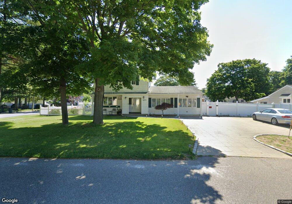
1271 Coates Ave Holbrook, NY 11741
Estimated Value: $616,000 - $706,000
4
Beds
2
Baths
2,100
Sq Ft
$316/Sq Ft
Est. Value
About This Home
This home is located at 1271 Coates Ave, Holbrook, NY 11741 and is currently estimated at $663,855, approximately $316 per square foot. 1271 Coates Ave is a home located in Suffolk County with nearby schools including Hiawatha School, Seneca Middle School, and Sachem High School North.
Ownership History
Date
Name
Owned For
Owner Type
Purchase Details
Closed on
Jun 6, 2023
Sold by
Robles
Bought by
Pawluk Robert and Pawluk Jenny
Current Estimated Value
Home Financials for this Owner
Home Financials are based on the most recent Mortgage that was taken out on this home.
Original Mortgage
$0
Interest Rate
6.79%
Mortgage Type
Purchase Money Mortgage
Purchase Details
Closed on
Aug 26, 2014
Sold by
Robles Raymond and Robles Rosalie
Bought by
Raymond And Rosalie Robles Family Trust and Robles
Create a Home Valuation Report for This Property
The Home Valuation Report is an in-depth analysis detailing your home's value as well as a comparison with similar homes in the area
Home Values in the Area
Average Home Value in this Area
Purchase History
| Date | Buyer | Sale Price | Title Company |
|---|---|---|---|
| Pawluk Robert | $560,000 | Westcore Title | |
| Pawluk Robert | $560,000 | Westcore Title | |
| Raymond And Rosalie Robles Family Trust | -- | -- | |
| Raymond And Rosalie Robles Family Trust | -- | -- |
Source: Public Records
Mortgage History
| Date | Status | Borrower | Loan Amount |
|---|---|---|---|
| Previous Owner | Pawluk Robert | $0 |
Source: Public Records
Tax History Compared to Growth
Tax History
| Year | Tax Paid | Tax Assessment Tax Assessment Total Assessment is a certain percentage of the fair market value that is determined by local assessors to be the total taxable value of land and additions on the property. | Land | Improvement |
|---|---|---|---|---|
| 2024 | -- | $36,800 | $11,000 | $25,800 |
| 2023 | -- | $36,800 | $11,000 | $25,800 |
| 2022 | $6,122 | $36,800 | $11,000 | $25,800 |
| 2021 | $6,122 | $36,800 | $11,000 | $25,800 |
| 2020 | $7,301 | $36,800 | $11,000 | $25,800 |
| 2019 | $6,122 | $0 | $0 | $0 |
| 2018 | -- | $36,800 | $11,000 | $25,800 |
| 2017 | $6,289 | $36,800 | $11,000 | $25,800 |
| 2016 | $5,979 | $36,800 | $11,000 | $25,800 |
| 2015 | -- | $36,800 | $11,000 | $25,800 |
| 2014 | -- | $36,800 | $11,000 | $25,800 |
Source: Public Records
Map
Nearby Homes
- 191 Philip St
- 130 Center St
- 3 Knollwood Ct
- 332 Terry Blvd
- 167 Officials Ave
- 348 Hauser Ave
- 183 Ballad Cir
- 144 Maystrik Ave
- 423 Alphabet St
- 386 Lillian Blvd
- 339 Halbert Dr
- 122 Dougherty Ave
- 16 Ballad Cir
- 438 Lillian Blvd
- 1014 Coates Ave
- 1529 Carl Ave
- 376 Grace St
- 1264 Broadway Ave
- 204 Helen St
- 1130 Broadway Ave
- 1267 Coates Ave
- 1272 Ellis St
- 1264 Ellis St
- 199 Pauline St
- 233 Clarice Blvd
- 1259 Coates Ave
- 237 Clarice Blvd Unit Basement apartment
- 237 Clarice Blvd
- 200 Pauline St
- 241 Clarice Blvd
- 1256 Ellis St
- 242 Clarice Blvd
- 1265 Ellis St
- 196 Pauline St
- 191 Pauline St
- 1279 Coates Ave
- 3 Resiak Ct
- 249 Clarice Blvd
- 1248 Ellis St
- 192 Pauline St