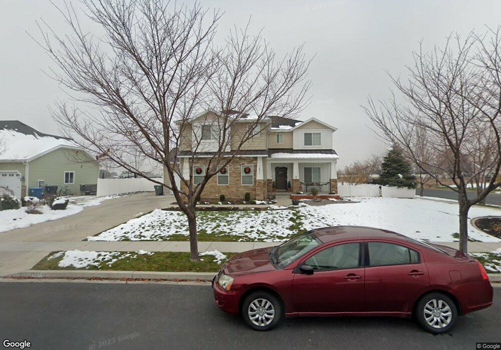
1271 N 1050 E American Fork, UT 84003
Estimated Value: $800,000 - $1,048,000
6
Beds
4
Baths
3,858
Sq Ft
$233/Sq Ft
Est. Value
About This Home
This home is located at 1271 N 1050 E, American Fork, UT 84003 and is currently estimated at $900,840, approximately $233 per square foot. 1271 N 1050 E is a home located in Utah County with nearby schools including Deerfield Elementary School, Mountain Ridge Junior High School, and American Fork High School.
Ownership History
Date
Name
Owned For
Owner Type
Purchase Details
Closed on
Jul 17, 2017
Sold by
Kidd Damian W and Kidd Jenifer J
Bought by
Hutchings Kevin and Hutchings Jessica
Current Estimated Value
Home Financials for this Owner
Home Financials are based on the most recent Mortgage that was taken out on this home.
Original Mortgage
$402,750
Outstanding Balance
$335,076
Interest Rate
3.94%
Mortgage Type
New Conventional
Estimated Equity
$565,764
Purchase Details
Closed on
Dec 20, 2012
Sold by
Stone Ridge Financial Llc
Bought by
Kidd Damian W and Kidd Jenifer J
Home Financials for this Owner
Home Financials are based on the most recent Mortgage that was taken out on this home.
Original Mortgage
$329,415
Interest Rate
3.25%
Mortgage Type
FHA
Purchase Details
Closed on
Aug 13, 2012
Sold by
Pemberton Properties Llc
Bought by
Stoue Ridge Financial Llc
Create a Home Valuation Report for This Property
The Home Valuation Report is an in-depth analysis detailing your home's value as well as a comparison with similar homes in the area
Home Values in the Area
Average Home Value in this Area
Purchase History
| Date | Buyer | Sale Price | Title Company |
|---|---|---|---|
| Hutchings Kevin | -- | Inwest Title Services Inc | |
| Kidd Damian W | -- | Select Title Ins Agency | |
| Stoue Ridge Financial Llc | -- | Select Title Insurance Agenc |
Source: Public Records
Mortgage History
| Date | Status | Borrower | Loan Amount |
|---|---|---|---|
| Open | Hutchings Kevin | $402,750 | |
| Previous Owner | Kidd Damian W | $329,415 |
Source: Public Records
Tax History
| Year | Tax Paid | Tax Assessment Tax Assessment Total Assessment is a certain percentage of the fair market value that is determined by local assessors to be the total taxable value of land and additions on the property. | Land | Improvement |
|---|---|---|---|---|
| 2025 | $3,429 | $429,440 | -- | -- |
| 2024 | $3,429 | $380,985 | $0 | $0 |
| 2023 | $3,246 | $382,360 | $0 | $0 |
| 2022 | $3,278 | $381,095 | $0 | $0 |
| 2021 | $2,877 | $522,400 | $178,000 | $344,400 |
| 2020 | $2,798 | $492,800 | $164,800 | $328,000 |
| 2019 | $2,614 | $476,100 | $153,300 | $322,800 |
| 2018 | $2,529 | $440,500 | $145,600 | $294,900 |
| 2017 | $2,533 | $238,095 | $0 | $0 |
| 2016 | $2,416 | $210,980 | $0 | $0 |
| 2015 | $2,369 | $196,295 | $0 | $0 |
| 2014 | $2,271 | $185,680 | $0 | $0 |
Source: Public Records
Map
Nearby Homes
- 1089 N 950 E
- 1077 N 950 E
- 1058 N 930 E Unit 64
- 1125 N 1270 E
- 9587 N 4500 W
- 1045 N 930 E Unit 58
- 9617 N 4500 W
- 4675 W Ferguson Way
- 4552 W Windsor Cir
- 4531 W Cambridge Dr
- 9752 N Dorchester Dr
- 4979 W Willowbank Dr
- 4968 W Evergreen Ln
- 5061 W Evergreen Ln
- 5034 W Green Ash Ln
- 5042 W Green Ash Ln
- 4998 W Green Ash Ln
- 4992 W Green Ash Ln
- 5056 W Green Ash Ln
- 1793 E Kern Mountain
- 1253 N 1050 E
- 1035 E 1280 N
- 1047 E 1280 N
- 1276 N 1050 E
- 1235 N 1050 E
- 1235 N 1050 E Unit 3
- 1258 N 1050 E
- 1079 E 1280 N Unit 8
- 1238 N 1050 E
- 1292 N 1020 E
- 1217 N 1050 E
- 1217 N 1050 E Unit 2
- 1096 E 1280 N
- 1251 N 1100 E
- 1084 E 1300 N
- 1222 N 1050 E
- 1072 E 1300 N
- 1072 E 1300 N Unit 8
- 1239 N 1100 E
- 1095 E 1280 N
Your Personal Tour Guide
Ask me questions while you tour the home.