Estimated Value: $498,000 - $542,000
4
Beds
2
Baths
2,086
Sq Ft
$249/Sq Ft
Est. Value
About This Home
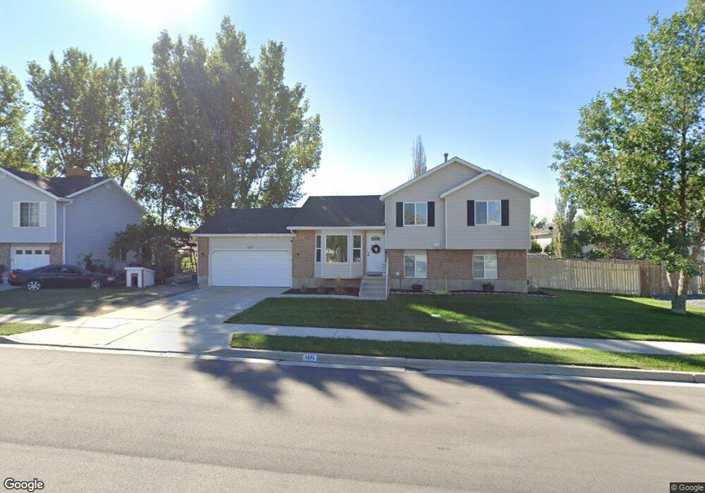
This home is located at 1271 W 1870 N, Lehi, UT 84043 and is currently estimated at $518,405, approximately $248 per square foot. 1271 W 1870 N is a home located in Utah County with nearby schools including Lehi Elementary School, Lehi Junior High School, and Lehi High School.
Ownership History
Date
Name
Owned For
Owner Type
Purchase Details
Closed on
Mar 14, 2018
Sold by
Bosshardt Bradley T and Bosshardt Amy L
Bought by
Barnett Joshua R and Barnett Madison
Current Estimated Value
Home Financials for this Owner
Home Financials are based on the most recent Mortgage that was taken out on this home.
Original Mortgage
$279,739
Outstanding Balance
$238,799
Interest Rate
4.22%
Mortgage Type
FHA
Estimated Equity
$279,606
Purchase Details
Closed on
Aug 29, 2008
Sold by
Winger Sherri K and Winger Sherri
Bought by
Bosshardt Bradley T and Bosshardt Amy L
Home Financials for this Owner
Home Financials are based on the most recent Mortgage that was taken out on this home.
Original Mortgage
$197,393
Interest Rate
6.5%
Mortgage Type
FHA
Purchase Details
Closed on
Jun 3, 2005
Sold by
Goff Nathaniel G and Goff Courtney L
Bought by
Winger Joseph E and Winger Sherri
Purchase Details
Closed on
Jan 14, 2005
Sold by
Goff Nathaniel
Bought by
Goff Nathaniel G and Goff Courtney L
Home Financials for this Owner
Home Financials are based on the most recent Mortgage that was taken out on this home.
Original Mortgage
$27,200
Interest Rate
5.67%
Mortgage Type
Stand Alone Second
Purchase Details
Closed on
Jan 11, 2005
Sold by
Bank One Na
Bought by
Goff Nathaniel
Home Financials for this Owner
Home Financials are based on the most recent Mortgage that was taken out on this home.
Original Mortgage
$27,200
Interest Rate
5.67%
Mortgage Type
Stand Alone Second
Purchase Details
Closed on
Oct 26, 2004
Sold by
Roach Troy A and Roach Lu Anne R
Bought by
Bank One Na
Purchase Details
Closed on
Jun 11, 1998
Sold by
Norman Thomas E and Norman Shelly G
Bought by
Roach Troy A and Roach Luanne R
Home Financials for this Owner
Home Financials are based on the most recent Mortgage that was taken out on this home.
Original Mortgage
$127,600
Interest Rate
7.17%
Create a Home Valuation Report for This Property
The Home Valuation Report is an in-depth analysis detailing your home's value as well as a comparison with similar homes in the area
Home Values in the Area
Average Home Value in this Area
Purchase History
| Date | Buyer | Sale Price | Title Company |
|---|---|---|---|
| Barnett Joshua R | -- | Backman Title Services | |
| Bosshardt Bradley T | -- | Cornerstone Title Insurance | |
| Winger Joseph E | -- | Provo Land Title Co | |
| Goff Nathaniel G | -- | -- | |
| Goff Nathaniel | -- | United Title Services | |
| Bank One Na | $139,035 | Inwest Title | |
| Roach Troy A | -- | Provo Land Title |
Source: Public Records
Mortgage History
| Date | Status | Borrower | Loan Amount |
|---|---|---|---|
| Open | Barnett Joshua R | $279,739 | |
| Previous Owner | Bosshardt Bradley T | $197,393 | |
| Previous Owner | Goff Nathaniel | $27,200 | |
| Previous Owner | Goff Nathaniel | $108,800 | |
| Previous Owner | Roach Troy A | $127,600 |
Source: Public Records
Tax History Compared to Growth
Tax History
| Year | Tax Paid | Tax Assessment Tax Assessment Total Assessment is a certain percentage of the fair market value that is determined by local assessors to be the total taxable value of land and additions on the property. | Land | Improvement |
|---|---|---|---|---|
| 2025 | $1,985 | $241,670 | $174,300 | $265,100 |
| 2024 | $1,985 | $232,320 | $0 | $0 |
| 2023 | $1,873 | $238,040 | $0 | $0 |
| 2022 | $1,923 | $236,940 | $0 | $0 |
| 2021 | $1,721 | $320,500 | $100,900 | $219,600 |
| 2020 | $1,622 | $298,600 | $93,400 | $205,200 |
| 2019 | $1,451 | $277,600 | $93,400 | $184,200 |
| 2018 | $1,386 | $250,800 | $88,500 | $162,300 |
| 2017 | $1,324 | $127,325 | $0 | $0 |
| 2016 | $1,276 | $113,905 | $0 | $0 |
| 2015 | $1,251 | $105,930 | $0 | $0 |
| 2014 | $1,257 | $105,820 | $0 | $0 |
Source: Public Records
Map
Nearby Homes
- 1272 W 1800 N
- 1249 W 1800 N
- 1332 W 1500 N
- 1610 N 1125 W
- 1011 W Mountain Way Unit 316
- 1094 W 1425 N
- 1627 W Boxwood Dr Unit 110
- 1817 W Bad Rock Cir
- 1659 W Boxwood Dr Unit 109
- 902 W 1500 N
- 1542 N 1900 W
- 5312 N Springview Ct Unit 106
- 1027 N 3685 W Unit 248
- 2191 W Swift Fox Dr Unit 274
- 999 Empire St
- 2184 W Cape Fox Way N Unit 220
- 1060 N Canvasback Dr Unit 405
- 1089 N 3685 W Unit 253
- 500 S Center St E
- 1077 N 3685 W Unit 252