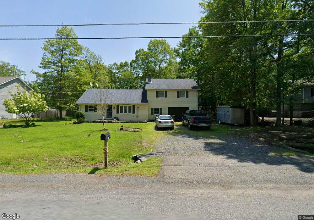
12711 Deer Path Dr East Stroudsburg, PA 18302
Estimated Value: $261,956 - $350,000
3
Beds
2
Baths
1,879
Sq Ft
$165/Sq Ft
Est. Value
About This Home
This home is located at 12711 Deer Path Dr, East Stroudsburg, PA 18302 and is currently estimated at $310,239, approximately $165 per square foot. 12711 Deer Path Dr is a home located in Monroe County with nearby schools including East Stroudsburg Elementary School, J.T. Lambert Intermediate School, and East Stroudsburg Senior High School South.
Ownership History
Date
Name
Owned For
Owner Type
Purchase Details
Closed on
Jan 12, 2011
Sold by
Muti Peter F
Bought by
Muti Paula Ann
Current Estimated Value
Home Financials for this Owner
Home Financials are based on the most recent Mortgage that was taken out on this home.
Original Mortgage
$60,000
Interest Rate
4.62%
Mortgage Type
New Conventional
Create a Home Valuation Report for This Property
The Home Valuation Report is an in-depth analysis detailing your home's value as well as a comparison with similar homes in the area
Home Values in the Area
Average Home Value in this Area
Purchase History
| Date | Buyer | Sale Price | Title Company |
|---|---|---|---|
| Muti Paula Ann | $60,000 | None Available |
Source: Public Records
Mortgage History
| Date | Status | Borrower | Loan Amount |
|---|---|---|---|
| Closed | Muti Paula Ann | $60,000 |
Source: Public Records
Tax History Compared to Growth
Tax History
| Year | Tax Paid | Tax Assessment Tax Assessment Total Assessment is a certain percentage of the fair market value that is determined by local assessors to be the total taxable value of land and additions on the property. | Land | Improvement |
|---|---|---|---|---|
| 2025 | $885 | $108,640 | $14,500 | $94,140 |
| 2024 | $725 | $108,640 | $14,500 | $94,140 |
| 2023 | $3,904 | $108,640 | $14,500 | $94,140 |
| 2022 | $3,956 | $108,640 | $14,500 | $94,140 |
| 2021 | $3,897 | $108,640 | $14,500 | $94,140 |
| 2020 | $3,514 | $108,640 | $14,500 | $94,140 |
| 2019 | $4,020 | $19,170 | $1,750 | $17,420 |
| 2018 | $4,020 | $19,170 | $1,750 | $17,420 |
| 2017 | $4,020 | $19,170 | $1,750 | $17,420 |
| 2016 | $3,593 | $19,170 | $1,750 | $17,420 |
| 2015 | -- | $19,170 | $1,750 | $17,420 |
| 2014 | -- | $19,170 | $1,750 | $17,420 |
Source: Public Records
Map
Nearby Homes
- 12723 Magnolia Dr
- 12104 Big Buck Ln
- 12036 Maplewood Dr
- 12044 Maplewood Dr
- 0 Green Meadow Dr
- Lot 24 Green Meadow Dr
- 6 Westridge Ct
- 28 Lenape Dr
- Lot 4 Adams Dr
- 0 Lenape Dr Unit Lot 31 & 32 763518
- 237 Footprint Rd
- 0 Lace Dr 24 Dr
- Lot18 Lenape Dr
- Lot 36 Lenape Dr
- 84 Lenape Dr
- Lot 31 & 32 Lenape Dr
- 811 Knoll Dr
- 430 Indian Way
- 3584 Bristol Cir W
- Lot 17 Footprint Rd
- 12728 Deer Path Dr
- 12728 Magnolia Dr
- 12709 Deer Path Dr
- 12705 Deer Path Dr
- 12730 Deer Path Dr
- 12708 Deer Path Dr
- 12703 Deer Path Dr
- 12726 Deer Path Dr
- 12726 Magnolia Dr
- 12702 Deer Path Dr
- 12729 Deer Path Dr
- 12725 Deer Path Dr
- 12725 Magnolia Dr
- 12732 Deer Path Dr
- 12722 Deer Path Dr
- 12336 Havenwood Dr
- 12336 Haven Wood Dr
- 12723 Deer Path Dr
- 12722 Magnolia Dr
- 12125 Big Buck Ln