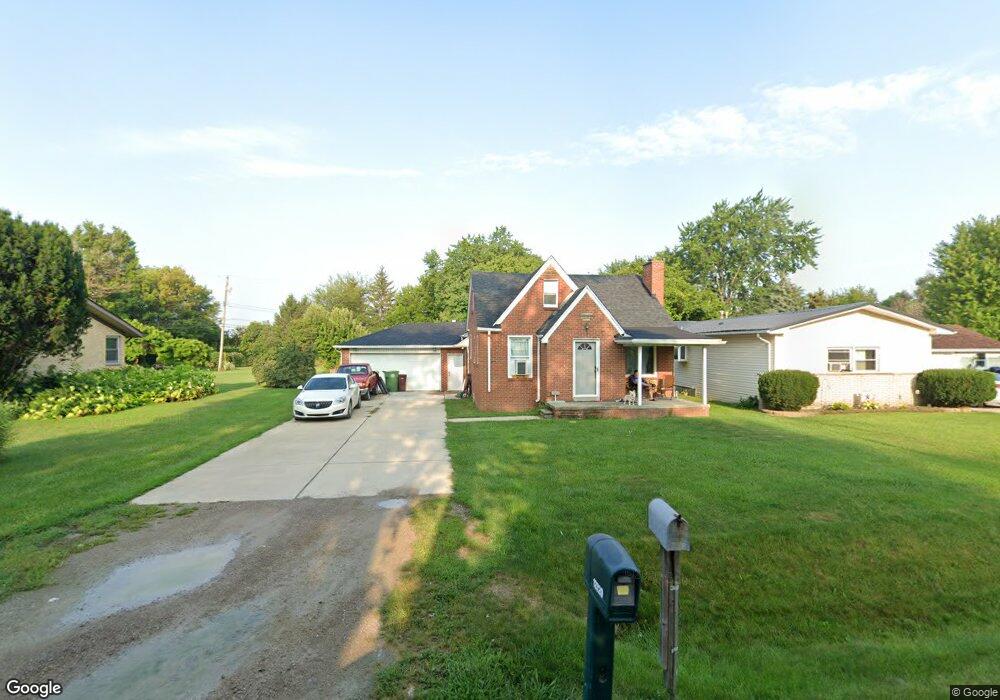
12720 Devoe St Southgate, MI 48195
Estimated Value: $174,000 - $191,426
2
Beds
1
Bath
1,000
Sq Ft
$183/Sq Ft
Est. Value
About This Home
This home is located at 12720 Devoe St, Southgate, MI 48195 and is currently estimated at $182,857, approximately $182 per square foot. 12720 Devoe St is a home located in Wayne County with nearby schools including Shelters Elementary School, Davidson Middle School, and Southgate Anderson High School.
Ownership History
Date
Name
Owned For
Owner Type
Purchase Details
Closed on
Sep 30, 2008
Sold by
Deutsche Bank National Trust Company
Bought by
Hassell Aaron Michael
Current Estimated Value
Purchase Details
Closed on
Apr 19, 2007
Sold by
Mortgage Electronic Registration Systems
Bought by
Deutsche Bank National Trust Co and Gsamp Trust 2005-Ahl Mortgage Pass Throu
Purchase Details
Closed on
Feb 28, 2007
Sold by
Kennedy John
Bought by
Mortgage Electronic Registration Systems
Purchase Details
Closed on
Dec 29, 2004
Sold by
Mcmullen Kenneth P and Mcmullen Katherine
Bought by
Kennedy John
Purchase Details
Closed on
Mar 1, 2004
Sold by
Mento Dominick and Mento Beryl
Bought by
Mcmullen Kenneth P
Create a Home Valuation Report for This Property
The Home Valuation Report is an in-depth analysis detailing your home's value as well as a comparison with similar homes in the area
Home Values in the Area
Average Home Value in this Area
Purchase History
| Date | Buyer | Sale Price | Title Company |
|---|---|---|---|
| Hassell Aaron Michael | $39,374 | None Available | |
| Deutsche Bank National Trust Co | -- | None Available | |
| Mortgage Electronic Registration Systems | $128,700 | None Available | |
| Kennedy John | $163,000 | Commonwealth Land Title | |
| Mcmullen Kenneth P | $93,000 | Multiple |
Source: Public Records
Tax History
| Year | Tax Paid | Tax Assessment Tax Assessment Total Assessment is a certain percentage of the fair market value that is determined by local assessors to be the total taxable value of land and additions on the property. | Land | Improvement |
|---|---|---|---|---|
| 2025 | $2,513 | $88,600 | $0 | $0 |
| 2024 | $2,404 | $80,400 | $0 | $0 |
| 2023 | $2,533 | $70,700 | $0 | $0 |
| 2022 | $2,623 | $64,400 | $0 | $0 |
| 2021 | $2,557 | $57,800 | $0 | $0 |
| 2020 | $2,516 | $55,600 | $0 | $0 |
| 2019 | $2,486 | $50,100 | $0 | $0 |
| 2018 | $1,922 | $46,100 | $0 | $0 |
| 2017 | $1,071 | $45,000 | $0 | $0 |
| 2016 | $2,308 | $42,500 | $0 | $0 |
| 2015 | $3,799 | $40,200 | $0 | $0 |
| 2013 | $3,680 | $37,600 | $0 | $0 |
| 2012 | $1,728 | $36,200 | $7,400 | $28,800 |
Source: Public Records
Map
Nearby Homes
- 12750 Churchill Ave
- 12900 Churchill Ave
- 12690 Churchill Ave
- 15602 Northline Rd
- 15468 Northline Rd
- 12630 Churchill Ave
- 15405 Oakleigh
- 12661 Fordline St
- 16685 Rudgate St
- 16285 Raleigh Square Dr
- 12487 First Ave S
- 13621 Mulberry St
- 12421 Helen St
- 13367 Fordline St
- 12100 Helen St
- 4241 Fordline Rd
- 14212 Northline Rd
- 11367 Suffolk Dr
- 0 Poplar St
- 13747 Humphrey St