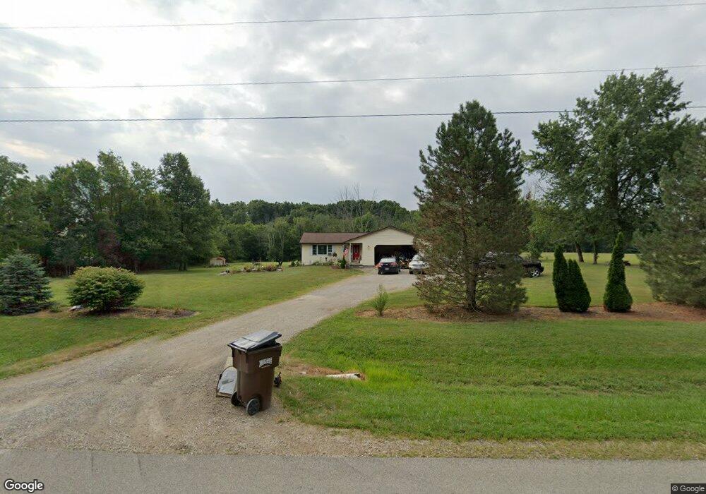
12721 Taylor Rd Plain City, OH 43064
Estimated Value: $328,000 - $483,000
3
Beds
2
Baths
1,300
Sq Ft
$313/Sq Ft
Est. Value
About This Home
This home is located at 12721 Taylor Rd, Plain City, OH 43064 and is currently estimated at $406,546, approximately $312 per square foot. 12721 Taylor Rd is a home located in Union County with nearby schools including Plain City Elementary School, Jonathan Alder Junior High School, and Canaan Middle School.
Ownership History
Date
Name
Owned For
Owner Type
Purchase Details
Closed on
Dec 30, 1996
Sold by
Ross George A
Bought by
Burchett Randall D and Burchett Joan
Current Estimated Value
Home Financials for this Owner
Home Financials are based on the most recent Mortgage that was taken out on this home.
Original Mortgage
$126,000
Outstanding Balance
$13,545
Interest Rate
7.64%
Mortgage Type
New Conventional
Estimated Equity
$393,001
Create a Home Valuation Report for This Property
The Home Valuation Report is an in-depth analysis detailing your home's value as well as a comparison with similar homes in the area
Home Values in the Area
Average Home Value in this Area
Purchase History
| Date | Buyer | Sale Price | Title Company |
|---|---|---|---|
| Burchett Randall D | $140,000 | -- |
Source: Public Records
Mortgage History
| Date | Status | Borrower | Loan Amount |
|---|---|---|---|
| Open | Burchett Randall D | $126,000 |
Source: Public Records
Tax History Compared to Growth
Tax History
| Year | Tax Paid | Tax Assessment Tax Assessment Total Assessment is a certain percentage of the fair market value that is determined by local assessors to be the total taxable value of land and additions on the property. | Land | Improvement |
|---|---|---|---|---|
| 2024 | $2,968 | $96,200 | $34,170 | $62,030 |
| 2023 | $2,968 | $96,200 | $34,170 | $62,030 |
| 2022 | $3,460 | $96,200 | $34,170 | $62,030 |
| 2021 | $2,941 | $78,980 | $26,290 | $52,690 |
| 2020 | $2,847 | $78,980 | $26,290 | $52,690 |
| 2019 | $2,794 | $78,980 | $26,290 | $52,690 |
| 2018 | $2,628 | $72,960 | $21,940 | $51,020 |
| 2017 | $2,626 | $72,960 | $21,940 | $51,020 |
| 2016 | $2,647 | $72,960 | $21,940 | $51,020 |
| 2015 | $2,329 | $62,670 | $21,940 | $40,730 |
| 2014 | $2,326 | $62,670 | $21,940 | $40,730 |
| 2013 | $2,349 | $62,670 | $21,940 | $40,730 |
Source: Public Records
Map
Nearby Homes
- 12697 Taylor Rd
- 13420 Taylor Rd
- 9334 State Route 736
- 11682 Taylor Rd
- 13017 Adams Rd
- 10205 Coronado Ct
- 10119 Biscayne Ct
- 10589 Laguna Cir
- 9530 Mission Dr
- 9755 Fresno Ct
- 10700 Laguna Cir
- 11033 Sacramento Ct
- 9617 New California Dr
- 10035 Industrial Pkwy
- 10465 Industrial Pkwy
- 9794 Mimosa Ct
- Galveston Plan at Reserve at New California
- Manchester Plan at Reserve at New California
- McKenzie Plan at Reserve at New California
- Sanibel Plan at Reserve at New California
- 12709 Taylor Rd
- 12821 Taylor Rd
- 12726 Taylor Rd
- 12775 Taylor Rd
- 0 Taylor Rd Unit 2742384
- 0 Taylor Rd Unit LOTE2 2022624
- 0 Taylor Rd Unit Lot 4 2402725
- 0 Taylor Rd Unit 2315212
- 0 Taylor Rd Unit L-11 2114778
- 0 Taylor Rd Unit LOTF 2034552
- 0 Taylor Rd Unit L-H1 2034557
- 0 Taylor Rd Unit LOTI 2022619
- 0 Taylor Rd Unit LOTH 2022600
- 0 Taylor Rd Unit 2102181
- 0 Taylor Rd Unit 2100108
- 0 Taylor Rd Unit L-H2 2034566
- 0 Taylor Rd Unit LOTG 2034554
- 0 Taylor Rd Unit LOT2 2026867
- 0 Taylor Rd Unit LOTK 2022608
- 0 Taylor Rd Unit LOTJ 2013965