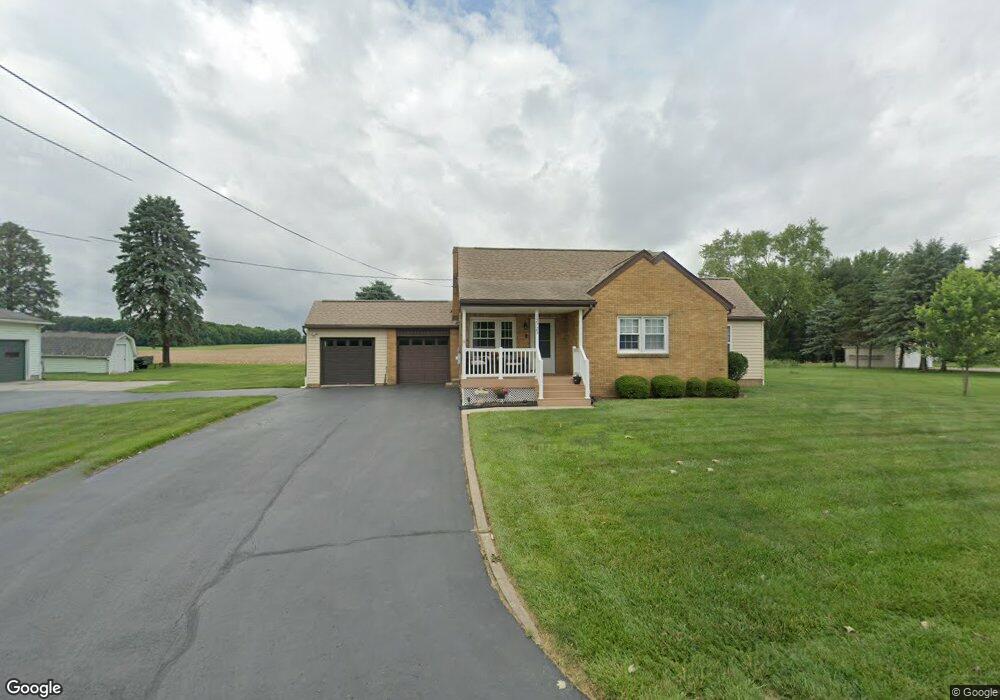
12725 Wooster St NW Massillon, OH 44647
Amherst Heights-Clearview NeighborhoodEstimated Value: $230,000 - $269,000
2
Beds
1
Bath
1,355
Sq Ft
$185/Sq Ft
Est. Value
About This Home
This home is located at 12725 Wooster St NW, Massillon, OH 44647 and is currently estimated at $250,643, approximately $184 per square foot. 12725 Wooster St NW is a home located in Stark County with nearby schools including Tuslaw Elementary School, Tuslaw Middle School, and Tuslaw High School.
Ownership History
Date
Name
Owned For
Owner Type
Purchase Details
Closed on
Jan 5, 2024
Sold by
Donald E Aman And Carol M Aman Revocable
Bought by
Buck Sarah N
Current Estimated Value
Purchase Details
Closed on
Oct 17, 2017
Sold by
Aman Elizabeth
Bought by
Aman Donald E and Aman Carol M
Purchase Details
Closed on
Feb 24, 2012
Sold by
Estate Of Susan M Aman
Bought by
Aman Elizabeth
Create a Home Valuation Report for This Property
The Home Valuation Report is an in-depth analysis detailing your home's value as well as a comparison with similar homes in the area
Home Values in the Area
Average Home Value in this Area
Purchase History
| Date | Buyer | Sale Price | Title Company |
|---|---|---|---|
| Buck Sarah N | -- | None Listed On Document | |
| Aman Donald E | $130,000 | None Available | |
| Aman Elizabeth | -- | None Available |
Source: Public Records
Tax History Compared to Growth
Tax History
| Year | Tax Paid | Tax Assessment Tax Assessment Total Assessment is a certain percentage of the fair market value that is determined by local assessors to be the total taxable value of land and additions on the property. | Land | Improvement |
|---|---|---|---|---|
| 2025 | -- | $71,970 | $27,060 | $44,910 |
| 2024 | -- | $71,970 | $27,060 | $44,910 |
| 2023 | $2,212 | $55,130 | $18,870 | $36,260 |
| 2022 | $2,213 | $55,130 | $18,870 | $36,260 |
| 2021 | $2,245 | $55,130 | $18,870 | $36,260 |
| 2020 | $1,927 | $44,560 | $15,470 | $29,090 |
| 2019 | $1,864 | $44,560 | $15,470 | $29,090 |
| 2018 | $1,838 | $44,560 | $15,470 | $29,090 |
| 2017 | $1,336 | $30,450 | $5,250 | $25,200 |
| 2016 | $1,074 | $24,190 | $4,200 | $19,990 |
| 2015 | $1,087 | $24,190 | $4,200 | $19,990 |
| 2014 | $1,099 | $23,380 | $4,060 | $19,320 |
| 2013 | $555 | $23,380 | $4,060 | $19,320 |
Source: Public Records
Map
Nearby Homes
- 4420 Lockhart Cir NW
- 4745 Sippo Reserves Dr NW
- 2636 Kenyon Ave NW
- Eden Cay w/ Basement Plan at Sippo Reserves
- Aruba Bay Plan at Sippo Reserves
- Grand Cayman w/ Basement Plan at Sippo Reserves
- Grand Bahama w/ Basement Plan at Sippo Reserves
- 3610 Kenyon Creek Ave NW
- 3564 Kenyon Creek Ave NW
- 1350 Alpha St NW
- 1783 Heron Creek St NW
- 1252 Gabrielle Cir NW
- 0 Ben Fulton Ave NW
- 982 Lanedale St NW
- 1220 Ben Fulton Ave NW
- 0 Manchester Ave NW
- 1173 Manchester Ave SW
- 1174 Manchester Ave SW
- 3069 Castle West Cir NW
- 3130 Lincoln Way W
- 12757 Wooster St NW
- 12655 Wooster St NW
- 12682 Wooster St NW
- 12708 Wooster St NW
- 12716 Wooster St NW
- 12781 Wooster St NW
- 12658 Wooster St NW
- 12635 Wooster St NW
- 12632 Wooster St NW
- 12608 Wooster St NW
- 12881 Wooster St NW
- 12535 Wooster St NW
- 2333 Parkbrook St NW
- 2311 Parkbrook St NW
- 2355 Parkbrook St NW
- 2281 Parkbrook St NW
- 2383 Parkbrook St NW
- 12660 Lakeridge St NW
- 12851 Sunshine Cir NW
- 2485 Parkbrook St NW