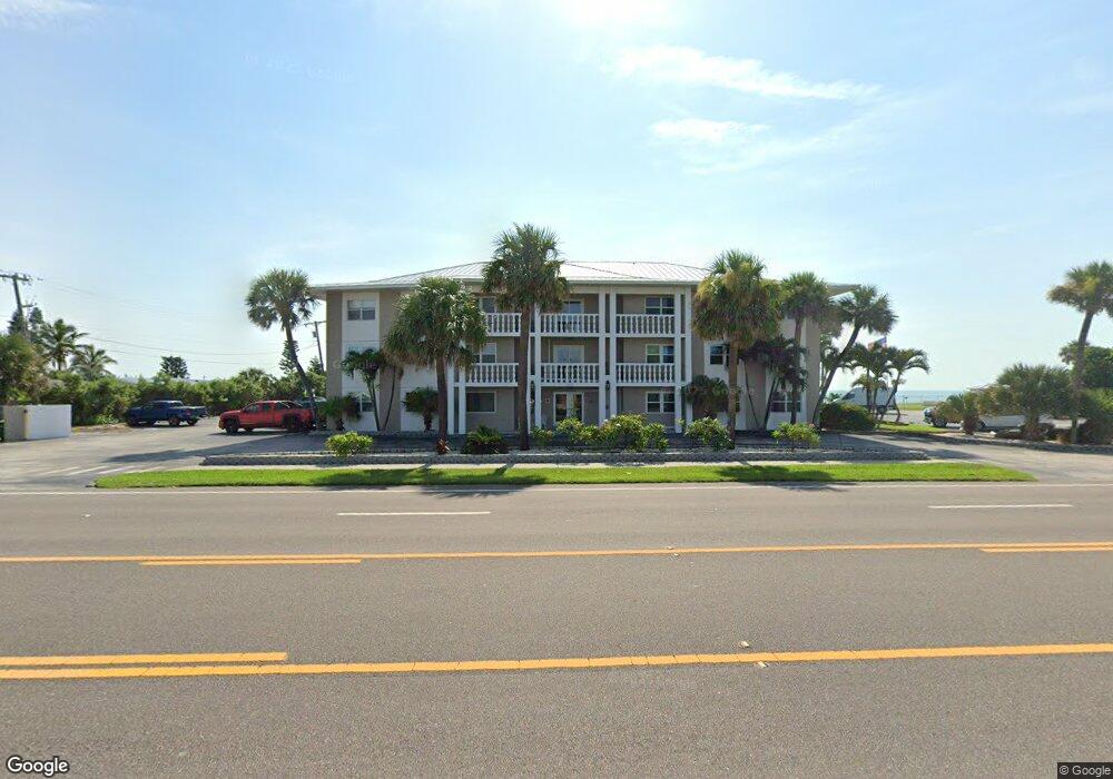
1273 Highway A1a Unit 311 Satellite Beach, FL 32937
Estimated Value: $285,000 - $404,000
--
Bed
--
Bath
1,092
Sq Ft
$335/Sq Ft
Est. Value
About This Home
This home is located at 1273 Highway A1a Unit 311, Satellite Beach, FL 32937 and is currently estimated at $365,656, approximately $334 per square foot. 1273 Highway A1a Unit 311 is a home located in Brevard County with nearby schools including Satellite Senior High School, Surfside Elementary School, and DeLaura Middle School.
Ownership History
Date
Name
Owned For
Owner Type
Purchase Details
Closed on
Dec 4, 2024
Sold by
Catrambone Anthony Ralph and Catrambone Donna Marie
Bought by
Catrambone Anthony Ralph and Catrambone Donna Marie
Current Estimated Value
Purchase Details
Closed on
Jan 19, 2024
Sold by
Anthony Ralph Catrambone and Anthony Donna Marie
Bought by
Catrambone Anthony Ralph
Purchase Details
Closed on
Dec 19, 2022
Sold by
Catrambone Anthony R and Catrambone Donna Marie
Bought by
Anthony Ralph Catrambone And Donna Marie Catr
Purchase Details
Closed on
Oct 15, 2013
Sold by
Witzleb Warren J and Witzleb Dixie A
Bought by
Catrambone Anthony R and Catrambone Donna Marie
Create a Home Valuation Report for This Property
The Home Valuation Report is an in-depth analysis detailing your home's value as well as a comparison with similar homes in the area
Home Values in the Area
Average Home Value in this Area
Purchase History
| Date | Buyer | Sale Price | Title Company |
|---|---|---|---|
| Catrambone Anthony Ralph | $100 | None Listed On Document | |
| Catrambone Anthony Ralph | $100 | None Listed On Document | |
| Catrambone Anthony Ralph | $100 | None Listed On Document | |
| Catrambone Anthony Ralph | $100 | None Listed On Document | |
| Catrambone Anthony Ralph | $100 | None Listed On Document | |
| Anthony Ralph Catrambone And Donna Marie Catr | $100 | -- | |
| Catrambone Anthony R | $188,000 | Alliance Title Insurance Age |
Source: Public Records
Tax History Compared to Growth
Tax History
| Year | Tax Paid | Tax Assessment Tax Assessment Total Assessment is a certain percentage of the fair market value that is determined by local assessors to be the total taxable value of land and additions on the property. | Land | Improvement |
|---|---|---|---|---|
| 2025 | $3,530 | $233,580 | -- | -- |
| 2024 | $3,477 | $227,000 | -- | -- |
| 2023 | $3,477 | $220,390 | $0 | $0 |
| 2022 | $3,256 | $213,980 | $0 | $0 |
| 2021 | $3,368 | $207,750 | $0 | $207,750 |
| 2020 | $4,257 | $207,750 | $0 | $207,750 |
| 2019 | $4,140 | $197,390 | $0 | $197,390 |
| 2018 | $4,372 | $203,690 | $0 | $203,690 |
| 2017 | $3,953 | $187,530 | $0 | $187,530 |
| 2016 | $3,805 | $184,580 | $0 | $0 |
| 2015 | $3,531 | $154,420 | $0 | $0 |
| 2014 | $3,217 | $140,390 | $0 | $0 |
Source: Public Records
Map
Nearby Homes
- 1273 Highway A1a Unit 308
- 1303 Highway A1a Unit 401
- 1326 Highway A1a
- 129 Seawind Dr Unit 25
- 1369 Highway A1a Unit 8
- 1369 Highway A1a Unit 7
- 170 Norwood Ave
- 130 Roosevelt Ave Unit 207
- 298 Harwood Ave
- 0 Cassia Blvd
- 310 Glenwood Ave
- 204 Queens Ct
- 210 Queens Ct
- 240 Sheridan Ave
- 320 Glenwood Ave
- 295 Cinnamon Dr
- 1125 Highway A1a Unit 903
- 1125 Highway A1a Unit 501
- 348 Sherwood Ave
- 1455 Highway A1a Unit 507
- 1273 Highway A1a Unit 20
- 1273 Highway A1a
- 1273 Highway A1a Unit 114
- 1273 Highway A1a Unit 210
- 1273 Highway A1a Unit 205
- 1273 Highway A1a Unit 211
- 1273 Highway A1a Unit 202
- 1273 Highway A1a Unit 310
- 1273 Highway A1a Unit 314
- 1273 Highway A1a Unit 306
- 1273 Highway A1a Unit 101
- 1273 Highway A1a Unit 309
- 1273 Highway A1a Unit 204
- 1273 Highway A1a Unit 303
- 1273 Highway A1a Unit 305
- 1273 Highway A1a Unit 108
- 1273 Highway A1a Unit 102
- 1273 Highway A1a Unit 201
- 1273 Highway A1a Unit 203
- 1273 Highway A1a Unit 312