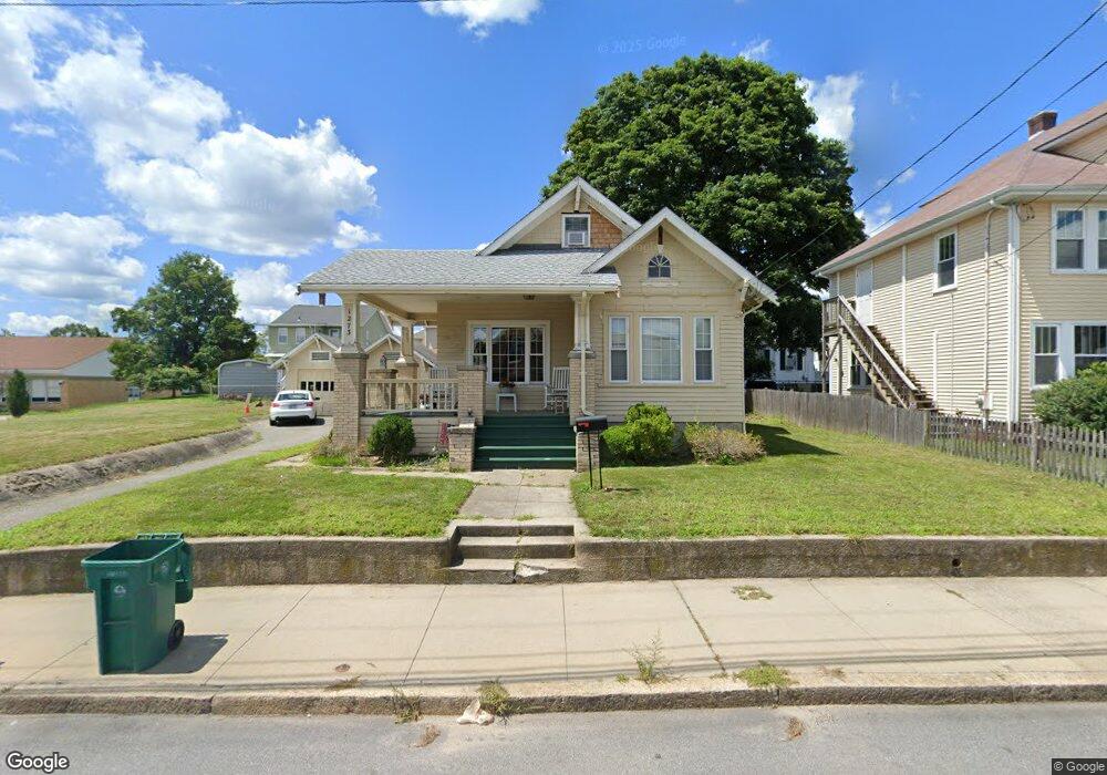
1273 Park Ave Woonsocket, RI 02895
Globe District NeighborhoodEstimated Value: $329,417 - $374,000
2
Beds
1
Bath
1,228
Sq Ft
$286/Sq Ft
Est. Value
About This Home
This home is located at 1273 Park Ave, Woonsocket, RI 02895 and is currently estimated at $351,604, approximately $286 per square foot. 1273 Park Ave is a home located in Providence County with nearby schools including Woonsocket High School, Founders Academy, and Beacon Charter School.
Ownership History
Date
Name
Owned For
Owner Type
Purchase Details
Closed on
Apr 29, 1994
Sold by
Park Square Cu
Bought by
Edwards David H
Current Estimated Value
Home Financials for this Owner
Home Financials are based on the most recent Mortgage that was taken out on this home.
Original Mortgage
$58,000
Interest Rate
7.7%
Create a Home Valuation Report for This Property
The Home Valuation Report is an in-depth analysis detailing your home's value as well as a comparison with similar homes in the area
Home Values in the Area
Average Home Value in this Area
Purchase History
| Date | Buyer | Sale Price | Title Company |
|---|---|---|---|
| Edwards David H | $72,500 | -- | |
| Edwards David H | $72,500 | -- |
Source: Public Records
Mortgage History
| Date | Status | Borrower | Loan Amount |
|---|---|---|---|
| Open | Edwards David H | $100,000 | |
| Closed | Edwards David H | $40,000 | |
| Closed | Edwards David H | $58,000 |
Source: Public Records
Tax History Compared to Growth
Tax History
| Year | Tax Paid | Tax Assessment Tax Assessment Total Assessment is a certain percentage of the fair market value that is determined by local assessors to be the total taxable value of land and additions on the property. | Land | Improvement |
|---|---|---|---|---|
| 2025 | $3,524 | $313,800 | $90,600 | $223,200 |
| 2024 | $3,443 | $236,800 | $92,300 | $144,500 |
| 2023 | $3,310 | $236,800 | $92,300 | $144,500 |
| 2022 | $3,310 | $236,800 | $92,300 | $144,500 |
| 2021 | $3,042 | $128,100 | $38,400 | $89,700 |
| 2020 | $3,074 | $128,100 | $38,400 | $89,700 |
| 2018 | $3,085 | $128,100 | $38,400 | $89,700 |
| 2017 | $3,991 | $132,600 | $41,200 | $91,400 |
| 2016 | $4,222 | $132,600 | $41,200 | $91,400 |
| 2015 | $4,851 | $132,600 | $41,200 | $91,400 |
| 2014 | $4,360 | $121,300 | $45,400 | $75,900 |
Source: Public Records
Map
Nearby Homes
- 25 Ormond St
- 61 Warwick St
- 97 Warwick St
- 109 Hemond Ave
- 0 Laflamme Ave
- 0 Caron Ave Unit 1379503
- 0 Caron Ave Unit 73342710
- 203 Hemond Ave
- 58 Cranston St
- 1014 Park Ave
- 28 White Pkwy
- 0 Chester St
- 604 Providence St
- 124 Darwin St
- 2 Raymond St
- 243 Transit St
- 36 Old Louisquisset Pike Unit 104
- 36 Old Louisquisset Pike Unit 204
- 36 Old Louisquisset Pike Unit 206
- 36 Old Louisquisset Pike Unit 109