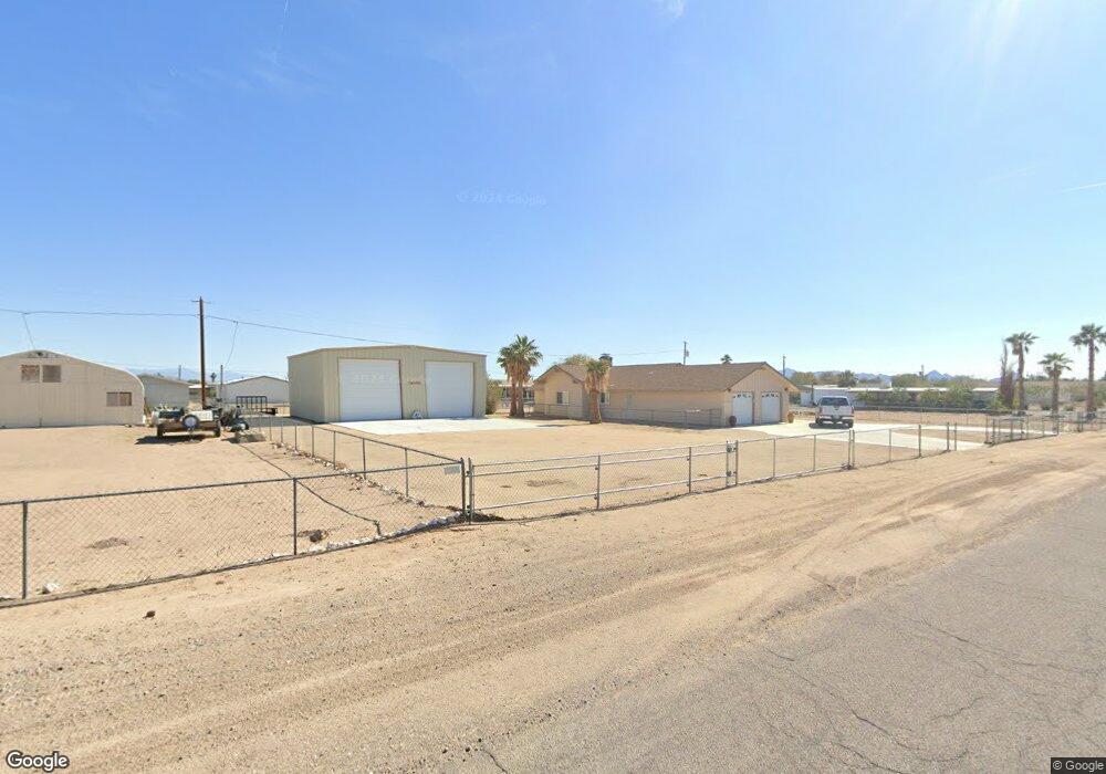
12732 S Apache Pkwy Topock/Golden Shores, AZ 86436
Golden Shores NeighborhoodEstimated Value: $286,000 - $498,000
2
Beds
1
Bath
1,640
Sq Ft
$230/Sq Ft
Est. Value
About This Home
This home is located at 12732 S Apache Pkwy, Topock/Golden Shores, AZ 86436 and is currently estimated at $376,567, approximately $229 per square foot. 12732 S Apache Pkwy is a home located in Mohave County with nearby schools including Topock Elementary School and River Valley High School.
Ownership History
Date
Name
Owned For
Owner Type
Purchase Details
Closed on
May 10, 2024
Sold by
Michael & Diane Madden Family Trust and Madden Diane
Bought by
Madden Diane I and Riat Christine
Current Estimated Value
Purchase Details
Closed on
Feb 20, 2020
Sold by
Madden Michael J and Madden Diane
Bought by
Madden Michael J and Madden Diane
Purchase Details
Closed on
Feb 13, 2017
Sold by
Fiscus Norma K
Bought by
Madden Michael J and Madden Diane
Purchase Details
Closed on
Jan 30, 2004
Sold by
Chemleski Lillian
Bought by
Fiscus Norma K
Home Financials for this Owner
Home Financials are based on the most recent Mortgage that was taken out on this home.
Original Mortgage
$88,000
Interest Rate
5.65%
Mortgage Type
Purchase Money Mortgage
Purchase Details
Closed on
Nov 18, 2002
Sold by
Chemleski Lillian
Bought by
Chemleski Lillian
Create a Home Valuation Report for This Property
The Home Valuation Report is an in-depth analysis detailing your home's value as well as a comparison with similar homes in the area
Home Values in the Area
Average Home Value in this Area
Purchase History
| Date | Buyer | Sale Price | Title Company |
|---|---|---|---|
| Madden Diane I | -- | None Listed On Document | |
| Madden Michael J | -- | None Available | |
| Madden Michael J | $142,000 | Chicago Title Agency Inc | |
| Fiscus Norma K | $110,000 | First American Title Ins Co | |
| Chemleski Lillian | -- | -- |
Source: Public Records
Mortgage History
| Date | Status | Borrower | Loan Amount |
|---|---|---|---|
| Previous Owner | Fiscus Norma K | $88,000 |
Source: Public Records
Tax History Compared to Growth
Tax History
| Year | Tax Paid | Tax Assessment Tax Assessment Total Assessment is a certain percentage of the fair market value that is determined by local assessors to be the total taxable value of land and additions on the property. | Land | Improvement |
|---|---|---|---|---|
| 2026 | -- | -- | -- | -- |
| 2025 | $2,222 | $37,496 | $0 | $0 |
| 2024 | $2,222 | $39,085 | $0 | $0 |
| 2023 | $2,222 | $30,167 | $0 | $0 |
| 2022 | $2,151 | $23,796 | $0 | $0 |
| 2021 | $2,151 | $19,303 | $0 | $0 |
| 2019 | $2,043 | $18,163 | $0 | $0 |
| 2018 | $1,205 | $9,464 | $0 | $0 |
| 2017 | $1,221 | $9,420 | $0 | $0 |
| 2016 | $956 | $10,233 | $0 | $0 |
| 2015 | $929 | $9,173 | $0 | $0 |
Source: Public Records
Map
Nearby Homes
- 12732 Pima Pkwy
- 5078 Maricopa Dr
- 12748 S Cortaro Dr
- 12720 S Cortaro Dr
- 12816 S Pima Pkwy
- 5390 E Maricopa Dr
- 12858 Apache Pkwy
- 12934/38 Pima Pkwy
- 5378 Gila Place
- 12633 S Apache Pkwy
- 5419 E Coconino Dr
- 5461 E Coconino Dr
- 12587 El Mirage Dr
- 5119 E Ajo Place
- 5196 E Concho Place
- 5415 Apache Dr
- 5389 Pinal Place
- 5388 Pinal Place
- 12693 S Oatman Hwy
- 5117 E Bonita Place
- 12732 S Apache Pkwy
- 12732 Apache Pkwy 31-J-6
- 12731 S Apache Pkwy Unit 6
- 12731 S Apache Pkwy
- 12731 S Apache Pkwy Unit 2021
- 12731 S Apache Pkwy Unit 3451
- 12731 S Apache Pkwy Unit 6
- 12735 Yavapai Dr
- 12735 S Yavapai Dr 2 3j6 Unit 6
- 12727 S Yavapai Dr Unit 2060
- 12727 S Yavapai Dr
- 12727 Yavapai Dr 6j4 3253 Unit 6
- 12723 Yavapai Dr 6j5 Unit 3131
- 12723 Yavapai Dr
- 12735 S Apache Pkwy
- 12731 Apache Pkwy 3i6 Unit 2021
- 12731 Apache Pky 3i6 Unit 3451
- 12731 S Apache Pkwy
- 12731 S Apache Pkwy Unit 6
- 12739 S Yavapai Dr