Estimated Value: $187,326 - $280,000
2
Beds
2
Baths
1,212
Sq Ft
$179/Sq Ft
Est. Value
About This Home
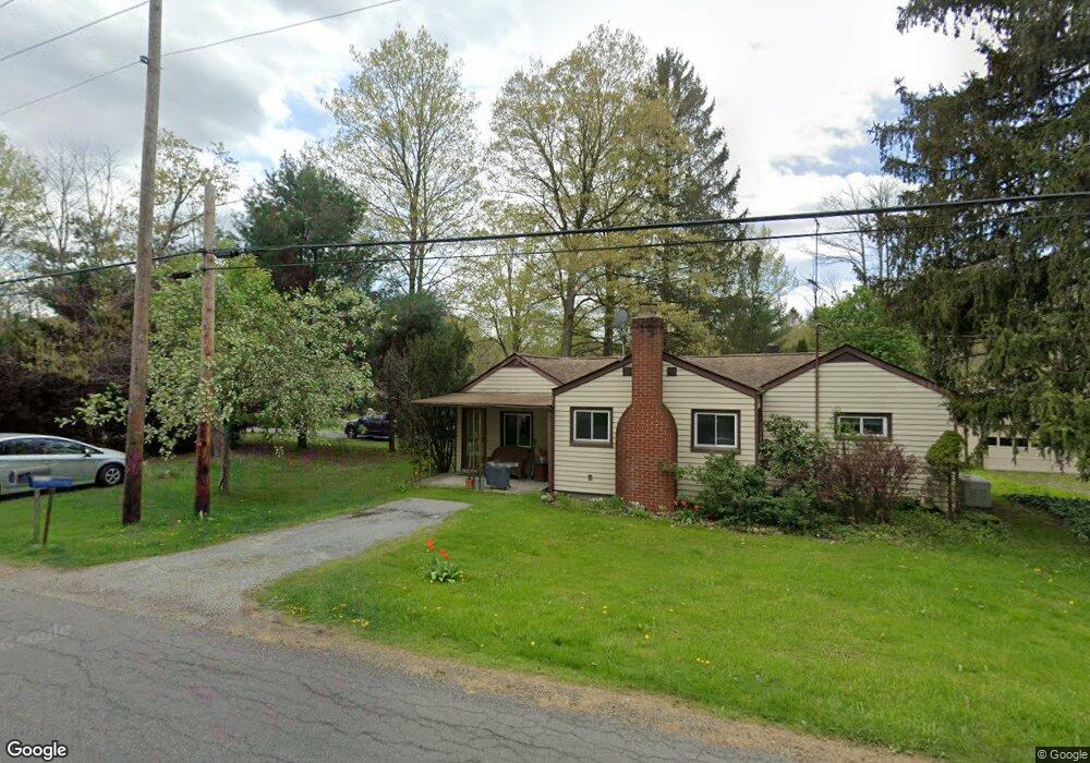
This home is located at 12733 Abbott Rd, Hiram, OH 44234 and is currently estimated at $216,582, approximately $178 per square foot. 12733 Abbott Rd is a home located in Portage County with nearby schools including Crestwood Primary School, Crestwood Intermediate School, and Crestwood Middle School.
Ownership History
Date
Name
Owned For
Owner Type
Purchase Details
Closed on
Aug 18, 2004
Sold by
Callitsis Paul and Callitsis Melissa
Bought by
Patella Joseph A
Current Estimated Value
Home Financials for this Owner
Home Financials are based on the most recent Mortgage that was taken out on this home.
Original Mortgage
$115,000
Interest Rate
6.1%
Mortgage Type
Purchase Money Mortgage
Purchase Details
Closed on
Jul 22, 1998
Sold by
Rennick Bruce L
Bought by
Callitsis Paul
Home Financials for this Owner
Home Financials are based on the most recent Mortgage that was taken out on this home.
Original Mortgage
$83,200
Interest Rate
7.13%
Mortgage Type
New Conventional
Create a Home Valuation Report for This Property
The Home Valuation Report is an in-depth analysis detailing your home's value as well as a comparison with similar homes in the area
Home Values in the Area
Average Home Value in this Area
Purchase History
| Date | Buyer | Sale Price | Title Company |
|---|---|---|---|
| Patella Joseph A | $147,000 | Midland Title Security Inc | |
| Callitsis Paul | $104,000 | -- |
Source: Public Records
Mortgage History
| Date | Status | Borrower | Loan Amount |
|---|---|---|---|
| Previous Owner | Patella Joseph A | $115,000 | |
| Previous Owner | Callitsis Paul | $83,200 |
Source: Public Records
Tax History Compared to Growth
Tax History
| Year | Tax Paid | Tax Assessment Tax Assessment Total Assessment is a certain percentage of the fair market value that is determined by local assessors to be the total taxable value of land and additions on the property. | Land | Improvement |
|---|---|---|---|---|
| 2024 | $1,771 | $54,670 | $11,620 | $43,050 |
| 2023 | $1,538 | $44,170 | $9,310 | $34,860 |
| 2022 | $1,575 | $44,170 | $9,310 | $34,860 |
| 2021 | $1,637 | $44,170 | $9,310 | $34,860 |
| 2020 | $1,427 | $38,120 | $9,310 | $28,810 |
| 2019 | $1,412 | $38,120 | $9,310 | $28,810 |
| 2018 | $1,211 | $33,740 | $9,310 | $24,430 |
| 2017 | $1,211 | $33,740 | $9,310 | $24,430 |
| 2016 | $1,208 | $33,740 | $9,310 | $24,430 |
| 2015 | $1,210 | $33,740 | $9,310 | $24,430 |
| 2014 | $1,233 | $33,740 | $9,310 | $24,430 |
| 2013 | $1,190 | $33,740 | $9,310 | $24,430 |
Source: Public Records
Map
Nearby Homes
- 19109 Tilden Rd
- SR 82 Ohio 82
- 0 Garfield Rd
- 6846 Wakefield Rd
- 18400 Shaw Rd
- 30 Cardinal Dr
- 11383 Rolling Meadows Dr
- 151 Oaktree Ln
- 76 Cardinal Dr
- 142 Oaktree Ln
- 7000 Village Way Dr
- 14020 Kimpton Trail
- 7050 Village Way Dr
- 7076 Village Way Dr
- 7991 Norton Rd
- 11945 Ladue Trail
- 11830 Starbush Ct
- 7972 State Route 305
- 12157 State Route 88
- 4791 Pioneer Trail