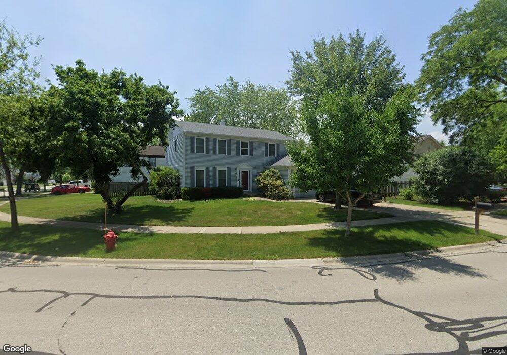
1274 Devonshire Rd Buffalo Grove, IL 60089
Prairie Park-Lake County NeighborhoodEstimated Value: $581,745 - $621,000
5
Beds
4
Baths
2,199
Sq Ft
$270/Sq Ft
Est. Value
About This Home
This home is located at 1274 Devonshire Rd, Buffalo Grove, IL 60089 and is currently estimated at $594,436, approximately $270 per square foot. 1274 Devonshire Rd is a home located in Lake County with nearby schools including Prairie Elementary School, Twin Groves Middle School, and Adlai E Stevenson High School.
Ownership History
Date
Name
Owned For
Owner Type
Purchase Details
Closed on
Nov 21, 2017
Sold by
Parker Houston James B and Parker Houston Jean
Bought by
Hatangala Pubudu Pulasthika Bandara and Ratnayake Thushani Jayanga
Current Estimated Value
Home Financials for this Owner
Home Financials are based on the most recent Mortgage that was taken out on this home.
Original Mortgage
$317,500
Outstanding Balance
$264,416
Interest Rate
3.62%
Mortgage Type
New Conventional
Estimated Equity
$330,020
Purchase Details
Closed on
May 20, 1996
Sold by
Roth Harvey D and Roth Renee I
Bought by
Parker Houston James B and Parker Houston Jean
Home Financials for this Owner
Home Financials are based on the most recent Mortgage that was taken out on this home.
Original Mortgage
$75,000
Interest Rate
8.1%
Create a Home Valuation Report for This Property
The Home Valuation Report is an in-depth analysis detailing your home's value as well as a comparison with similar homes in the area
Home Values in the Area
Average Home Value in this Area
Purchase History
| Date | Buyer | Sale Price | Title Company |
|---|---|---|---|
| Hatangala Pubudu Pulasthika Bandara | $397,500 | Chicago Title | |
| Parker Houston James B | $257,000 | Chicago Title Insurance Co |
Source: Public Records
Mortgage History
| Date | Status | Borrower | Loan Amount |
|---|---|---|---|
| Open | Hatangala Pubudu Pulasthika Bandara | $317,500 | |
| Previous Owner | Parker Houston James B | $75,000 |
Source: Public Records
Tax History
| Year | Tax Paid | Tax Assessment Tax Assessment Total Assessment is a certain percentage of the fair market value that is determined by local assessors to be the total taxable value of land and additions on the property. | Land | Improvement |
|---|---|---|---|---|
| 2024 | $14,417 | $157,429 | $33,472 | $123,957 |
| 2023 | $13,661 | $148,546 | $31,583 | $116,963 |
| 2022 | $13,661 | $137,009 | $29,130 | $107,879 |
| 2021 | $13,143 | $135,532 | $28,816 | $106,716 |
| 2020 | $12,834 | $135,994 | $28,914 | $107,080 |
| 2019 | $12,832 | $137,287 | $28,807 | $108,480 |
| 2018 | $11,906 | $134,201 | $28,471 | $105,730 |
| 2017 | $11,438 | $131,068 | $27,806 | $103,262 |
| 2016 | $11,118 | $125,508 | $26,626 | $98,882 |
| 2015 | $10,790 | $117,374 | $24,900 | $92,474 |
| 2014 | $9,736 | $105,592 | $26,743 | $78,849 |
| 2012 | $9,791 | $105,804 | $26,797 | $79,007 |
Source: Public Records
Map
Nearby Homes
- 1234 Devonshire Rd
- 1265 Devonshire Rd
- 1318 Gail Dr Unit 4
- 1328 Larchmont Dr
- 327 Lasalle Ln
- 962 Thompson Blvd
- 1152 Courtland Dr Unit 406
- 1120 Courtland Dr
- 5176 Aptakisic Rd
- 1135 Thompson Blvd
- 1161 Parker Ln
- 810 Silver Rock Ln
- 5107 N Arlington Heights Rd
- 5152 Bridlewood Ln
- 5135 Bridlewood Ct
- 711 Woodhollow Ln
- 1217 Franklin Ln Unit G5
- 736 Clohesey Dr
- 927 Hidden Lake Dr
- 938 Hidden Lake Dr
- 1254 Devonshire Rd
- 1265 Dayton Rd
- 1255 Dayton Rd
- 1244 Devonshire Rd
- 1245 Dayton Rd
- 1257 Devonshire Rd
- 1275 Devonshire Rd
- 1269 Devonshire Rd
- 1281 Devonshire Rd
- 1235 Dayton Rd
- 1245 Devonshire Rd
- 1261 Devonshire Rd
- 1287 Devonshire Rd
- 1239 Devonshire Rd
- 1225 Dayton Rd
- 1264 Dayton Rd
- 1293 Devonshire Rd
- 796 Dannet Rd
- 1224 Devonshire Rd
- 1270 Brandywyn Ln
Your Personal Tour Guide
Ask me questions while you tour the home.