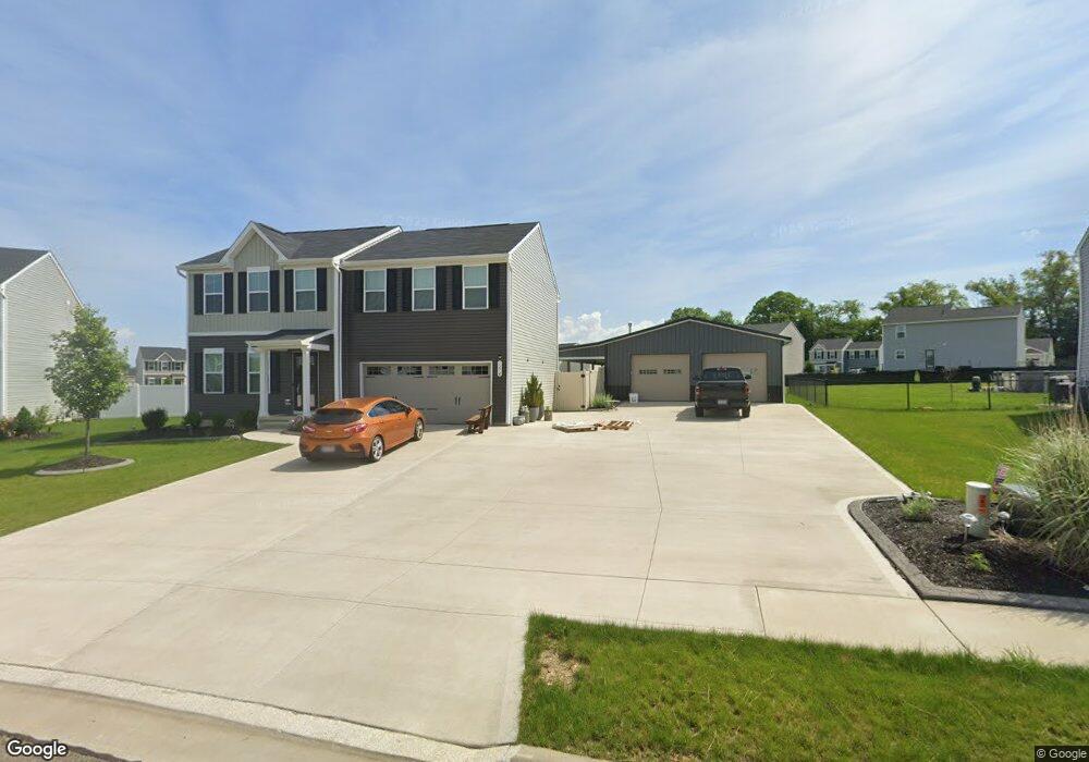
1274 Gabrielle Cir NW Massillon, OH 44647
West Brookfield NeighborhoodEstimated Value: $314,000 - $356,000
4
Beds
3
Baths
1,920
Sq Ft
$177/Sq Ft
Est. Value
About This Home
This home is located at 1274 Gabrielle Cir NW, Massillon, OH 44647 and is currently estimated at $339,222, approximately $176 per square foot. 1274 Gabrielle Cir NW is a home with nearby schools including Tuslaw Elementary School, Tuslaw Middle School, and Tuslaw High School.
Ownership History
Date
Name
Owned For
Owner Type
Purchase Details
Closed on
Nov 23, 2020
Sold by
Nvr Inc
Bought by
Mccrae Michaela N
Current Estimated Value
Home Financials for this Owner
Home Financials are based on the most recent Mortgage that was taken out on this home.
Original Mortgage
$214,377
Outstanding Balance
$190,765
Interest Rate
2.8%
Mortgage Type
New Conventional
Estimated Equity
$148,457
Purchase Details
Closed on
Sep 8, 2020
Sold by
A R Lockhart Development Co
Bought by
Nvr Inc
Create a Home Valuation Report for This Property
The Home Valuation Report is an in-depth analysis detailing your home's value as well as a comparison with similar homes in the area
Home Values in the Area
Average Home Value in this Area
Purchase History
| Date | Buyer | Sale Price | Title Company |
|---|---|---|---|
| Mccrae Michaela N | $225,700 | Nvr Title Agency Llc | |
| Nvr Inc | $40,000 | None Available |
Source: Public Records
Mortgage History
| Date | Status | Borrower | Loan Amount |
|---|---|---|---|
| Open | Mccrae Michaela N | $214,377 |
Source: Public Records
Tax History Compared to Growth
Tax History
| Year | Tax Paid | Tax Assessment Tax Assessment Total Assessment is a certain percentage of the fair market value that is determined by local assessors to be the total taxable value of land and additions on the property. | Land | Improvement |
|---|---|---|---|---|
| 2025 | -- | $99,790 | $26,460 | $73,330 |
| 2024 | -- | $99,790 | $26,460 | $73,330 |
| 2023 | $3,130 | $82,850 | $20,900 | $61,950 |
| 2022 | $3,123 | $82,850 | $20,900 | $61,950 |
| 2021 | $2,926 | $76,620 | $20,900 | $55,720 |
| 2020 | $1,073 | $2,660 | $2,660 | $0 |
Source: Public Records
Map
Nearby Homes
- 982 Lanedale St NW
- 4420 Lockhart Cir NW
- 4745 Sippo Reserves Dr NW
- 4981 Raya Dr NW
- 1855 Alpha St NW
- 1174 Manchester Ave SW
- 1220 Ben Fulton Ave NW
- 1200 Kenyon Ave SW
- 3610 Kenyon Creek Ave NW
- 3575 Kenyon Creek Ave NW
- 3564 Kenyon Creek Ave NW
- 1783 Heron Creek St NW
- 12259 Garnell St NW
- 3241 Lincoln Way NW
- 822 32nd St NW
- 3130 Lincoln Way W
- 2636 Kenyon Ave NW
- 3069 Castle West Cir NW
- 2855 Poplar St NW
- 14656 Lincoln St
- 3057 Gabriel Cir NW
- 1266 Gabrielle Cir NW
- 1271 Gabrielle Cir NW
- 1292 Gabrielle Cir NW
- 1257 Gabrielle Cir NW
- 1283 Gabrielle Cir NW
- 4475 Casey Cir NW
- 4487 Casey Cir NW
- 4461 Casey Cir NW
- 1245 Gabrielle Cir NW
- 4447 Casey Cir NW
- 1240 Gabrielle Cir NW
- 1291 Alpha St NW
- 1257 Alpha St NW
- 1305 Alpha St NW
- 1273 Alpha St NW
- 4494 Casey Cir NW
- 4538 Brightleaf Ave NW
- 4472 Casey Cir NW
- 1337 Alpha St NW