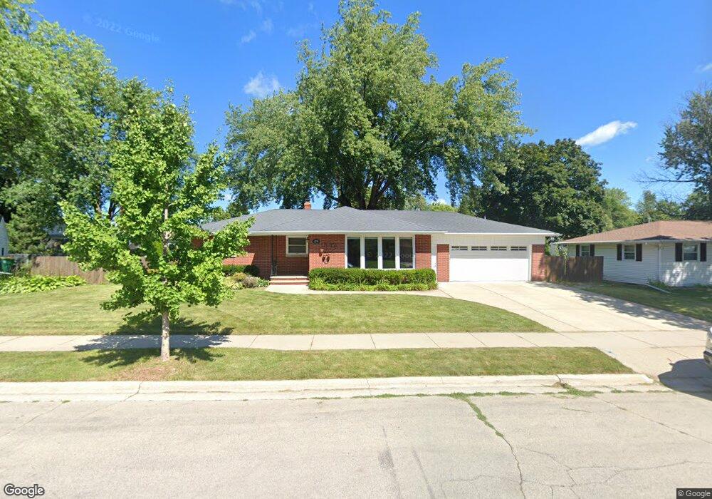
1274 Rockdale St Green Bay, WI 54304
Colburn NeighborhoodEstimated Value: $313,350 - $351,000
1
Bed
1
Bath
2,000
Sq Ft
$164/Sq Ft
Est. Value
About This Home
This home is located at 1274 Rockdale St, Green Bay, WI 54304 and is currently estimated at $328,588, approximately $164 per square foot. 1274 Rockdale St is a home located in Brown County with nearby schools including Jackson Elementary School, Franklin Middle School, and West High School.
Ownership History
Date
Name
Owned For
Owner Type
Purchase Details
Closed on
Nov 2, 2010
Sold by
Hehl Karl R and Hehl Sarah H
Bought by
Hehl Karl R and Hehl Sarah A
Current Estimated Value
Purchase Details
Closed on
Apr 18, 2005
Sold by
Hehl Karl R and Hehl Sarah A
Bought by
The Karl R & Sarah A Hehl Living Trust
Purchase Details
Closed on
May 22, 2001
Sold by
Reinhard Evelyn E
Bought by
Hehl Karl R and Hehl Sarah A
Home Financials for this Owner
Home Financials are based on the most recent Mortgage that was taken out on this home.
Original Mortgage
$85,700
Interest Rate
8.37%
Mortgage Type
Purchase Money Mortgage
Create a Home Valuation Report for This Property
The Home Valuation Report is an in-depth analysis detailing your home's value as well as a comparison with similar homes in the area
Home Values in the Area
Average Home Value in this Area
Purchase History
| Date | Buyer | Sale Price | Title Company |
|---|---|---|---|
| Hehl Karl R | -- | None Available | |
| The Karl R & Sarah A Hehl Living Trust | -- | -- | |
| Hehl Karl R | $117,500 | Liberty Title |
Source: Public Records
Mortgage History
| Date | Status | Borrower | Loan Amount |
|---|---|---|---|
| Previous Owner | Hehl Karl R | $85,700 | |
| Closed | Hehl Karl R | $20,000 |
Source: Public Records
Tax History Compared to Growth
Tax History
| Year | Tax Paid | Tax Assessment Tax Assessment Total Assessment is a certain percentage of the fair market value that is determined by local assessors to be the total taxable value of land and additions on the property. | Land | Improvement |
|---|---|---|---|---|
| 2024 | $4,086 | $208,600 | $42,600 | $166,000 |
| 2023 | $3,960 | $208,600 | $42,600 | $166,000 |
| 2022 | $3,829 | $208,600 | $42,600 | $166,000 |
| 2021 | $3,191 | $131,400 | $27,500 | $103,900 |
| 2020 | $3,166 | $131,400 | $27,500 | $103,900 |
| 2019 | $2,896 | $131,400 | $27,500 | $103,900 |
| 2018 | $2,832 | $131,400 | $27,500 | $103,900 |
| 2017 | $2,805 | $131,400 | $27,500 | $103,900 |
| 2016 | $2,759 | $131,400 | $27,500 | $103,900 |
| 2015 | $2,862 | $131,400 | $27,500 | $103,900 |
| 2014 | $3,269 | $131,400 | $27,500 | $103,900 |
| 2013 | $3,269 | $131,400 | $27,500 | $103,900 |
Source: Public Records
Map
Nearby Homes
- 1428 Beauchamp St
- 1212 9th St
- 1181 Roscoe St
- 1244 Liberty St
- 1252 Marian Ln
- 1203 Spence St
- 1348 Liberty St
- 1286 7th St
- 1122 Biemeret St
- 1427 Russell St
- 1507 Delores St
- 1255 Loch Dr
- 1110 Roscoe St
- 1444 Liberty St
- 1749 S Oneida St Unit 1751
- 1751 S Oneida St
- 1128 Marquette Ave
- 1163 Thorndale St
- 1500 S Fisk St
- 1201 S Fisk St
- 1266 Rockdale St
- 0 Rockdale St
- 1275 Langlade Ave
- 1280 Rockdale St
- 1279 Langlade Ave
- 1269 Langlade Ave
- 1262 Rockdale St
- 1283 Langlade Ave
- 1273 Rockdale St
- 1420 Frank St
- 1263 Langlade Ave
- 1265 Rockdale St
- 1287 Langlade Ave
- 1424 Frank St
- 1261 Rockdale St
- 1254 Rockdale St
- 1255 Langlade Ave
- 1274 Langlade Ave
- 1268 Langlade Ave
- 1433 Frank St