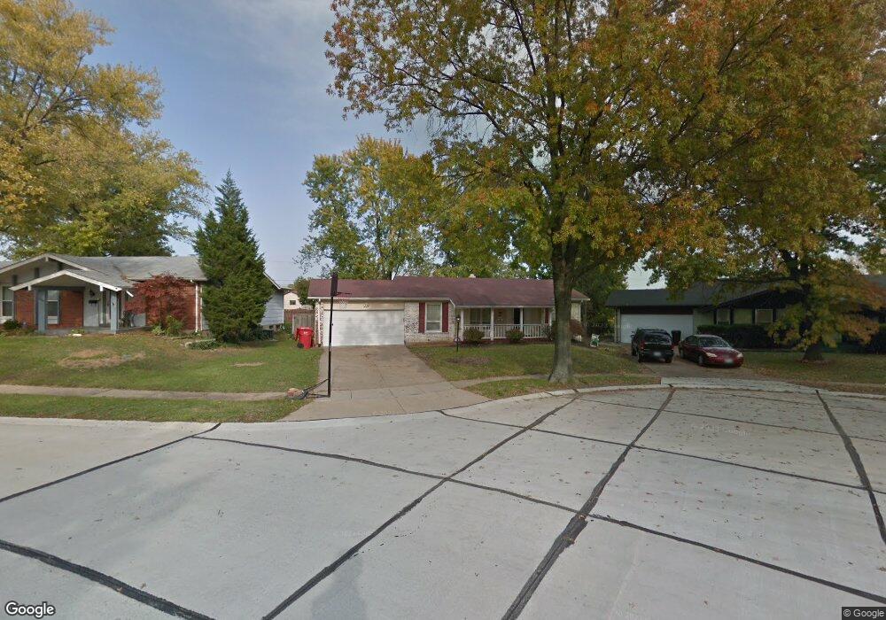
1274 Woodpath Dr Florissant, MO 63031
Estimated Value: $209,000 - $243,000
3
Beds
2
Baths
1,292
Sq Ft
$172/Sq Ft
Est. Value
About This Home
This home is located at 1274 Woodpath Dr, Florissant, MO 63031 and is currently estimated at $221,672, approximately $171 per square foot. 1274 Woodpath Dr is a home located in St. Louis County with nearby schools including North Middle School, Hazelwood Central High School, and St Norbert School.
Ownership History
Date
Name
Owned For
Owner Type
Purchase Details
Closed on
May 14, 2001
Sold by
Crowder Bonita G and Crowder Bonita G
Bought by
Davis Keith L and Davis Janet E
Current Estimated Value
Home Financials for this Owner
Home Financials are based on the most recent Mortgage that was taken out on this home.
Original Mortgage
$111,022
Outstanding Balance
$41,333
Interest Rate
6.99%
Mortgage Type
FHA
Estimated Equity
$180,339
Create a Home Valuation Report for This Property
The Home Valuation Report is an in-depth analysis detailing your home's value as well as a comparison with similar homes in the area
Home Values in the Area
Average Home Value in this Area
Purchase History
| Date | Buyer | Sale Price | Title Company |
|---|---|---|---|
| Davis Keith L | $111,900 | -- | |
| Davis Keith L | $111,900 | -- |
Source: Public Records
Mortgage History
| Date | Status | Borrower | Loan Amount |
|---|---|---|---|
| Open | Davis Keith L | $111,022 | |
| Closed | Davis Keith L | $111,022 |
Source: Public Records
Tax History Compared to Growth
Tax History
| Year | Tax Paid | Tax Assessment Tax Assessment Total Assessment is a certain percentage of the fair market value that is determined by local assessors to be the total taxable value of land and additions on the property. | Land | Improvement |
|---|---|---|---|---|
| 2025 | $2,909 | $36,650 | $5,680 | $30,970 |
| 2024 | $2,909 | $33,310 | $2,260 | $31,050 |
| 2023 | $2,905 | $33,310 | $2,260 | $31,050 |
| 2022 | $2,521 | $25,730 | $3,710 | $22,020 |
| 2021 | $2,485 | $25,730 | $3,710 | $22,020 |
| 2020 | $2,470 | $23,810 | $5,680 | $18,130 |
| 2019 | $2,432 | $23,810 | $5,680 | $18,130 |
| 2018 | $2,224 | $20,010 | $1,860 | $18,150 |
| 2017 | $2,222 | $20,010 | $1,860 | $18,150 |
| 2016 | $2,192 | $19,470 | $2,200 | $17,270 |
| 2015 | $2,145 | $19,470 | $2,200 | $17,270 |
| 2014 | $1,830 | $17,080 | $3,590 | $13,490 |
Source: Public Records
Map
Nearby Homes
- 1323 Woodpath Dr
- 3870 Hope Haven Dr
- 3865 Kentucky Derby Dr
- 3213 Yvette Ct
- 1455 Burnside Ct
- 3660 Woodman Dr
- 4097 Fox Island Dr
- 3849 Secretariat Dr
- 3645 Woodman Dr
- 1638 Matlock Dr
- 1069 Saratoga Springs Ct
- 1114 Ransome Ct
- 1056 Saratoga Springs Ct
- 738 Waterfall Dr
- 1522 Sherwood Forest Dr
- 16256 Rose Wreath Ln Unit 156
- 1303 Topsider Ct
- 1641 Sherwood Forest Dr
- 3932 Secretariat Dr
- 2 Aspen II at Riverstone
- 1284 Woodpath Dr
- 1264 Woodpath Dr
- 1294 Woodpath Dr
- 3694 Woodpath Dr
- 3684 Woodpath Dr
- 1304 Woodpath Dr
- 1293 Woodpath Dr
- 3674 Woodpath Dr
- 3800 Salvation Rd
- 1303 Woodpath Dr
- 1314 Woodpath Dr
- 3801 Salvation Rd
- 3663 Woodpath Dr
- 1313 Woodpath Dr
- 3664 Woodpath Dr
- 3804 Salvation Rd
- 3643 Woodpath Dr
- 1324 Woodpath Dr
- 3805 Salvation Rd
- 3644 Woodpath Dr