Estimated Value: $500,000 - $543,000
4
Beds
3
Baths
1,967
Sq Ft
$263/Sq Ft
Est. Value
About This Home
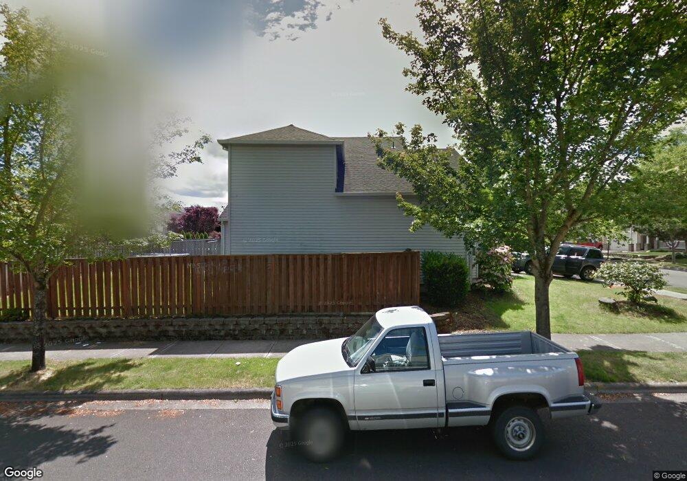
This home is located at 12740 NW Ashton Dr, Banks, OR 97106 and is currently estimated at $517,636, approximately $263 per square foot. 12740 NW Ashton Dr is a home located in Washington County with nearby schools including Banks Elementary School, Banks Middle School, and Banks High School.
Ownership History
Date
Name
Owned For
Owner Type
Purchase Details
Closed on
Sep 10, 2008
Sold by
Labonte Louie E and Labonte Agneta W
Bought by
Evans Rusty A and Evans Mary K
Current Estimated Value
Home Financials for this Owner
Home Financials are based on the most recent Mortgage that was taken out on this home.
Original Mortgage
$260,100
Outstanding Balance
$172,920
Interest Rate
6.51%
Mortgage Type
Unknown
Estimated Equity
$344,716
Purchase Details
Closed on
Apr 14, 1998
Sold by
West Hills Development Company
Bought by
Labonte Louie E and Labonte Agneta W
Home Financials for this Owner
Home Financials are based on the most recent Mortgage that was taken out on this home.
Original Mortgage
$164,255
Interest Rate
6.78%
Create a Home Valuation Report for This Property
The Home Valuation Report is an in-depth analysis detailing your home's value as well as a comparison with similar homes in the area
Home Values in the Area
Average Home Value in this Area
Purchase History
| Date | Buyer | Sale Price | Title Company |
|---|---|---|---|
| Evans Rusty A | $255,000 | Transnation Title Agency Or | |
| Labonte Louie E | $174,767 | Chicago Title Insurance Co |
Source: Public Records
Mortgage History
| Date | Status | Borrower | Loan Amount |
|---|---|---|---|
| Open | Evans Rusty A | $260,100 | |
| Previous Owner | Labonte Louie E | $164,255 |
Source: Public Records
Tax History Compared to Growth
Tax History
| Year | Tax Paid | Tax Assessment Tax Assessment Total Assessment is a certain percentage of the fair market value that is determined by local assessors to be the total taxable value of land and additions on the property. | Land | Improvement |
|---|---|---|---|---|
| 2025 | $5,275 | $287,130 | -- | -- |
| 2024 | $4,795 | $278,770 | -- | -- |
| 2023 | $4,795 | $270,660 | $0 | $0 |
| 2022 | $4,668 | $270,660 | $0 | $0 |
| 2021 | $4,503 | $255,130 | $0 | $0 |
| 2020 | $4,370 | $247,700 | $0 | $0 |
| 2019 | $4,195 | $240,490 | $0 | $0 |
| 2018 | $4,082 | $233,490 | $0 | $0 |
| 2017 | $3,909 | $226,690 | $0 | $0 |
| 2016 | $3,848 | $220,090 | $0 | $0 |
| 2015 | $3,698 | $213,680 | $0 | $0 |
| 2014 | $3,645 | $207,460 | $0 | $0 |
Source: Public Records
Map
Nearby Homes
- 41710 NW Oak Way
- 41753 NW Buckshire St
- 41637 NW Buckshire St
- 12734 NW Hammond Place
- 42015 NW Buckshire St
- 42002 NW Elmhurst Ct
- 42098 NW Broadshire Ln
- 42371 NW Banks Rd
- 0 NW Lodge Rd
- 48025 NW Strohmayer Rd
- 46345 NW Strohmayer Rd
- 45868 NW Hillside Rd
- 0 NW Green Mountain Rd Unit 1 23320324
- 0 NW Green Mountain Rd Unit 24253646
- 18282 NW Hilltop Place
- 11911 NW Seavey Rd
- 40748 NW Verboort Rd
- 21076 NW Green Mountain Rd
- 36303 NW 3 Cedars Ln
- 8648 NW Redtail Dr
- 12754 NW Ashton Dr
- 41617 NW Oak Way
- 12762 NW Ashton Dr
- 41631 NW Oak Way
- 12652 NW Ashton Dr 3 15 Bac
- 12668 NW Ashton Dr
- 12652 NW Ashton Dr
- 12674 NW Ashton Dr
- 12638 NW Ashton Dr
- 12680 NW Ashton Dr
- 12737 NW Ashton Dr
- 12749 NW Ashton Dr
- 12624 NW Ashton Dr
- 12770 NW Ashton Dr
- 12692 NW Ashton Dr
- 12757 NW Ashton Dr
- 12610 NW Ashton Dr
- 12702 NW Hammond Place
- 41675 NW Oak Way
- 12602 NW Ashton Dr