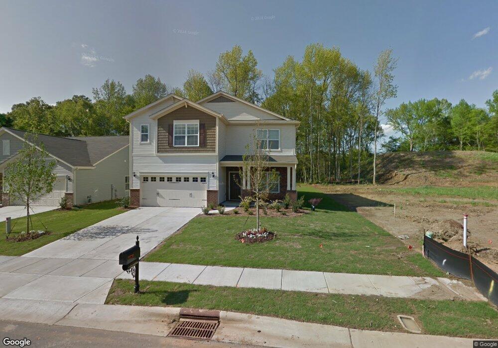
12744 Swann Branch Dr Charlotte, NC 28273
Brown Road NeighborhoodEstimated Value: $499,000 - $519,000
4
Beds
3
Baths
2,722
Sq Ft
$187/Sq Ft
Est. Value
About This Home
This home is located at 12744 Swann Branch Dr, Charlotte, NC 28273 and is currently estimated at $509,220, approximately $187 per square foot. 12744 Swann Branch Dr is a home with nearby schools including Lake Wylie Elementary School, Southwest Middle School, and Unity Classical Charter School.
Ownership History
Date
Name
Owned For
Owner Type
Purchase Details
Closed on
Jan 23, 2015
Sold by
M I Homes Of Charlotte Llc
Bought by
Sawtell Amy Louise
Current Estimated Value
Home Financials for this Owner
Home Financials are based on the most recent Mortgage that was taken out on this home.
Original Mortgage
$237,066
Outstanding Balance
$180,977
Interest Rate
3.75%
Mortgage Type
FHA
Estimated Equity
$328,243
Create a Home Valuation Report for This Property
The Home Valuation Report is an in-depth analysis detailing your home's value as well as a comparison with similar homes in the area
Home Values in the Area
Average Home Value in this Area
Purchase History
| Date | Buyer | Sale Price | Title Company |
|---|---|---|---|
| Sawtell Amy Louise | $241,500 | None Available |
Source: Public Records
Mortgage History
| Date | Status | Borrower | Loan Amount |
|---|---|---|---|
| Open | Sawtell Amy Louise | $237,066 |
Source: Public Records
Tax History Compared to Growth
Tax History
| Year | Tax Paid | Tax Assessment Tax Assessment Total Assessment is a certain percentage of the fair market value that is determined by local assessors to be the total taxable value of land and additions on the property. | Land | Improvement |
|---|---|---|---|---|
| 2025 | $3,633 | $459,500 | $100,000 | $359,500 |
| 2024 | $3,633 | $459,500 | $100,000 | $359,500 |
| 2023 | $3,510 | $459,500 | $100,000 | $359,500 |
| 2022 | $3,078 | $306,000 | $65,000 | $241,000 |
| 2021 | $3,067 | $306,000 | $65,000 | $241,000 |
| 2020 | $3,060 | $306,000 | $65,000 | $241,000 |
| 2019 | $3,044 | $306,000 | $65,000 | $241,000 |
| 2018 | $3,019 | $224,500 | $42,800 | $181,700 |
| 2017 | $2,969 | $224,500 | $42,800 | $181,700 |
| 2016 | $2,959 | $224,500 | $42,800 | $181,700 |
| 2015 | $2,948 | $0 | $0 | $0 |
Source: Public Records
Map
Nearby Homes
- 15137 Callow Forest Dr
- 13001 Greycrest Dr
- 15131 Callow Forest Dr
- 11012 Southfield Dr
- 14101 Arbor Ridge Dr
- 14514 Arbor Ridge Dr
- 12609 Cedar Crossings Dr
- 14308 Asheton Creek Dr
- 14311 Arbor Ridge Dr
- 13660 Meade Glen Ct
- 13648 Meade Glen Ct
- Douglas Plan at Parkside Crossing - Glen
- Murray Plan at Parkside Crossing - Glen
- Harris Plan at Parkside Crossing - Glen
- Amberwood Plan at Parkside Crossing - Reserve
- Wingate Plan at Parkside Crossing - Reserve
- Furman Plan at Parkside Crossing - Reserve
- Hampton Plan at Parkside Crossing - Meadow
- Mitchell Plan at Parkside Crossing - Meadow
- Hartwell Plan at Parkside Crossing - Meadow
- 12740 Swann Branch Dr Unit Lot # 53 NEWPORT B
- 12802 Swann Branch Dr
- 12736 Swann Branch Dr Unit Lot #52 -MARVIN C
- 12806 Swann Branch Dr
- 12741 Swann Branch Dr
- 12737 Swann Branch Dr Unit HF-45
- 12732 Swann Branch Dr
- 12732 Swann Branch Dr Unit Lot # 51 PINNACLE C
- 12810 Swann Branch Dr
- 15223 Taylor Ridge Ln Unit HF-29
- 12733 Swann Branch Dr
- 12728 Swann Branch Dr
- 15214 Taylor Ridge Ln Unit 43
- 15219 Taylor Ridge Ln
- 12814 Swann Branch Dr
- 12729 Swann Branch Dr
- 12729 Swann Branch Dr Unit HF-45
- 15213 Taylor Ridge Ln
- 12722 Swann Branch Dr Unit Lot #49 NEWPORT B
- 15210 Taylor Ridge Ln