Estimated Value: $499,000 - $535,000
4
Beds
3
Baths
2,006
Sq Ft
$256/Sq Ft
Est. Value
About This Home
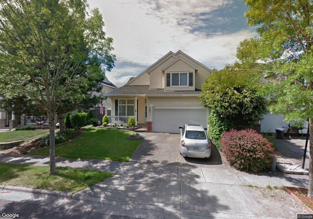
This home is located at 12749 NW Ashton Dr, Banks, OR 97106 and is currently estimated at $513,147, approximately $255 per square foot. 12749 NW Ashton Dr is a home located in Washington County with nearby schools including Banks Elementary School, Banks Middle School, and Banks High School.
Ownership History
Date
Name
Owned For
Owner Type
Purchase Details
Closed on
Sep 7, 2006
Sold by
Bates John Brian
Bought by
Molitor Bryan T
Current Estimated Value
Home Financials for this Owner
Home Financials are based on the most recent Mortgage that was taken out on this home.
Original Mortgage
$190,000
Outstanding Balance
$113,104
Interest Rate
6.51%
Mortgage Type
Unknown
Estimated Equity
$400,043
Purchase Details
Closed on
Aug 30, 2000
Sold by
West Hills Development Company
Bought by
Bates John Brian
Home Financials for this Owner
Home Financials are based on the most recent Mortgage that was taken out on this home.
Original Mortgage
$169,000
Interest Rate
8.2%
Create a Home Valuation Report for This Property
The Home Valuation Report is an in-depth analysis detailing your home's value as well as a comparison with similar homes in the area
Home Values in the Area
Average Home Value in this Area
Purchase History
| Date | Buyer | Sale Price | Title Company |
|---|---|---|---|
| Molitor Bryan T | $279,999 | Fidelity Natl Title Co Of Or | |
| Bates John Brian | $177,900 | Chicago Title Insurance Co |
Source: Public Records
Mortgage History
| Date | Status | Borrower | Loan Amount |
|---|---|---|---|
| Open | Molitor Bryan T | $190,000 | |
| Previous Owner | Bates John Brian | $169,000 |
Source: Public Records
Tax History Compared to Growth
Tax History
| Year | Tax Paid | Tax Assessment Tax Assessment Total Assessment is a certain percentage of the fair market value that is determined by local assessors to be the total taxable value of land and additions on the property. | Land | Improvement |
|---|---|---|---|---|
| 2025 | $5,164 | $281,100 | -- | -- |
| 2024 | $4,694 | $272,920 | -- | -- |
| 2023 | $4,694 | $264,980 | $0 | $0 |
| 2022 | $4,570 | $264,980 | $0 | $0 |
| 2021 | $4,409 | $249,780 | $0 | $0 |
| 2020 | $4,278 | $242,510 | $0 | $0 |
| 2019 | $4,107 | $235,450 | $0 | $0 |
| 2018 | $3,997 | $228,600 | $0 | $0 |
| 2017 | $3,828 | $221,950 | $0 | $0 |
| 2016 | $3,767 | $215,490 | $0 | $0 |
| 2015 | $3,621 | $209,220 | $0 | $0 |
| 2014 | $3,568 | $203,130 | $0 | $0 |
Source: Public Records
Map
Nearby Homes
- 12734 NW Hammond Place
- 41637 NW Buckshire St
- 41710 NW Oak Way
- 41753 NW Buckshire St
- 42002 NW Elmhurst Ct
- 42015 NW Buckshire St
- 42098 NW Broadshire Ln
- 42371 NW Banks Rd
- 0 NW Lodge Rd
- 48025 NW Strohmayer Rd
- 46345 NW Strohmayer Rd
- 0 NW Green Mountain Rd Unit 1 23320324
- 0 NW Green Mountain Rd Unit 24253646
- 45868 NW Hillside Rd
- 18282 NW Hilltop Place
- 11911 NW Seavey Rd
- 21076 NW Green Mountain Rd
- 36303 NW 3 Cedars Ln
- 40748 NW Verboort Rd
- 20270 NW Pihl Rd
- 12757 NW Ashton Dr
- 12737 NW Ashton Dr
- 12727 NW Hammond Place
- 12765 NW Ashton Dr
- 12739 NW Hammond Place
- 12751 NW Hammond Place
- 12754 NW Ashton Dr
- 12740 NW Ashton Dr
- 12710 NW Hammond Place
- 12763 NW Hammond Place
- 12702 NW Hammond Place
- 12787 NW Ashton Dr
- 12762 NW Ashton Dr
- 12722 NW Hammond Place
- 12692 NW Ashton Dr
- 12680 NW Ashton Dr
- 12746 NW Hammond Place
- 12770 NW Ashton Dr
- 12674 NW Ashton Dr
- 12775 NW Hammond Place