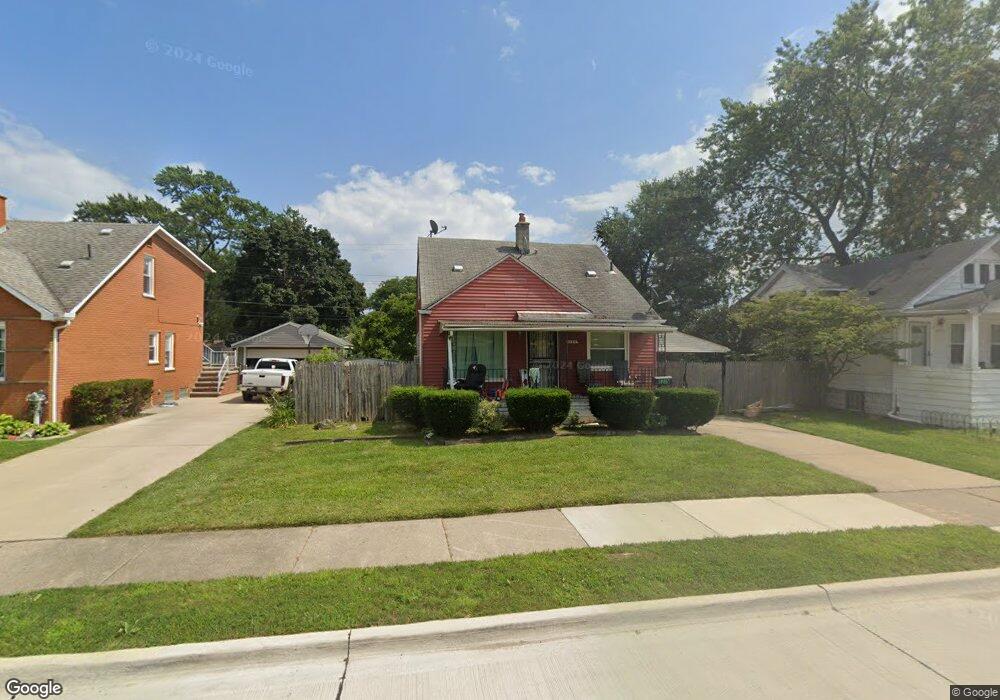
1275 Austin Ave Unit Bldg-Unit Lincoln Park, MI 48146
Estimated Value: $147,000 - $178,000
--
Bed
2
Baths
1,224
Sq Ft
$132/Sq Ft
Est. Value
About This Home
This home is located at 1275 Austin Ave Unit Bldg-Unit, Lincoln Park, MI 48146 and is currently estimated at $161,954, approximately $132 per square foot. 1275 Austin Ave Unit Bldg-Unit is a home located in Wayne County with nearby schools including Raupp Elementary School, Lincoln Park Middle School, and Lincoln Park High School.
Ownership History
Date
Name
Owned For
Owner Type
Purchase Details
Closed on
Jun 25, 2024
Sold by
Dihort Rosa Emma Clark
Bought by
Contreras-Aquino Santiago
Current Estimated Value
Purchase Details
Closed on
Feb 16, 2018
Sold by
Federal Home Loan Mortgag E Corporatio and Freddie Mac Freddie
Bought by
Clark Rosa E and Clarkdihort Rosa E
Home Financials for this Owner
Home Financials are based on the most recent Mortgage that was taken out on this home.
Interest Rate
4.38%
Purchase Details
Closed on
Feb 2, 2017
Sold by
Case Linda S and Case Thomas E
Bought by
Federal Home Loan Mortgage Corporation
Purchase Details
Closed on
Jun 13, 2002
Sold by
Shirlen Edith W
Bought by
Shirlen Robert B
Create a Home Valuation Report for This Property
The Home Valuation Report is an in-depth analysis detailing your home's value as well as a comparison with similar homes in the area
Home Values in the Area
Average Home Value in this Area
Purchase History
| Date | Buyer | Sale Price | Title Company |
|---|---|---|---|
| Contreras-Aquino Santiago | $38,000 | None Listed On Document | |
| Contreras-Aquino Santiago | $38,000 | None Listed On Document | |
| Clark Rosa E | $43,000 | -- | |
| Federal Home Loan Mortgage Corporation | $34,636 | None Available | |
| Shirlen Robert B | $77,500 | -- |
Source: Public Records
Mortgage History
| Date | Status | Borrower | Loan Amount |
|---|---|---|---|
| Previous Owner | Clark Rosa E | -- |
Source: Public Records
Tax History Compared to Growth
Tax History
| Year | Tax Paid | Tax Assessment Tax Assessment Total Assessment is a certain percentage of the fair market value that is determined by local assessors to be the total taxable value of land and additions on the property. | Land | Improvement |
|---|---|---|---|---|
| 2025 | $1,709 | $81,700 | $0 | $0 |
| 2024 | $1,709 | $74,700 | $0 | $0 |
| 2023 | $1,933 | $62,700 | $0 | $0 |
| 2022 | $1,972 | $53,100 | $0 | $0 |
| 2021 | $1,875 | $46,600 | $0 | $0 |
| 2020 | $1,858 | $41,800 | $0 | $0 |
| 2019 | $1,468 | $33,400 | $0 | $0 |
| 2018 | $1,143 | $28,200 | $0 | $0 |
| 2017 | $849 | $28,200 | $0 | $0 |
| 2016 | $1,500 | $28,300 | $0 | $0 |
| 2015 | $2,770 | $27,700 | $0 | $0 |
| 2013 | $2,960 | $30,900 | $0 | $0 |
| 2012 | $1,833 | $31,800 | $6,700 | $25,100 |
Source: Public Records
Map
Nearby Homes
- 1326 Marion Ave
- 1428 Chandler Ave
- 1473 Austin Ave
- 1506 Chandler Ave
- 1375 Wilson Ave
- 1267 Fort Park Blvd
- 1554 Austin Ave
- 1523 Marion Ave
- 1582 Chandler Ave
- 1383 Cicotte Ave
- 26165 W Outer Dr
- 1402 Morris Ave
- 1329 Grant Ave
- 1424 Cicotte Ave
- 1581 Wilson Ave
- 1654 Chandler Ave
- 1458 Cicotte Ave
- 1622 Wilson Ave
- 1382 Euclid St
- 1463 Cicotte Ave
- 1275 Austin Ave
- 1267 Austin Ave
- 1283 Austin Ave
- 1303 Austin Ave
- 1263 Austin Ave
- 1280 Ferris Ave
- 1288 Ferris Ave
- 1276 Ferris Ave
- 1307 Austin Ave
- 1304 Ferris Ave
- 1284 Austin Ave
- 1276 Austin Ave
- 1268 Ferris Ave
- 1272 Austin Ave
- 1286 Austin Ave
- 1288 Austin Ave
- 1268 Austin Ave
- 1312 Ferris Ave
- 1308 Austin Ave
- 1260 Ferris Ave