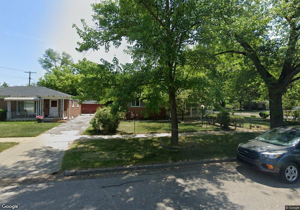
1275 Lori St Ypsilanti, MI 48198
West Willow NeighborhoodEstimated Value: $210,000 - $234,000
3
Beds
1
Bath
1,064
Sq Ft
$206/Sq Ft
Est. Value
About This Home
This home is located at 1275 Lori St, Ypsilanti, MI 48198 and is currently estimated at $218,735, approximately $205 per square foot. 1275 Lori St is a home located in Washtenaw County with nearby schools including Rawsonville Elementary School, Owen Intermediate School, and McBride Middle School.
Ownership History
Date
Name
Owned For
Owner Type
Purchase Details
Closed on
Oct 14, 2003
Sold by
Bellard Lue Brenda
Bought by
Searcy Kimberly
Current Estimated Value
Home Financials for this Owner
Home Financials are based on the most recent Mortgage that was taken out on this home.
Original Mortgage
$104,000
Outstanding Balance
$51,537
Interest Rate
7.12%
Mortgage Type
Balloon
Estimated Equity
$167,198
Create a Home Valuation Report for This Property
The Home Valuation Report is an in-depth analysis detailing your home's value as well as a comparison with similar homes in the area
Home Values in the Area
Average Home Value in this Area
Purchase History
| Date | Buyer | Sale Price | Title Company |
|---|---|---|---|
| Searcy Kimberly | $130,000 | American Pioneer Title Insur |
Source: Public Records
Mortgage History
| Date | Status | Borrower | Loan Amount |
|---|---|---|---|
| Open | Searcy Kimberly | $104,000 | |
| Closed | Searcy Kimberly | $26,000 |
Source: Public Records
Tax History Compared to Growth
Tax History
| Year | Tax Paid | Tax Assessment Tax Assessment Total Assessment is a certain percentage of the fair market value that is determined by local assessors to be the total taxable value of land and additions on the property. | Land | Improvement |
|---|---|---|---|---|
| 2025 | -- | $95,300 | $0 | $0 |
| 2024 | -- | $82,200 | $0 | $0 |
| 2023 | -- | $75,100 | $0 | $0 |
| 2022 | $0 | $60,800 | $0 | $0 |
| 2021 | $873 | $51,100 | $0 | $0 |
| 2020 | $873 | $44,600 | $0 | $0 |
| 2019 | $873 | $37,600 | $37,600 | $0 |
| 2018 | $916 | $27,600 | $0 | $0 |
| 2017 | $916 | $27,900 | $0 | $0 |
| 2016 | $461 | $19,972 | $0 | $0 |
| 2015 | $830 | $19,913 | $0 | $0 |
| 2014 | $830 | $22,000 | $0 | $0 |
| 2013 | -- | $22,000 | $0 | $0 |
Source: Public Records
Map
Nearby Homes
- 1385 Andrea St
- 2106 Chevrolet St
- 1168 Studebaker Ave
- 1122 Lori St
- 1098 Lori St
- 1027 Lori St
- 1815 Heatherridge St
- 1658 Foley Ave
- 1094 Nash Ave
- 1324 Woodglen Ave
- 803 Dorset Ave
- 1336 Woodglen Ave
- 1033 Nash Ave
- 2319 George Ave
- 830 Gates Ave
- 2215 Harmon Ave
- 1593 Wingate Blvd
- 620 Kansas Ave
- 1428 Foley Ave
- 3208 Grove Rd
- 1255 Lori St
- 2025 Mary Catherine St
- 2033 Mary Catherine St
- 2020 Chevrolet St
- 2028 Chevrolet St
- 1985 Mary Catherine St
- 2004 Mary Catherine St
- 2034 Chevrolet St
- 2041 Mary Catherine St
- 2040 Chevrolet St
- 2020 Mary Catherine St
- 1988 Mary Catherine St
- 2018 Chevrolet St
- 1979 Mary Catherine St
- 2049 Mary Catherine St
- 1984 Mary Catherine St
- 2050 Chevrolet St
- 2028 Mary Catherine St
- 1975 Mary Catherine St
- 1980 Mary Catherine St