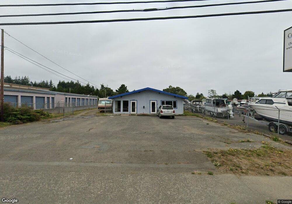
1275 Ocean Blvd NW Coos Bay, OR 97420
--
Bed
--
Bath
2,448
Sq Ft
0.33
Acres
About This Home
This home is located at 1275 Ocean Blvd NW, Coos Bay, OR 97420. 1275 Ocean Blvd NW is a home located in Coos County with nearby schools including Sunset School, Madison Elementary School, and Marshfield Senior High School.
Ownership History
Date
Name
Owned For
Owner Type
Purchase Details
Closed on
Dec 29, 2020
Sold by
Rutherford Logan and Rutherford Kristen
Bought by
Rutherford Logan and Rutherford Kristen
Purchase Details
Closed on
Nov 8, 2005
Sold by
A & S Llc
Bought by
Cascade Tel Inc
Home Financials for this Owner
Home Financials are based on the most recent Mortgage that was taken out on this home.
Original Mortgage
$182,084
Interest Rate
5.9%
Mortgage Type
Commercial
Purchase Details
Closed on
Dec 29, 2004
Sold by
Cascade Tel Inc
Bought by
A & S Llc
Create a Home Valuation Report for This Property
The Home Valuation Report is an in-depth analysis detailing your home's value as well as a comparison with similar homes in the area
Home Values in the Area
Average Home Value in this Area
Purchase History
| Date | Buyer | Sale Price | Title Company |
|---|---|---|---|
| Rutherford Logan | -- | None Available | |
| Cascade Tel Inc | -- | Ticor Title Insurance | |
| A & S Llc | -- | -- |
Source: Public Records
Mortgage History
| Date | Status | Borrower | Loan Amount |
|---|---|---|---|
| Previous Owner | Cascade Tel Inc | $182,084 |
Source: Public Records
Tax History Compared to Growth
Tax History
| Year | Tax Paid | Tax Assessment Tax Assessment Total Assessment is a certain percentage of the fair market value that is determined by local assessors to be the total taxable value of land and additions on the property. | Land | Improvement |
|---|---|---|---|---|
| 2024 | $4,158 | $239,200 | -- | -- |
| 2023 | $4,032 | $232,240 | $0 | $0 |
| 2022 | $3,966 | $225,480 | $0 | $0 |
| 2021 | $3,863 | $218,920 | $0 | $0 |
| 2020 | $3,754 | $218,920 | $0 | $0 |
| 2019 | $3,604 | $206,360 | $0 | $0 |
| 2018 | $3,461 | $200,350 | $0 | $0 |
| 2017 | $3,146 | $200,350 | $0 | $0 |
| 2016 | $2,958 | $190,810 | $0 | $0 |
| 2015 | $2,918 | $195,040 | $0 | $0 |
| 2014 | $2,918 | $189,360 | $0 | $0 |
Source: Public Records
Map
Nearby Homes
- 01500 Cape Arago Hwy
- 1088 Newmark Ave
- 245/247 Ackerman Ave
- 340 Radar Rd
- 1022 Newmark Ave
- 993 Salmon Ave
- 0 Newmark Ave Unit 24289444
- 507 Puerto Vista Dr
- 283 N Main St
- 274 N Cammann St
- 1435 Ventana Ct
- 1060 Pacific Ave
- 0 N Cammann St
- 715 Jackson Ave
- 242 N Wasson St
- 235 N Wall St
- 437 N Wasson St
- 0 N Morrison St
- 1445 Village Pines Ave
- 1066 Pirates Ct
- 1293 Ocean Blvd NW
- 3600 Cape Arago Hwy
- 1185 Salmon Ave
- 1195 Newmark Ave
- 160 Woolridge Ave
- 1190 Michigan Ave
- 1177 Salmon Ave
- 190 Woolridge Ave
- 1170 Michigan Ave
- 1175 Newmark Ave
- 1160 Michigan Ave
- 1252 Newmark Ave
- 1191 Michigan Ave Unit 1
- 1191 Michigan Ave
- 1150 Michigan Ave
- 1190 Newmark Ave
- 1155 Newmark Ave Unit 1
- 1155 Newmark Ave
- 1177 Michigan Ave
- 1129 Salmon Ave