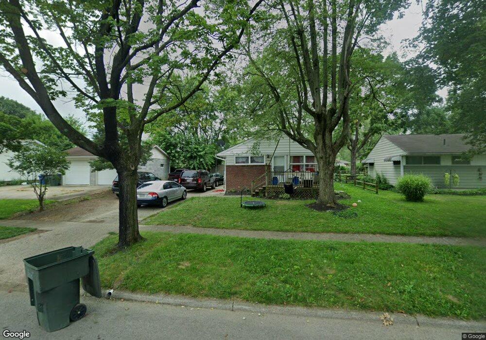
1275 Simpson Dr Columbus, OH 43227
Shady Lane NeighborhoodEstimated Value: $176,827 - $226,000
3
Beds
1
Bath
1,056
Sq Ft
$187/Sq Ft
Est. Value
About This Home
This home is located at 1275 Simpson Dr, Columbus, OH 43227 and is currently estimated at $197,457, approximately $186 per square foot. 1275 Simpson Dr is a home located in Franklin County with nearby schools including Shady Lane Elementary School, Sherwood Middle School, and Walnut Ridge High School.
Ownership History
Date
Name
Owned For
Owner Type
Purchase Details
Closed on
Jul 10, 2018
Sold by
Bogin Igor
Bought by
Abi 3 Llc
Current Estimated Value
Purchase Details
Closed on
Jun 28, 2011
Sold by
Baldwin Ricky and Bladwin Wendy
Bought by
Bogin Igor
Purchase Details
Closed on
Oct 30, 2006
Sold by
Baldwin Wendy
Bought by
Baldwin Ricky and Baldwin Wendy
Home Financials for this Owner
Home Financials are based on the most recent Mortgage that was taken out on this home.
Original Mortgage
$80,250
Interest Rate
6.38%
Mortgage Type
New Conventional
Purchase Details
Closed on
May 26, 2004
Sold by
Hud
Bought by
Baldwin Wendy
Purchase Details
Closed on
Sep 10, 2003
Sold by
Amburgey Beton M and Nationwide Home Mortgage Co
Bought by
Hud
Purchase Details
Closed on
Dec 18, 1990
Bought by
Amburgey Benton M
Purchase Details
Closed on
Jun 25, 1990
Purchase Details
Closed on
Jan 4, 1988
Create a Home Valuation Report for This Property
The Home Valuation Report is an in-depth analysis detailing your home's value as well as a comparison with similar homes in the area
Home Values in the Area
Average Home Value in this Area
Purchase History
| Date | Buyer | Sale Price | Title Company |
|---|---|---|---|
| Abi 3 Llc | -- | None Available | |
| Bogin Igor | $22,000 | Tlc Title | |
| Baldwin Ricky | -- | Foundation | |
| Baldwin Wendy | $46,144 | -- | |
| Hud | $50,000 | -- | |
| Amburgey Benton M | $58,000 | -- | |
| -- | -- | -- | |
| -- | -- | -- |
Source: Public Records
Mortgage History
| Date | Status | Borrower | Loan Amount |
|---|---|---|---|
| Previous Owner | Baldwin Ricky | $80,250 |
Source: Public Records
Tax History
| Year | Tax Paid | Tax Assessment Tax Assessment Total Assessment is a certain percentage of the fair market value that is determined by local assessors to be the total taxable value of land and additions on the property. | Land | Improvement |
|---|---|---|---|---|
| 2025 | $2,745 | $59,890 | $16,800 | $43,090 |
| 2024 | $2,745 | $59,890 | $16,800 | $43,090 |
| 2023 | $2,710 | $59,885 | $16,800 | $43,085 |
| 2022 | $1,577 | $29,680 | $6,300 | $23,380 |
| 2021 | $1,580 | $29,680 | $6,300 | $23,380 |
| 2020 | $1,582 | $29,680 | $6,300 | $23,380 |
| 2019 | $1,593 | $23,590 | $5,040 | $18,550 |
| 2018 | $732 | $23,590 | $5,040 | $18,550 |
| 2017 | $1,467 | $23,590 | $5,040 | $18,550 |
| 2016 | $833 | $12,260 | $4,940 | $7,320 |
| 2015 | $379 | $12,260 | $4,940 | $7,320 |
| 2014 | $988 | $12,260 | $4,940 | $7,320 |
| 2013 | $791 | $20,825 | $5,810 | $15,015 |
Source: Public Records
Map
Nearby Homes
- 1229 Simpson Dr
- 1284 Thurston Dr
- 1193 Marble Dr
- 1281 Maetzel Dr
- 1377 Marble Dr
- 4467 Grimsby Rd
- 1356 Harlow Rd
- 4472 Aragon Ave
- 1085 S Hamilton Rd
- 1260 Country Club Rd
- 4677 E Livingston Ave
- 1301 Bernhard Rd
- 4859 Folger Dr
- 1612 Simpson Dr
- 1607 Baxter Dr
- 1639 Shady Lane Rd
- 1691 Shady Lane Rd
- 1492 Burlington Ave
- 4649 Dundee Ave
- 1469 Burlington Ave
- 1267 Simpson Dr
- 1285 Simpson Dr
- 1298 Huntly Dr
- 1259 Simpson Dr
- 1280 Huntly Dr
- 1288 Huntly Dr
- 1296 Huntly Dr
- 1272 Huntly Dr
- 1274 Simpson Dr
- 1251 Simpson Dr
- 1266 Simpson Dr
- 1282 Simpson Dr
- 1266 Huntly Dr
- 1258 Simpson Dr
- 1290 Simpson Dr
- 1243 Simpson Dr
- 1258 Huntly Dr
- 1250 Simpson Dr
- 1309 Simpson Dr
- 1300 Simpson Dr
Your Personal Tour Guide
Ask me questions while you tour the home.