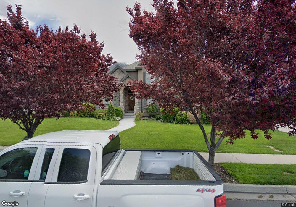
1276 N 1270 E American Fork, UT 84003
Estimated Value: $997,000 - $1,394,000
7
Beds
4
Baths
5,748
Sq Ft
$218/Sq Ft
Est. Value
About This Home
This home is located at 1276 N 1270 E, American Fork, UT 84003 and is currently estimated at $1,253,696, approximately $218 per square foot. 1276 N 1270 E is a home located in Utah County with nearby schools including Deerfield Elementary School, Mountain Ridge Junior High School, and American Fork High School.
Ownership History
Date
Name
Owned For
Owner Type
Purchase Details
Closed on
Jun 8, 2016
Sold by
Bloxham Daren S and Bloxham Julie L
Bought by
Bowers Brian and Bowers Alison
Current Estimated Value
Purchase Details
Closed on
Jan 31, 2006
Sold by
Bloxham Daren S
Bought by
Bloxham Daren S and Bloxham Julie L
Home Financials for this Owner
Home Financials are based on the most recent Mortgage that was taken out on this home.
Original Mortgage
$83,750
Interest Rate
6.21%
Mortgage Type
Credit Line Revolving
Purchase Details
Closed on
Jan 11, 2006
Sold by
Bloxham Daren S
Bought by
Bloxham Daren S and Bloxham Julie L
Home Financials for this Owner
Home Financials are based on the most recent Mortgage that was taken out on this home.
Original Mortgage
$83,750
Interest Rate
6.21%
Mortgage Type
Credit Line Revolving
Purchase Details
Closed on
Dec 29, 2004
Sold by
Hennefer Michael and Hennefer Kari K
Bought by
Bloxham Daren S
Home Financials for this Owner
Home Financials are based on the most recent Mortgage that was taken out on this home.
Original Mortgage
$368,000
Interest Rate
5.74%
Mortgage Type
Construction
Create a Home Valuation Report for This Property
The Home Valuation Report is an in-depth analysis detailing your home's value as well as a comparison with similar homes in the area
Home Values in the Area
Average Home Value in this Area
Purchase History
| Date | Buyer | Sale Price | Title Company |
|---|---|---|---|
| Bowers Brian | -- | Access Title Co | |
| Bloxham Daren S | -- | Beehive Title Insurance Age | |
| Bloxham Daren S | -- | Beehive Title Insurance Age | |
| Bloxham Daren S | -- | Beehive Title Insurance Age | |
| Bloxham Daren S | -- | Equity Title Agency Inc |
Source: Public Records
Mortgage History
| Date | Status | Borrower | Loan Amount |
|---|---|---|---|
| Previous Owner | Bloxham Daren S | $83,750 | |
| Previous Owner | Bloxham Daren S | $392,500 | |
| Previous Owner | Bloxham Daren S | $368,000 |
Source: Public Records
Tax History Compared to Growth
Tax History
| Year | Tax Paid | Tax Assessment Tax Assessment Total Assessment is a certain percentage of the fair market value that is determined by local assessors to be the total taxable value of land and additions on the property. | Land | Improvement |
|---|---|---|---|---|
| 2025 | $5,009 | $638,440 | $266,900 | $893,900 |
| 2024 | $4,789 | $556,600 | $0 | $0 |
| 2023 | $4,789 | $564,135 | $0 | $0 |
| 2022 | $4,529 | $526,460 | $0 | $0 |
| 2021 | $3,965 | $719,900 | $186,900 | $533,000 |
| 2020 | $3,865 | $680,700 | $173,100 | $507,600 |
| 2019 | $3,644 | $663,700 | $161,000 | $502,700 |
| 2018 | $3,433 | $597,900 | $152,900 | $445,000 |
| 2017 | $3,263 | $306,680 | $0 | $0 |
| 2016 | $2,970 | $259,380 | $0 | $0 |
| 2015 | $3,130 | $259,380 | $0 | $0 |
| 2014 | $3,015 | $246,510 | $0 | $0 |
Source: Public Records
Map
Nearby Homes
- 1243 N 1270 E
- 1162 E 1180 N
- 1172 Murdock Dr
- 4441 W Bridgestone Dr
- 1228 E 1030 N
- 248 N Deerfield Ln
- 9587 N 4500 W
- 9681 N Peach Ct
- 1058 N 930 E Unit 64
- 2969 N 1350 W
- 1089 N 950 E
- 1059 N 930 E
- The McKenzie Plan at Autumn Crest
- The Christine Plan at Autumn Crest
- The Avery Plan at Autumn Crest
- The Madison Plan at Autumn Crest
- The Roosevelt Plan at Autumn Crest
- The Annie Plan at Autumn Crest
- The Michelle Plan at Autumn Crest
- 1053 N 930 E Unit 73
- 1276 N 1270 E Unit 52
- 1264 N 1270 E
- 1264 N 1270 E Unit 53
- 3611 N 1590 W
- 1277 N 1270 E
- 1277 N 1270 E Unit 75
- 1296 N 1270 E
- 3573 N 1590 W
- 1265 N 1270 E
- 1265 N 1270 E Unit 74
- 1242 N 1270 E
- 1242 N 1270 E Unit 54
- 1299 N 1270 E
- 1251 E 1280 N
- 3539 N 1590 W
- 1338 N 1270 E
- 1338 N 1270 E Unit 50
- 1248 E 1280 N
- 1331 N 1270 E
- 1576 W 3600 N