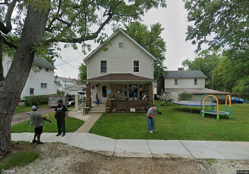
1276 South St Alliance, OH 44601
Estimated Value: $68,000 - $110,000
3
Beds
1
Bath
1,248
Sq Ft
$74/Sq Ft
Est. Value
About This Home
This home is located at 1276 South St, Alliance, OH 44601 and is currently estimated at $92,359, approximately $74 per square foot. 1276 South St is a home located in Stark County with nearby schools including Alliance Elementary School at Rockhill, Alliance Intermediate School at Northside, and Alliance Middle School.
Ownership History
Date
Name
Owned For
Owner Type
Purchase Details
Closed on
Aug 22, 2005
Sold by
Wharmby James B and Wharmby Amy T
Bought by
Sayers Danny
Current Estimated Value
Home Financials for this Owner
Home Financials are based on the most recent Mortgage that was taken out on this home.
Original Mortgage
$40,000
Outstanding Balance
$21,053
Interest Rate
5.69%
Mortgage Type
Purchase Money Mortgage
Estimated Equity
$71,306
Purchase Details
Closed on
Jan 28, 2005
Sold by
Johnson Larry F and Johnson Julia D
Bought by
Wharmby James B
Home Financials for this Owner
Home Financials are based on the most recent Mortgage that was taken out on this home.
Original Mortgage
$28,000
Interest Rate
5.77%
Mortgage Type
Purchase Money Mortgage
Purchase Details
Closed on
Dec 20, 1989
Create a Home Valuation Report for This Property
The Home Valuation Report is an in-depth analysis detailing your home's value as well as a comparison with similar homes in the area
Home Values in the Area
Average Home Value in this Area
Purchase History
| Date | Buyer | Sale Price | Title Company |
|---|---|---|---|
| Sayers Danny | $40,000 | -- | |
| Wharmby James B | $35,000 | -- | |
| -- | $10,000 | -- |
Source: Public Records
Mortgage History
| Date | Status | Borrower | Loan Amount |
|---|---|---|---|
| Open | Sayers Danny | $40,000 | |
| Previous Owner | Wharmby James B | $28,000 |
Source: Public Records
Tax History Compared to Growth
Tax History
| Year | Tax Paid | Tax Assessment Tax Assessment Total Assessment is a certain percentage of the fair market value that is determined by local assessors to be the total taxable value of land and additions on the property. | Land | Improvement |
|---|---|---|---|---|
| 2025 | -- | $26,260 | $3,330 | $22,930 |
| 2024 | -- | $26,260 | $3,330 | $22,930 |
| 2023 | $845 | $21,040 | $3,400 | $17,640 |
| 2022 | $851 | $21,040 | $3,400 | $17,640 |
| 2021 | $852 | $21,040 | $3,400 | $17,640 |
| 2020 | $709 | $16,350 | $2,940 | $13,410 |
| 2019 | $699 | $16,350 | $2,940 | $13,410 |
| 2018 | $702 | $16,350 | $2,940 | $13,410 |
| 2017 | $645 | $14,770 | $2,450 | $12,320 |
| 2016 | $650 | $14,770 | $2,450 | $12,320 |
| 2015 | $656 | $14,770 | $2,450 | $12,320 |
| 2014 | $384 | $8,230 | $2,240 | $5,990 |
| 2013 | $191 | $8,230 | $2,240 | $5,990 |
Source: Public Records
Map
Nearby Homes
- 1233 Woodland Ave
- 831 Wade Ave
- 814 Milner St
- 1395 S Webb Ave
- 815 Grace St
- 729 Waugh St
- 1044 S Liberty Ave
- 551 South St
- 1005 S Freedom Ave
- 1437 S Linden Ave
- 452 E Summit St
- 442 S Liberty Ave
- 390 E College St
- 1846 S Freedom Ave
- 167 11th St
- 548 E High St
- V/L S Fredeom Ave
- 432 S Linden Ave
- 1475 Chatauqua Ct
- 404 S Linden Ave
- 1157 Meadow Ave
- 1266 South St
- 1145 Meadow Ave
- 1258 South St
- 1148 Clay Ave
- 1306 South St
- 1139 Meadow Ave
- 1140 Clay Ave
- 1289 South St
- 1267 South St
- 1133 Meadow Ave
- 1148 Meadow Ave
- 1130 Clay Ave
- 1312 South St
- 1257 South St
- 1125 Meadow Ave
- 1140 Meadow Ave
- 1307 South St Unit 1315
- 1307 South St
- 1124 Clay Ave