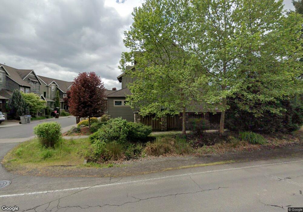
12761 SW Killpack Ln Beaverton, OR 97005
Estimated Value: $691,000 - $715,126
3
Beds
3
Baths
2,502
Sq Ft
$282/Sq Ft
Est. Value
About This Home
This home is located at 12761 SW Killpack Ln, Beaverton, OR 97005 and is currently estimated at $704,782, approximately $281 per square foot. 12761 SW Killpack Ln is a home located in Washington County with nearby schools including Ridgewood Elementary School, Cedar Park Middle School, and Beaverton High School.
Ownership History
Date
Name
Owned For
Owner Type
Purchase Details
Closed on
Feb 2, 2016
Sold by
Sphar Paul and Sphar Sandra
Bought by
Bergseng Nicholas James and Bergseng Emily Ganz
Current Estimated Value
Home Financials for this Owner
Home Financials are based on the most recent Mortgage that was taken out on this home.
Original Mortgage
$396,800
Outstanding Balance
$314,669
Interest Rate
3.79%
Mortgage Type
New Conventional
Estimated Equity
$390,113
Purchase Details
Closed on
Apr 29, 2013
Sold by
Mission Homes Nw Llc
Bought by
Sphar Paul and Sphar Sandra
Home Financials for this Owner
Home Financials are based on the most recent Mortgage that was taken out on this home.
Original Mortgage
$343,561
Interest Rate
3.75%
Mortgage Type
FHA
Create a Home Valuation Report for This Property
The Home Valuation Report is an in-depth analysis detailing your home's value as well as a comparison with similar homes in the area
Home Values in the Area
Average Home Value in this Area
Purchase History
| Date | Buyer | Sale Price | Title Company |
|---|---|---|---|
| Bergseng Nicholas James | $496,000 | First American | |
| Sphar Paul | $349,900 | First American |
Source: Public Records
Mortgage History
| Date | Status | Borrower | Loan Amount |
|---|---|---|---|
| Open | Bergseng Nicholas James | $396,800 | |
| Previous Owner | Sphar Paul | $343,561 |
Source: Public Records
Tax History Compared to Growth
Tax History
| Year | Tax Paid | Tax Assessment Tax Assessment Total Assessment is a certain percentage of the fair market value that is determined by local assessors to be the total taxable value of land and additions on the property. | Land | Improvement |
|---|---|---|---|---|
| 2025 | $8,042 | $444,080 | -- | -- |
| 2024 | $7,552 | $431,150 | -- | -- |
| 2023 | $7,552 | $418,600 | $0 | $0 |
| 2022 | $7,307 | $418,600 | $0 | $0 |
| 2021 | $7,044 | $394,580 | $0 | $0 |
| 2020 | $6,832 | $383,090 | $0 | $0 |
| 2019 | $6,609 | $371,940 | $0 | $0 |
| 2018 | $6,392 | $361,110 | $0 | $0 |
| 2017 | $6,163 | $350,600 | $0 | $0 |
| 2016 | $5,943 | $340,390 | $0 | $0 |
| 2015 | $5,713 | $330,480 | $0 | $0 |
| 2014 | $5,530 | $320,860 | $0 | $0 |
Source: Public Records
Map
Nearby Homes
- 938 SW Adrian Terrace
- 12825 SW Evergreen St
- 13120 SW Rita Dr
- 414 SW Frenwood Way
- 1605 SW Filmont Ave
- 245 SW 133rd Ave
- 13720 SW Butner Rd
- 13520 SW Devonshire Dr
- 13375 SW Glenhaven St
- 11990 SW Corby Dr Unit 6
- 11990 SW Corby (#6) Dr
- 13860 SW Butner Rd
- 1865 SW Wellington Ave
- 12614 NW Barnes Rd Unit 12
- 12604 NW Barnes Rd Unit 3
- 13115 NW Glenridge Dr
- 12618 NW Barnes Rd Unit 11
- 12580 SW Faircrest St
- 12735 SW Edgewood St
- 12620 NW Barnes Rd Unit 5
- 12789 SW Killpack Ln
- 12747 SW Killpack Ln
- 12830 SW Aragon St
- 12850 SW Aragon St
- 12770 SW Killpack Ln
- 12756 SW Killpack Ln
- 12803 SW Killpack Ln
- 12784 SW Killpack Ln
- 12742 SW Killpack Ln
- 12800 SW Killpack Ln
- 12880 SW Aragon St
- 12819 SW Killpack Ln
- 12814 SW Killpack Ln
- 12885 SW Gentry Ln
- 12815 SW Butner Rd
- 12785 SW Butner Rd
- 12900 SW Aragon St
- 12835 SW Killpack Ln
- 12826 SW Killpack Ln
- 12845 SW Butner Rd