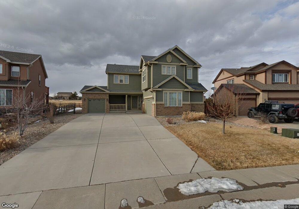
12765 Angelina Dr Peyton, CO 80831
Falcon NeighborhoodEstimated Value: $537,000 - $554,000
3
Beds
2
Baths
3,405
Sq Ft
$160/Sq Ft
Est. Value
About This Home
This home is located at 12765 Angelina Dr, Peyton, CO 80831 and is currently estimated at $546,025, approximately $160 per square foot. 12765 Angelina Dr is a home located in El Paso County with nearby schools including Meridian Ranch Elementary School, Falcon Middle School, and Falcon High School.
Ownership History
Date
Name
Owned For
Owner Type
Purchase Details
Closed on
Aug 28, 2020
Sold by
Erwin Raymond D and Erwin Marilyn I
Bought by
Angus Jeff Davis
Current Estimated Value
Home Financials for this Owner
Home Financials are based on the most recent Mortgage that was taken out on this home.
Original Mortgage
$312,000
Outstanding Balance
$277,388
Interest Rate
3%
Mortgage Type
New Conventional
Estimated Equity
$268,637
Purchase Details
Closed on
Nov 20, 2006
Sold by
Lennar Colorado Llc
Bought by
Erwin Raymond D and Erwin Marilyn I
Home Financials for this Owner
Home Financials are based on the most recent Mortgage that was taken out on this home.
Original Mortgage
$236,800
Interest Rate
6.37%
Mortgage Type
Unknown
Purchase Details
Closed on
Jan 3, 2006
Sold by
Gtl Inc
Bought by
Lennar Colorado Llc
Create a Home Valuation Report for This Property
The Home Valuation Report is an in-depth analysis detailing your home's value as well as a comparison with similar homes in the area
Home Values in the Area
Average Home Value in this Area
Purchase History
| Date | Buyer | Sale Price | Title Company |
|---|---|---|---|
| Angus Jeff Davis | $390,000 | Wfg National Title | |
| Erwin Raymond D | $296,062 | North American Title | |
| Lennar Colorado Llc | $282,000 | Fahtco |
Source: Public Records
Mortgage History
| Date | Status | Borrower | Loan Amount |
|---|---|---|---|
| Open | Angus Jeff Davis | $312,000 | |
| Previous Owner | Erwin Raymond D | $236,800 |
Source: Public Records
Tax History
| Year | Tax Paid | Tax Assessment Tax Assessment Total Assessment is a certain percentage of the fair market value that is determined by local assessors to be the total taxable value of land and additions on the property. | Land | Improvement |
|---|---|---|---|---|
| 2025 | $3,682 | $38,990 | -- | -- |
| 2024 | $3,553 | $39,650 | $9,000 | $30,650 |
| 2022 | $2,676 | $26,510 | $7,390 | $19,120 |
| 2021 | $2,773 | $27,270 | $7,600 | $19,670 |
| 2020 | $2,632 | $24,000 | $6,890 | $17,110 |
| 2019 | $2,617 | $24,000 | $6,890 | $17,110 |
| 2018 | $2,446 | $22,200 | $6,300 | $15,900 |
| 2017 | $2,313 | $22,200 | $6,300 | $15,900 |
| 2016 | $2,307 | $22,670 | $6,970 | $15,700 |
| 2015 | $2,308 | $22,670 | $6,970 | $15,700 |
| 2014 | $2,164 | $20,990 | $5,970 | $15,020 |
Source: Public Records
Map
Nearby Homes
- 12705 Angelina Dr
- 12320 Grand Teton Dr
- 10803 Greenbelt Dr
- 10603 Ross Lake Dr
- 12534 Angelina Dr
- 10952 Torreys Peak Way
- 10489 Cedar Breaks Dr
- 10488 Cedar Breaks Dr
- 10932 Huron Peak Place
- 10476 Ross Lake Dr
- 10467 Pictured Rocks Dr
- 10429 Cedar Breaks Dr
- 10952 Checo Way
- 12431 Mount Bross Place
- 10342 Biscayne Dr
- 12252 Point Reyes Dr
- 10388 Mount Wilson Place
- 12144 Point Reyes Dr
- 12692 Clark Peak Ct
- 12272 Isle Royale Dr
- 12775 Angelina Dr
- 12755 Angelina Dr
- 12745 Angelina Dr
- 12785 Angelina Dr
- 12744 Angelina Dr
- 12795 Angelina Dr
- 10812 White Sands Ct
- 10832 White Sands Ct
- 10691 Ross Lake Dr
- 12734 Angelina Dr
- 12804 Angelina Dr
- 10692 Ross Lake Dr
- 10852 White Sands Ct
- 12805 Angelina Dr
- 12724 Angelina Dr
- 10683 Ross Lake Dr
- 12825 Angelina Dr
- 12824 Angelina Dr
- 12815 Angelina Dr
- 10813 White Sands Ct
Your Personal Tour Guide
Ask me questions while you tour the home.