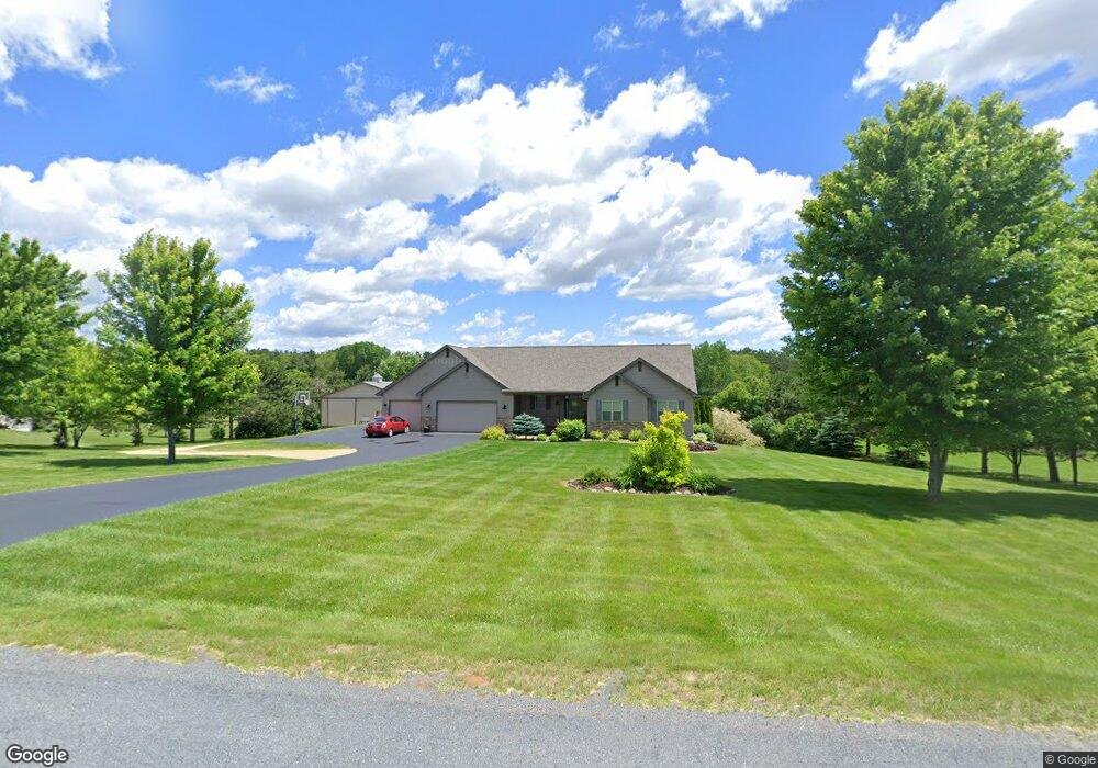
1277 142nd St New Richmond, WI 54017
Richmond NeighborhoodEstimated Value: $536,780 - $588,000
5
Beds
4
Baths
--
Sq Ft
2
Acres
About This Home
This home is located at 1277 142nd St, New Richmond, WI 54017 and is currently estimated at $555,945. 1277 142nd St is a home located in St. Croix County with nearby schools including New Richmond High School.
Ownership History
Date
Name
Owned For
Owner Type
Purchase Details
Closed on
Sep 27, 2018
Sold by
Lybeck Tyson B and Lybeck Tyson B
Bought by
Monson Garett L and Monson Amy L
Current Estimated Value
Home Financials for this Owner
Home Financials are based on the most recent Mortgage that was taken out on this home.
Original Mortgage
$313,650
Outstanding Balance
$273,521
Interest Rate
4.5%
Mortgage Type
New Conventional
Estimated Equity
$282,424
Purchase Details
Closed on
May 26, 2015
Sold by
Lybeck Tyson and Lybeck Jennifer
Bought by
Lybeck Tyson B and Revoc Jennifer M Lybeck
Purchase Details
Closed on
Nov 14, 2012
Sold by
Henning Christopher L and Henning Nicole M
Bought by
Lybeck Tyson and Lybeck Jennifer
Home Financials for this Owner
Home Financials are based on the most recent Mortgage that was taken out on this home.
Original Mortgage
$223,200
Interest Rate
3.38%
Mortgage Type
New Conventional
Create a Home Valuation Report for This Property
The Home Valuation Report is an in-depth analysis detailing your home's value as well as a comparison with similar homes in the area
Home Values in the Area
Average Home Value in this Area
Purchase History
| Date | Buyer | Sale Price | Title Company |
|---|---|---|---|
| Monson Garett L | $369,000 | Abstracts & Titles | |
| Lybeck Tyson B | -- | Attorney | |
| Lybeck Tyson | $279,000 | Alliance Title |
Source: Public Records
Mortgage History
| Date | Status | Borrower | Loan Amount |
|---|---|---|---|
| Open | Monson Garett L | $313,650 | |
| Previous Owner | Lybeck Tyson | $223,200 |
Source: Public Records
Tax History Compared to Growth
Tax History
| Year | Tax Paid | Tax Assessment Tax Assessment Total Assessment is a certain percentage of the fair market value that is determined by local assessors to be the total taxable value of land and additions on the property. | Land | Improvement |
|---|---|---|---|---|
| 2024 | $54 | $431,100 | $43,800 | $387,300 |
| 2023 | $4,996 | $431,100 | $43,800 | $387,300 |
| 2022 | $4,342 | $431,100 | $43,800 | $387,300 |
| 2021 | $4,249 | $431,100 | $43,800 | $387,300 |
| 2020 | $4,672 | $269,200 | $24,000 | $245,200 |
| 2019 | $4,536 | $269,200 | $24,000 | $245,200 |
| 2018 | $4,396 | $269,200 | $24,000 | $245,200 |
| 2017 | $4,282 | $269,200 | $24,000 | $245,200 |
| 2016 | $4,282 | $269,200 | $24,000 | $245,200 |
| 2015 | $4,461 | $269,200 | $24,000 | $245,200 |
| 2014 | $4,302 | $269,200 | $24,000 | $245,200 |
| 2013 | -- | $269,200 | $24,000 | $245,200 |
Source: Public Records
Map
Nearby Homes
- 1258 150th St
- 1448 142nd St
- 1417 146th Ave
- 1314 130th Ave
- xxx Lot #5 110th Ave
- xxx Lot #7 110th Ave
- xxx Lot #13 110th Ave
- xxx Lot#18 110th Ave
- xxx Lot #2 110th Ave
- xxx Lot #4 110th Ave
- xxx Lot#19 110th Ave
- xxx Lot#20 110th Ave
- xxx Lot#15 110th Ave
- xxx Lot#26 110th Ave
- xxx Lot #3 110th Ave
- xxx Lot#22 110th Ave
- xxx Lot#16 110th Ave
- xxx Lot #8 110th Ave
- xxx Lot#28 110th Ave
- xxx Lot#23 110th Ave
- 1273 142nd St
- 1281 142nd St
- 1267 142nd St
- 1287 142nd St
- 1274 142nd St
- 1274 1274 142nd St
- 1282 142nd St
- 1291 142nd St
- 1268 142nd St
- 1286 142nd St
- 1259 142nd St
- 1259 1259 142nd-Street-
- 1290 1290 142nd-Street-
- 1290 142nd St
- 1262 142nd St
- 1422 126th Ave
- 1422 1422 126th Ave
- 1297 142nd St
- 1285 140th St
- 1258 142nd St