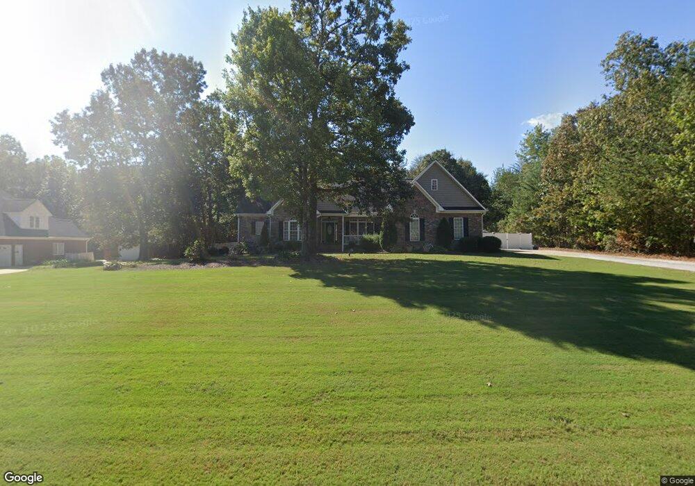
1277 Avalon Ln Anniston, AL 36207
Estimated Value: $431,000 - $478,000
4
Beds
3
Baths
3,035
Sq Ft
$151/Sq Ft
Est. Value
About This Home
This home is located at 1277 Avalon Ln, Anniston, AL 36207 and is currently estimated at $457,769, approximately $150 per square foot. 1277 Avalon Ln is a home located in Calhoun County with nearby schools including White Plains Elementary School, White Plains Middle School, and White Plains High School.
Ownership History
Date
Name
Owned For
Owner Type
Purchase Details
Closed on
Nov 28, 2016
Bought by
Shaw Cranford and Shaw Kerry
Current Estimated Value
Home Financials for this Owner
Home Financials are based on the most recent Mortgage that was taken out on this home.
Original Mortgage
$251,000
Outstanding Balance
$205,804
Interest Rate
4.03%
Estimated Equity
$251,965
Purchase Details
Closed on
Jun 1, 2011
Sold by
Fannie Mae
Bought by
Shaw Cranford Eugene and Shaw Kerry A
Create a Home Valuation Report for This Property
The Home Valuation Report is an in-depth analysis detailing your home's value as well as a comparison with similar homes in the area
Home Values in the Area
Average Home Value in this Area
Purchase History
| Date | Buyer | Sale Price | Title Company |
|---|---|---|---|
| Shaw Cranford | -- | -- | |
| Shaw Cranford Eugene | -- | -- |
Source: Public Records
Mortgage History
| Date | Status | Borrower | Loan Amount |
|---|---|---|---|
| Open | Shaw Cranford Eugene | $251,000 | |
| Closed | Shaw Cranford Eugene | -- |
Source: Public Records
Tax History Compared to Growth
Tax History
| Year | Tax Paid | Tax Assessment Tax Assessment Total Assessment is a certain percentage of the fair market value that is determined by local assessors to be the total taxable value of land and additions on the property. | Land | Improvement |
|---|---|---|---|---|
| 2024 | $1,459 | $41,170 | $3,700 | $37,470 |
| 2023 | $1,596 | $39,656 | $3,700 | $35,956 |
| 2022 | $1,443 | $37,336 | $3,700 | $33,636 |
| 2021 | $1,296 | $33,736 | $3,700 | $30,036 |
| 2020 | $1,219 | $31,740 | $3,700 | $28,040 |
| 2019 | $1,281 | $32,714 | $3,700 | $29,014 |
| 2018 | $1,258 | $32,720 | $0 | $0 |
| 2017 | $532 | $29,940 | $0 | $0 |
| 2016 | $1,147 | $29,940 | $0 | $0 |
| 2013 | -- | $30,200 | $0 | $0 |
Source: Public Records
Map
Nearby Homes
- 65 Camelot Ln
- 576 Lillian Ln
- 833 Lillian Ln
- 43 Faulkner Dr
- 1001 Kingsway Dr
- 64 Avalon Ln
- 6922 Choccolloco Rd
- 166 Freedom Way
- 247 Liberty Ln
- 65 Casey Ct
- 390 Jamestown Way Unit 9
- 115 Carnoustie Place
- 39 Carnoustie Place
- 4809 Laurel Trace Unit 7
- 4803 Laurel Trace
- 136 Dewey Ln Unit 4
- 121 Eastwood Dr
- 2318 Al Highway 9
- 115 Sandy Ln
- 1129 Earl Roberts Rd
- 1245 Avalon Ln
- 1278 Avalon Ln
- 1250 Avalon Ln
- 1205 Avalon Ln
- 1137 Avalon Ln
- 0 Buckingham Place Unit 85 416171
- 1224 Avalon Ln
- 1330 Avalon Ln
- 1109 Avalon Ln
- 166 Oak Trace Ln
- 1200 Avalon Ln
- 1200 Avalon Ln Unit 75
- 1363 Avalon Ln
- 36 Buckingham Place
- 1079 Avalon Ln
- 78 Buckingham Place
- 1186 Avalon Ln
- 1368 Avalon Ln
- 135 Buckingham Place
- 1051 Avalon Ln