Estimated Value: $295,000 - $334,000
3
Beds
3
Baths
1,620
Sq Ft
$198/Sq Ft
Est. Value
About This Home
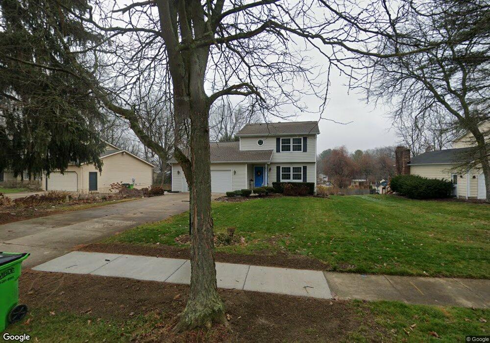
This home is located at 1277 Homesite Dr, Stow, OH 44224 and is currently estimated at $321,420, approximately $198 per square foot. 1277 Homesite Dr is a home located in Summit County with nearby schools including Stow-Munroe Falls High School, Primrose School of Hudson, and Holy Family Elementary School.
Ownership History
Date
Name
Owned For
Owner Type
Purchase Details
Closed on
Oct 10, 2002
Sold by
Mcdonald Christine T and Mcdonald Christine E
Bought by
Thomas Christine E
Current Estimated Value
Home Financials for this Owner
Home Financials are based on the most recent Mortgage that was taken out on this home.
Original Mortgage
$87,300
Interest Rate
6.24%
Purchase Details
Closed on
Jul 21, 1997
Sold by
Martucci Brian J
Bought by
Mcdonald Christine T
Home Financials for this Owner
Home Financials are based on the most recent Mortgage that was taken out on this home.
Original Mortgage
$100,000
Interest Rate
7.94%
Mortgage Type
New Conventional
Purchase Details
Closed on
Dec 15, 1995
Sold by
Gardner William J
Bought by
Martucci Brian J and Martucci Katherine D
Home Financials for this Owner
Home Financials are based on the most recent Mortgage that was taken out on this home.
Original Mortgage
$86,000
Interest Rate
7.45%
Mortgage Type
New Conventional
Create a Home Valuation Report for This Property
The Home Valuation Report is an in-depth analysis detailing your home's value as well as a comparison with similar homes in the area
Home Values in the Area
Average Home Value in this Area
Purchase History
| Date | Buyer | Sale Price | Title Company |
|---|---|---|---|
| Thomas Christine E | -- | Minnesota Title | |
| Mcdonald Christine T | $142,000 | -- | |
| Martucci Brian J | $126,000 | -- |
Source: Public Records
Mortgage History
| Date | Status | Borrower | Loan Amount |
|---|---|---|---|
| Closed | Thomas Christine E | $87,300 | |
| Closed | Mcdonald Christine T | $100,000 | |
| Previous Owner | Martucci Brian J | $86,000 |
Source: Public Records
Tax History Compared to Growth
Tax History
| Year | Tax Paid | Tax Assessment Tax Assessment Total Assessment is a certain percentage of the fair market value that is determined by local assessors to be the total taxable value of land and additions on the property. | Land | Improvement |
|---|---|---|---|---|
| 2025 | $5,567 | $98,872 | $13,412 | $85,460 |
| 2024 | $5,567 | $98,872 | $13,412 | $85,460 |
| 2023 | $5,567 | $98,872 | $13,412 | $85,460 |
| 2022 | $4,863 | $76,185 | $10,318 | $65,867 |
| 2021 | $4,353 | $76,185 | $10,318 | $65,867 |
| 2020 | $4,278 | $76,190 | $10,320 | $65,870 |
| 2019 | $3,949 | $65,670 | $10,320 | $55,350 |
| 2018 | $3,884 | $65,670 | $10,320 | $55,350 |
| 2017 | $3,520 | $65,670 | $10,320 | $55,350 |
| 2016 | $3,623 | $57,760 | $10,320 | $47,440 |
| 2015 | $3,520 | $57,760 | $10,320 | $47,440 |
| 2014 | $3,523 | $57,760 | $10,320 | $47,440 |
| 2013 | $3,216 | $52,980 | $10,320 | $42,660 |
Source: Public Records
Map
Nearby Homes
- 1470 Mac Dr
- 0 Hibbard Dr
- 1511 Apollo Dr
- V/L Lawnmark Dr
- 4877 Cedar Crest Ln
- 4891 Cedar Crest Ln
- 1664 Cypress Ct
- 1808 Higby Dr Unit A
- V/L Housley Rd
- 1627 Cypress Ct
- 1938 Higby Dr
- 4630 Red Willow Rd
- 1620 Sapphire Dr
- 1884 Village Ct Unit X66
- V/L Norton Rd
- V/L Diplomat Dr
- 734 Barlow Rd
- 2327 Crockett Cir
- 5426 Port Chester Dr
- 4024 Glenrich Cir
- 1269 Homesite Dr
- 1285 Homesite Dr
- 1291 Homesite Dr
- 1263 Homesite Dr
- 4833 Southbrook Dr
- 1280 Meadowbrook Blvd
- 1264 Meadowbrook Blvd
- 1284 Homesite Dr
- 4803 Southbrook Dr
- 1297 Homesite Dr
- 1270 Homesite Dr
- 1290 Meadowbrook Blvd
- 1294 Homesite Dr
- 4845 Southbrook Dr Unit 4849
- 1303 Homesite Dr
- 1304 Homesite Dr
- 1247 Homesite Dr
- 1300 Meadowbrook Blvd
- 1263 Meadowbrook Blvd
- 1291 Meadowbrook Blvd