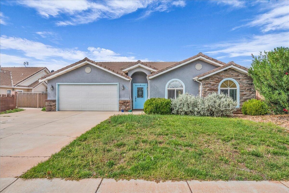
1277 N 1610 W Saint George, UT 84770
Estimated payment $2,296/month
Highlights
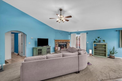
- Vaulted Ceiling
- Covered Patio or Porch
- Double Pane Windows
- No HOA
- Attached Garage
- Walk-In Closet
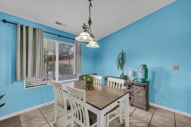
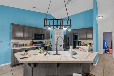
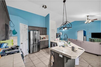
About This Home
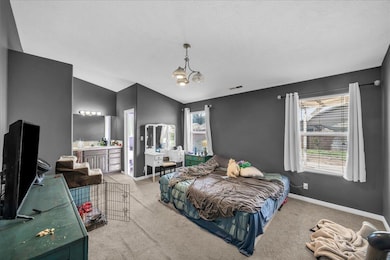
Charming single level home ideally located within walking distance to elementary school and park. Short drive to grocery stores, restaurants and more! The open floor plan features vaulted ceilings, cozy fireplace in living room and spacious bedrooms. Enjoy a fully fenced backyard with a garden area, shed and mature fruit trees. NO HOA!
Home Details
Home Type
- Single Family
Est. Annual Taxes
- $2,597
Year Built
- Built in 2001
Lot Details
- 7,841 Sq Ft Lot
- Property is Fully Fenced
- Landscaped
- Sprinkler System
Parking
- Attached Garage
Home Design
- Slab Foundation
- Tile Roof
- Stucco Exterior
- Stone Exterior Construction
Interior Spaces
- 1,616 Sq Ft Home
- 1-Story Property
- Vaulted Ceiling
- Ceiling Fan
- Gas Fireplace
- Double Pane Windows
Kitchen
- Free-Standing Range
- Dishwasher
- Disposal
Bedrooms and Bathrooms
- 3 Bedrooms
- Walk-In Closet
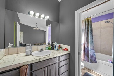
- 2 Bathrooms
- Bathtub With Separate Shower Stall
Outdoor Features
- Covered Patio or Porch
- Exterior Lighting
Schools
- Paradise Canyon Elementary School
- Snow Canyon Middle School
- Snow Canyon High School
Utilities
- Central Air
- Heating System Uses Natural Gas
Community Details
- No Home Owners Association
- Royal Oaks Subdivision
Listing and Financial Details
- Assessor Parcel Number SG-ROYL-4-68
Map
Home Values in the Area
Average Home Value in this Area
Tax History
| Year | Tax Paid | Tax Assessment Tax Assessment Total Assessment is a certain percentage of the fair market value that is determined by local assessors to be the total taxable value of land and additions on the property. | Land | Improvement |
|---|---|---|---|---|
| 2025 | $2,686 | $394,500 | $100,000 | $294,500 |
| 2023 | $2,729 | $407,800 | $100,000 | $307,800 |
| 2022 | $3,580 | $412,600 | $100,000 | $312,600 |
| 2021 | $2,666 | $307,300 | $60,000 | $247,300 |
| 2020 | $2,434 | $264,200 | $60,000 | $204,200 |
| 2019 | $2,380 | $252,400 | $60,000 | $192,400 |
| 2018 | $1,132 | $112,695 | $0 | $0 |
| 2017 | $1,049 | $101,365 | $0 | $0 |
| 2016 | $1,084 | $96,855 | $0 | $0 |
| 2015 | $1,977 | $169,500 | $0 | $0 |
| 2014 | $1,935 | $167,000 | $0 | $0 |
Property History
| Date | Event | Price | List to Sale | Price per Sq Ft |
|---|---|---|---|---|
| 11/07/2025 11/07/25 | Pending | -- | -- | -- |
| 11/03/2025 11/03/25 | For Sale | $395,000 | 0.0% | $244 / Sq Ft |
| 10/29/2025 10/29/25 | Pending | -- | -- | -- |
| 10/29/2025 10/29/25 | Price Changed | $395,000 | -6.0% | $244 / Sq Ft |
| 10/27/2025 10/27/25 | Price Changed | $420,000 | -3.4% | $260 / Sq Ft |
| 10/15/2025 10/15/25 | For Sale | $435,000 | -- | $269 / Sq Ft |
Purchase History
| Date | Type | Sale Price | Title Company |
|---|---|---|---|
| Warranty Deed | -- | Eagle Gate Title Ins Agency | |
| Interfamily Deed Transfer | -- | Mountain View Title | |
| Warranty Deed | -- | Eagle Gate Title Ins Agency | |
| Interfamily Deed Transfer | -- | None Available |
Mortgage History
| Date | Status | Loan Amount | Loan Type |
|---|---|---|---|
| Open | $219,000 | New Conventional |
Source: Washington County Board of REALTORS®
MLS Number: 25-266009
APN: 0641491
Disclaimer: Certain information contained herein is derived from information provided by parties other than Homes.com. All information provided is deemed reliable, but is not guaranteed to be accurate and should be independently verified.
![]() All information should be verified by the recipient and none is guaranteed as accurate by ARMLS
All information should be verified by the recipient and none is guaranteed as accurate by ARMLS
Listing Information presented by local MLS brokerage: Ten-X, local REALTOR®- Arlene Richardson - (888)-952-6393
- 1589 W 1270 N
- 1542 W 1270 N
- 1277 N 1610 West Cir
- 1373 N 1610 W
- 1548 W 1370 N
- 1748 W 1280 N
- 1811 W 1300 N
- 1454 N 1500 W
- 1305 N Royal Cir
- 1075 N 1400 W Unit 32
- 1360 N Dixie Downs Rd Unit 5
- 1360 N Dixie Downs Rd Unit 24
- 1360 N Dixie Downs Rd Unit 55
- 1708 W 1020 N Unit 146
- 1450 N Dixie Downs Rd Unit 151
- 1450 N Dixie Downs Rd Unit 50
- 1450 N Dixie Downs Rd Unit 24
- 1450 N Dixie Downs Rd Unit 148
- 1450 N Dixie Downs Rd Unit 84
