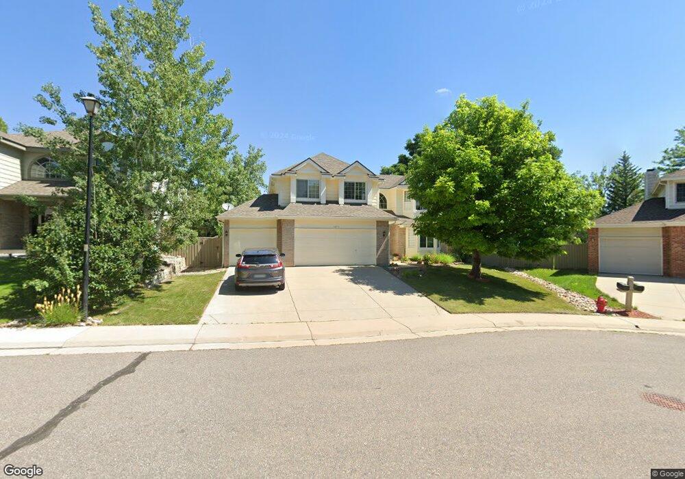
1277 Rand Way Superior, CO 80027
Estimated Value: $901,415 - $1,092,000
4
Beds
4
Baths
2,460
Sq Ft
$417/Sq Ft
Est. Value
About This Home
This home is located at 1277 Rand Way, Superior, CO 80027 and is currently estimated at $1,026,604, approximately $417 per square foot. 1277 Rand Way is a home located in Boulder County with nearby schools including Eldorado K-8 School, Superior Elementary School, and Monarch High School.
Ownership History
Date
Name
Owned For
Owner Type
Purchase Details
Closed on
May 9, 1995
Sold by
Fitch James A and Fitch Cathy L
Bought by
Abughosh Usama S
Current Estimated Value
Home Financials for this Owner
Home Financials are based on the most recent Mortgage that was taken out on this home.
Original Mortgage
$177,000
Interest Rate
8.35%
Purchase Details
Closed on
May 25, 1993
Bought by
Abughosh Usama S and Hanan Alghussian
Purchase Details
Closed on
Mar 24, 1992
Bought by
Abughosh Usama S and Hanan Alghussian
Create a Home Valuation Report for This Property
The Home Valuation Report is an in-depth analysis detailing your home's value as well as a comparison with similar homes in the area
Home Values in the Area
Average Home Value in this Area
Purchase History
| Date | Buyer | Sale Price | Title Company |
|---|---|---|---|
| Abughosh Usama S | $237,000 | -- | |
| Abughosh Usama S | $208,000 | -- | |
| Abughosh Usama S | -- | -- |
Source: Public Records
Mortgage History
| Date | Status | Borrower | Loan Amount |
|---|---|---|---|
| Closed | Abughosh Usama S | $177,000 |
Source: Public Records
Tax History Compared to Growth
Tax History
| Year | Tax Paid | Tax Assessment Tax Assessment Total Assessment is a certain percentage of the fair market value that is determined by local assessors to be the total taxable value of land and additions on the property. | Land | Improvement |
|---|---|---|---|---|
| 2025 | $5,840 | $55,762 | $23,931 | $31,831 |
| 2024 | $5,840 | $55,762 | $23,931 | $31,831 |
| 2023 | $5,760 | $56,360 | $21,239 | $38,806 |
| 2022 | $4,633 | $44,293 | $17,125 | $27,168 |
| 2021 | $4,844 | $47,969 | $18,547 | $29,422 |
| 2020 | $4,490 | $42,729 | $19,234 | $23,495 |
| 2019 | $4,427 | $42,729 | $19,234 | $23,495 |
| 2018 | $4,071 | $38,923 | $13,320 | $25,603 |
| 2017 | $4,161 | $43,032 | $14,726 | $28,306 |
| 2016 | $4,128 | $37,301 | $13,532 | $23,769 |
| 2015 | $3,923 | $32,684 | $11,701 | $20,983 |
| 2014 | $3,470 | $32,684 | $11,701 | $20,983 |
Source: Public Records
Map
Nearby Homes
- 1899 Breen Ln
- 1825 Keota Ln
- 1637 Reliance Cir
- 1812 Eldorado Dr
- 2112 Grayden Ct
- 1842 Reliance Cir
- 888 Northern Way
- 2204 Lasalle St
- 1820 Vernon Ln
- 1009 Monarch Way
- 1220 S Boyero Ct
- 977 Eldorado Dr
- 1302 Eldorado Dr
- 882 Eldorado Dr
- 1340 Stoneham St
- 1122 Eldorado Dr
- 1485 Stoneham St
- 1540 Masters Ct
- 520 Campo Way
- 1815 Spaulding Cir Unit 1815
- 1237 Rand Way
- 1297 Rand Way
- 1217 Rand Way
- 1222 Rand Way
- 1207 Rand Way
- 1212 Rand Way
- 1507 S Seibert Ct
- 1726 Alma Ln
- 1187 Rand Way
- 1508 S Seibert Ct
- 1505 S Seibert Ct
- 1746 Alma Ln
- 1245 Eldorado Dr
- 1367 Dillon Way
- 1265 Eldorado Dr
- 1225 Eldorado Dr
- 1362 Dillon Way
- 1167 Rand Way
- 1285 Eldorado Dr
- 1504 S Proctor Ct
