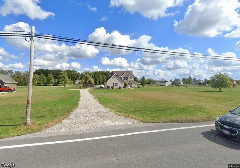
12771 State Route 301 Lagrange, OH 44050
Estimated Value: $403,956 - $497,000
4
Beds
3
Baths
1,946
Sq Ft
$235/Sq Ft
Est. Value
About This Home
This home is located at 12771 State Route 301, Lagrange, OH 44050 and is currently estimated at $456,489, approximately $234 per square foot. 12771 State Route 301 is a home located in Lorain County with nearby schools including Keystone Elementary School, Keystone Middle School, and Keystone High School.
Ownership History
Date
Name
Owned For
Owner Type
Purchase Details
Closed on
Oct 15, 2003
Sold by
Zickefoose Mary C
Bought by
Handley Daniel J and Czellath Heidi L
Current Estimated Value
Purchase Details
Closed on
Aug 21, 2000
Sold by
Colony Mtg Corp
Bought by
Zickefoose Mary C
Home Financials for this Owner
Home Financials are based on the most recent Mortgage that was taken out on this home.
Original Mortgage
$37,500
Interest Rate
8.12%
Purchase Details
Closed on
Jun 21, 2000
Sold by
Colony Mtg Corp
Bought by
Colony Mtg Corp
Create a Home Valuation Report for This Property
The Home Valuation Report is an in-depth analysis detailing your home's value as well as a comparison with similar homes in the area
Home Values in the Area
Average Home Value in this Area
Purchase History
| Date | Buyer | Sale Price | Title Company |
|---|---|---|---|
| Handley Daniel J | $51,900 | Chicago Title Insurance Co | |
| Zickefoose Mary C | $46,900 | Lorain County Title Co Inc | |
| Colony Mtg Corp | -- | -- |
Source: Public Records
Mortgage History
| Date | Status | Borrower | Loan Amount |
|---|---|---|---|
| Previous Owner | Zickefoose Mary C | $37,500 |
Source: Public Records
Tax History Compared to Growth
Tax History
| Year | Tax Paid | Tax Assessment Tax Assessment Total Assessment is a certain percentage of the fair market value that is determined by local assessors to be the total taxable value of land and additions on the property. | Land | Improvement |
|---|---|---|---|---|
| 2024 | $4,299 | $106,568 | $24,878 | $81,690 |
| 2023 | $4,198 | $85,894 | $24,129 | $61,765 |
| 2022 | $4,167 | $85,894 | $24,129 | $61,765 |
| 2021 | $4,167 | $85,894 | $24,129 | $61,765 |
| 2020 | $4,197 | $78,370 | $22,020 | $56,350 |
| 2019 | $4,170 | $78,370 | $22,020 | $56,350 |
| 2018 | $2,465 | $78,370 | $22,020 | $56,350 |
| 2017 | $3,711 | $64,830 | $18,490 | $46,340 |
| 2016 | $3,685 | $64,830 | $18,490 | $46,340 |
| 2015 | $3,623 | $64,830 | $18,490 | $46,340 |
| 2014 | $3,157 | $64,830 | $18,490 | $46,340 |
| 2013 | $3,013 | $64,830 | $18,490 | $46,340 |
Source: Public Records
Map
Nearby Homes
- 40163 Banks Rd
- 40175 Banks Rd
- 40185 Banks Rd
- 11861 Indian Hollow Rd
- 41635 Parsons Rd
- 11632 Robson Rd
- 114 River Run Dr
- 38627 Bear Creek Dr
- 10556 Lagrange Rd
- 150 River Run Dr
- 158 River Run Dr
- 40000 Myrtle Ct
- 221 River Run Dr
- 10832 Indian Hollow Rd
- 104 Willow Way
- 108 Willow Way
- 238 Leather Leaf Dr
- 414 Pheasant Run
- 1166 Hunting Hollow
- Alberti Ranch w/ Finished Basement Plan at Fox Run
- 12623 State Route 301
- 41000 Slife Rd
- 40950 Slife Rd
- 12700 Cissell Ln
- 12750 Cissell Ln
- 12597 State Route 301
- 12690 Cissell Ln
- 40900 Slife Rd
- 12597 Lagrange Rd
- 40850 Slife Rd
- 12579 State Route 301
- 12930 Lagrange Rd
- 12551 State Route 301
- 40999 Slife Rd
- 40957 Slife Rd
- 40903 Slife Rd
- 40853 Slife Rd
- 12751 Cissell Ln
- 12801 Cissell Ln
- 12793 Cissell Ln