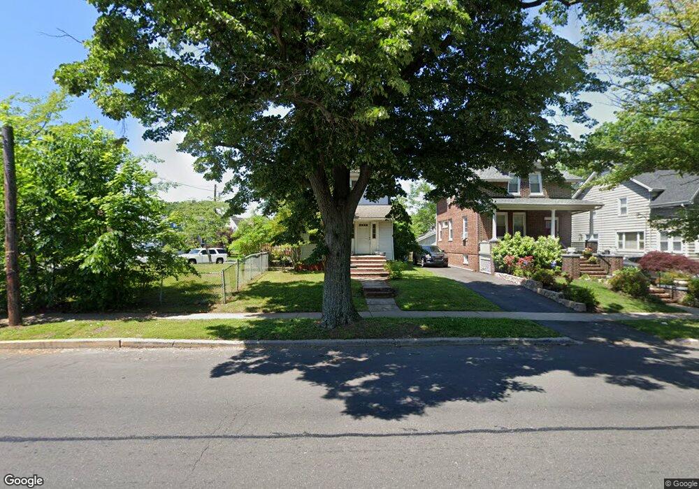
1278 Chestnut St Roselle, NJ 07203
Estimated Value: $422,926 - $512,000
Studio
--
Bath
1,200
Sq Ft
$382/Sq Ft
Est. Value
About This Home
This home is located at 1278 Chestnut St, Roselle, NJ 07203 and is currently estimated at $458,482, approximately $382 per square foot. 1278 Chestnut St is a home located in Union County with nearby schools including Dr Charles C Polk School, Grace Wilday Junior High School, and Leonard V. Moore Middle School.
Ownership History
Date
Name
Owned For
Owner Type
Purchase Details
Closed on
Sep 30, 2019
Sold by
Arrington Beverly J and Clark Beverly
Bought by
Arrington Beverly J and Clark Rashaad A
Current Estimated Value
Purchase Details
Closed on
Jun 3, 1999
Sold by
Carlo Christine and Carlo William
Bought by
Clark Beverly
Home Financials for this Owner
Home Financials are based on the most recent Mortgage that was taken out on this home.
Original Mortgage
$114,760
Outstanding Balance
$29,892
Interest Rate
6.9%
Estimated Equity
$428,590
Purchase Details
Closed on
Oct 28, 1997
Sold by
Carlo William
Bought by
Zazzarino Christine
Home Financials for this Owner
Home Financials are based on the most recent Mortgage that was taken out on this home.
Original Mortgage
$90,250
Interest Rate
7.31%
Create a Home Valuation Report for This Property
The Home Valuation Report is an in-depth analysis detailing your home's value as well as a comparison with similar homes in the area
Home Values in the Area
Average Home Value in this Area
Purchase History
| Date | Buyer | Sale Price | Title Company |
|---|---|---|---|
| Arrington Beverly J | -- | None Available | |
| Clark Beverly | $120,801 | -- | |
| Zazzarino Christine | $95,000 | Transnation Title Insurance |
Source: Public Records
Mortgage History
| Date | Status | Borrower | Loan Amount |
|---|---|---|---|
| Open | Clark Beverly | $114,760 | |
| Previous Owner | Zazzarino Christine | $90,250 |
Source: Public Records
Tax History Compared to Growth
Tax History
| Year | Tax Paid | Tax Assessment Tax Assessment Total Assessment is a certain percentage of the fair market value that is determined by local assessors to be the total taxable value of land and additions on the property. | Land | Improvement |
|---|---|---|---|---|
| 2025 | $9,095 | $104,600 | $69,800 | $34,800 |
| 2024 | $8,867 | $104,600 | $69,800 | $34,800 |
| 2023 | $8,867 | $104,600 | $69,800 | $34,800 |
| 2022 | $8,929 | $104,600 | $69,800 | $34,800 |
| 2021 | $8,875 | $104,600 | $69,800 | $34,800 |
| 2020 | $8,847 | $104,600 | $69,800 | $34,800 |
| 2019 | $8,734 | $104,600 | $69,800 | $34,800 |
| 2018 | $8,686 | $104,600 | $69,800 | $34,800 |
| 2017 | $8,640 | $104,600 | $69,800 | $34,800 |
| 2016 | $8,450 | $104,600 | $69,800 | $34,800 |
| 2015 | $8,449 | $104,600 | $69,800 | $34,800 |
| 2014 | $8,213 | $104,600 | $69,800 | $34,800 |
Source: Public Records
Map
Nearby Homes
- 115 Clark St
- 146 E 10th Ave Unit 2
- 211 E 10th Ave
- 1129 Spruce St
- 1220 Lincoln St
- 721 E Curtis St
- 812 Washington Ave
- 574 Sherman Ave
- 1202 Warren St
- 1204 Warren St
- 400 Douglas Rd
- 382 Douglas Rd
- 1809 N Wood Ave Unit D1
- 1112 Morris St
- 2209 N Wood Ave
- 902 Spruce St
- 221 Douglas Rd
- 250 E 9th Ave
- 1206 Morris St
- 806 Roselle St
- 1270 Chestnut St
- 1266 Chestnut St
- 1282 Wheatsheaf Rd
- 1286 Wheatsheaf Rd
- 1269 Wheatsheaf Rd
- 1278 Wheatsheaf Rd
- 1264 Chestnut St
- 1271 Chestnut St
- 1280 Chestnut St
- 1274 Wheatsheaf Rd
- 1269 Chestnut St
- 1265 Wheatsheaf Rd
- 1262 Chestnut St
- 1272 Wheatsheaf Rd
- 1265 Chestnut St
- 1258 Chestnut St
- 1261 Wheatsheaf Rd
- 1327 Crescent Ave
- 1335 Crescent Ave
- 1323 Crescent Ave