Estimated Value: $601,000 - $959,086
3
Beds
2
Baths
3,683
Sq Ft
$226/Sq Ft
Est. Value
About This Home
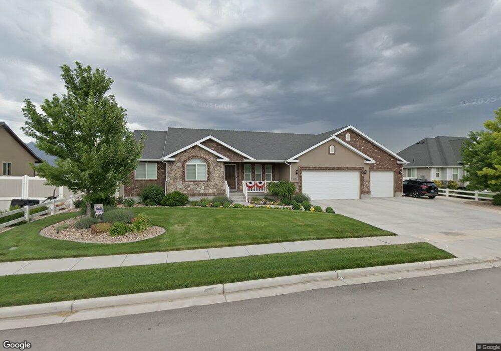
This home is located at 1278 N 1700 W Unit 3, Lehi, UT 84043 and is currently estimated at $832,522, approximately $226 per square foot. 1278 N 1700 W Unit 3 is a home located in Utah County with nearby schools including North Point Elementary School, Willowcreek Middle School, and Lehi High School.
Ownership History
Date
Name
Owned For
Owner Type
Purchase Details
Closed on
Mar 9, 2016
Sold by
Seyboldt Alan B
Bought by
Seyboldt Alan and Seyboldt Julie
Current Estimated Value
Purchase Details
Closed on
Aug 6, 2014
Sold by
Duboi9s Enterprises Inc
Bought by
J4 Development Inc
Purchase Details
Closed on
Apr 29, 2014
Sold by
Dubois Enterprises Inc
Bought by
Seyboldt Alan B and Seyboldt Julie A
Home Financials for this Owner
Home Financials are based on the most recent Mortgage that was taken out on this home.
Original Mortgage
$265,000
Interest Rate
3.87%
Mortgage Type
Adjustable Rate Mortgage/ARM
Purchase Details
Closed on
Sep 11, 2013
Sold by
Dubois Michael A and Dubois Joanne R
Bought by
Dubois Enterprises Inc
Home Financials for this Owner
Home Financials are based on the most recent Mortgage that was taken out on this home.
Original Mortgage
$203,650
Interest Rate
4.36%
Mortgage Type
Construction
Create a Home Valuation Report for This Property
The Home Valuation Report is an in-depth analysis detailing your home's value as well as a comparison with similar homes in the area
Home Values in the Area
Average Home Value in this Area
Purchase History
| Date | Buyer | Sale Price | Title Company |
|---|---|---|---|
| Seyboldt Alan | -- | None Available | |
| J4 Development Inc | -- | Provo Abstract Co | |
| Seyboldt Alan B | -- | None Available | |
| Dubois Enterprises Inc | -- | None Available |
Source: Public Records
Mortgage History
| Date | Status | Borrower | Loan Amount |
|---|---|---|---|
| Previous Owner | Seyboldt Alan B | $265,000 | |
| Previous Owner | Dubois Enterprises Inc | $203,650 |
Source: Public Records
Tax History Compared to Growth
Tax History
| Year | Tax Paid | Tax Assessment Tax Assessment Total Assessment is a certain percentage of the fair market value that is determined by local assessors to be the total taxable value of land and additions on the property. | Land | Improvement |
|---|---|---|---|---|
| 2025 | $3,554 | $472,065 | $318,200 | $540,100 |
| 2024 | $3,262 | $415,965 | $0 | $0 |
| 2023 | $3,262 | $414,535 | $0 | $0 |
| 2022 | $3,437 | $423,390 | $0 | $0 |
| 2021 | $3,068 | $571,400 | $184,100 | $387,300 |
| 2020 | $2,893 | $532,500 | $170,500 | $362,000 |
| 2019 | $2,589 | $495,400 | $170,500 | $324,900 |
| 2018 | $2,440 | $441,400 | $146,200 | $295,200 |
| 2017 | $2,401 | $230,945 | $0 | $0 |
| 2016 | $2,404 | $214,500 | $0 | $0 |
| 2015 | -- | $215,985 | $0 | $0 |
| 2014 | $1,123 | $94,600 | $0 | $0 |
Source: Public Records
Map
Nearby Homes
- 1659 W Boxwood Dr Unit 109
- 1627 W Boxwood Dr Unit 110
- 1127 N 1500 W
- 1542 N 1900 W
- 1132 Titan Dr
- 1032 Titan Dr
- 1332 W 1500 N
- 1094 W 1425 N
- 1249 W 1800 N
- 1272 W 1800 N
- 1610 N 1125 W
- 1908 N 2230 W
- 1896 N 2230 W
- 1301 N 900 W Unit 12
- 1970 N 2090 St W
- 1302 N 2450 W
- 902 W 1500 N
- 1011 W Mountain Way Unit 316
- Huntington Plan at Pioneer Meadows
- Silver Lake Plan at Pioneer Meadows