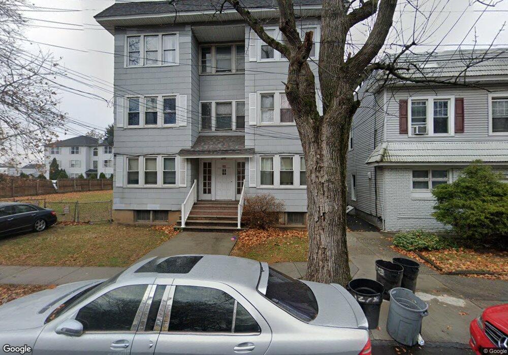
1278 N Broad St Hillside, NJ 07205
Westminster Neighborhood
--
Bed
--
Bath
--
Sq Ft
--
Built
About This Home
This home is located at 1278 N Broad St, Hillside, NJ 07205. 1278 N Broad St is a home located in Union County with nearby schools including Abram P. Morris-Saybrook Elementary School, Hurden Looker School, and Ola Edwards Community School.
Create a Home Valuation Report for This Property
The Home Valuation Report is an in-depth analysis detailing your home's value as well as a comparison with similar homes in the area
Home Values in the Area
Average Home Value in this Area
Tax History
| Year | Tax Paid | Tax Assessment Tax Assessment Total Assessment is a certain percentage of the fair market value that is determined by local assessors to be the total taxable value of land and additions on the property. | Land | Improvement |
|---|---|---|---|---|
| 2025 | $24,429 | $296,000 | $71,200 | $224,800 |
| 2024 | $23,718 | $296,000 | $71,200 | $224,800 |
Source: Public Records
Map
Nearby Homes
- 24 Hollywood Ave
- 1250 N Broad St Unit A1
- 1229 Robert St
- 1204 Salem Ave
- 1200 Salem Ave
- 137 Fairbanks St
- 1444 N Broad St
- 75 Hillside Ave
- 161 Virginia St
- 124 Woodruff Place
- 1408 Lexington Place Unit 1410
- 1504 Munn Ave
- 1379 Garfield Place
- 345 Sanford Ave
- 1018 John Glenn Dr
- 1406 Maple Ave
- 1318 State St
- 1038 Fairview Place
- 1437 Parkview Terrace
- 1414 Boa Place Unit 2
- 1280 N Broad St
- 1284 N Broad St
- 1282 N Broad St
- 16 Hollywood Ave
- 1270 N Broad St Unit 3A
- 1270 N Broad St Unit 2A
- 1270 N Broad St Unit 2B
- 1270 N Broad St Unit 2D
- 1270 N Broad St Unit 3C
- 1270 N Broad St Unit 1A
- 1270 N Broad St Unit 3D
- 1270 N Broad St Unit 3B
- 1270 N Broad St Unit 1D
- 1270 N Broad St Unit 1C
- 1270 N Broad St Unit 1B
- 1270 N Broad St
- 1288 N Broad St
- 20 Hollywood Ave
- 20 Hollywood Ave Unit 1
- 1264 N Broad St
Your Personal Tour Guide
Ask me questions while you tour the home.