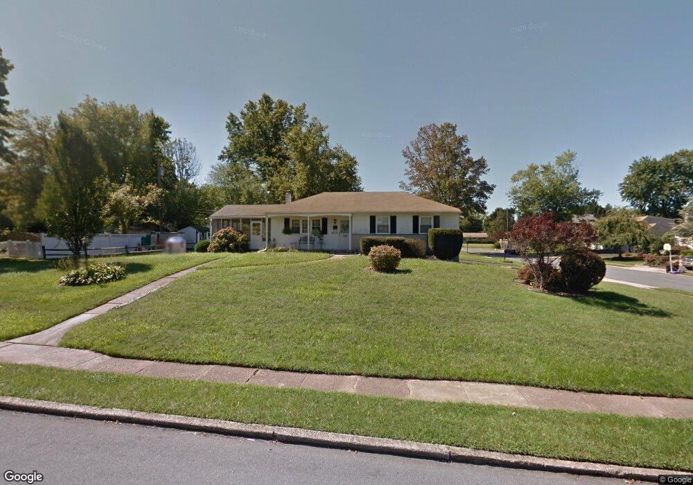
1278 Victoria Rd Warminster, PA 18974
Estimated Value: $460,000 - $508,000
3
Beds
2
Baths
1,648
Sq Ft
$292/Sq Ft
Est. Value
About This Home
This home is located at 1278 Victoria Rd, Warminster, PA 18974 and is currently estimated at $481,406, approximately $292 per square foot. 1278 Victoria Rd is a home located in Bucks County with nearby schools including Willow Dale El School, Log College Middle School, and William Tennent High School.
Ownership History
Date
Name
Owned For
Owner Type
Purchase Details
Closed on
May 17, 2000
Sold by
Meager James D and Prescott Mary Ellen
Bought by
Stanley Thomas F and Stanley Patricia A
Current Estimated Value
Home Financials for this Owner
Home Financials are based on the most recent Mortgage that was taken out on this home.
Original Mortgage
$131,200
Outstanding Balance
$45,489
Interest Rate
8.19%
Estimated Equity
$435,917
Purchase Details
Closed on
Sep 16, 1964
Bought by
Meager James A and Meager Mary E
Create a Home Valuation Report for This Property
The Home Valuation Report is an in-depth analysis detailing your home's value as well as a comparison with similar homes in the area
Home Values in the Area
Average Home Value in this Area
Purchase History
| Date | Buyer | Sale Price | Title Company |
|---|---|---|---|
| Stanley Thomas F | $164,000 | -- | |
| Meager James A | -- | -- |
Source: Public Records
Mortgage History
| Date | Status | Borrower | Loan Amount |
|---|---|---|---|
| Open | Stanley Thomas F | $131,200 |
Source: Public Records
Tax History Compared to Growth
Tax History
| Year | Tax Paid | Tax Assessment Tax Assessment Total Assessment is a certain percentage of the fair market value that is determined by local assessors to be the total taxable value of land and additions on the property. | Land | Improvement |
|---|---|---|---|---|
| 2025 | $4,812 | $22,800 | $5,040 | $17,760 |
| 2024 | $4,812 | $22,800 | $5,040 | $17,760 |
| 2023 | $4,664 | $22,800 | $5,040 | $17,760 |
| 2022 | $4,565 | $22,800 | $5,040 | $17,760 |
| 2021 | $4,458 | $22,800 | $5,040 | $17,760 |
| 2020 | $4,395 | $22,800 | $5,040 | $17,760 |
| 2019 | $4,162 | $22,800 | $5,040 | $17,760 |
| 2018 | $4,063 | $22,800 | $5,040 | $17,760 |
| 2017 | $3,943 | $22,800 | $5,040 | $17,760 |
| 2016 | $3,943 | $22,800 | $5,040 | $17,760 |
| 2015 | $3,889 | $22,800 | $5,040 | $17,760 |
| 2014 | $3,889 | $22,800 | $5,040 | $17,760 |
Source: Public Records
Map
Nearby Homes
- 1277 Beverly Rd
- 1274 Beverly Rd
- 1309 Clyde Rd
- 1130 Victoria Rd
- 64 Villa Dr Unit 206
- 159 Villa Dr Unit 91
- 100 Villa Dr Unit 224
- Faraday Plan at Liberty Ridge
- Westmont Plan at Liberty Ridge
- Northbrook Plan at Liberty Ridge
- 603 Liberty Ridge Rd
- 605 Liberty Ridge Rd
- 607 Liberty Ridge Rd
- 604 Liberty Ridge Rd
- 611 Liberty Ridge Rd
- 13 Eagle Ct
- 616 Liberty Ridge Rd
- 1002 Windsor Rd
- 1334 Mallard Cir
- 416 Aspen Ln
- 139 Kipling Dr
- 1264 Victoria Rd
- 131 Kipling Dr
- 161 Kipling Dr
- 1249 Beverly Rd
- 148 Kipling Dr
- 1265 Victoria Rd
- 140 Kipling Dr
- 169 Kipling Dr
- 1259 Beverly Rd
- 1297 Victoria Rd
- 132 Kipling Dr
- 168 Westbury Dr
- 1246 Victoria Rd
- 124 Kipling Dr
- 1248 Beverly Rd
- 177 Kipling Dr
- 176 Westbury Dr
- 143 Wellington Dr
- 1252 Beverly Rd