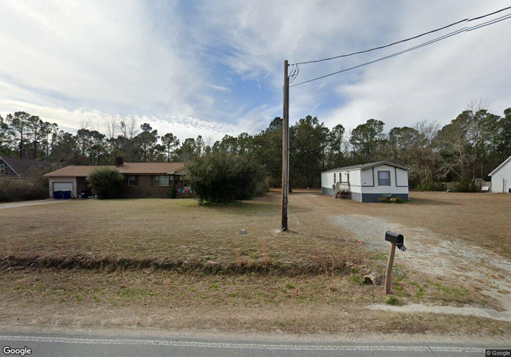
1278 Watts Landing Rd Hampstead, NC 28443
Estimated Value: $352,000 - $437,000
3
Beds
2
Baths
1,601
Sq Ft
$237/Sq Ft
Est. Value
About This Home
This home is located at 1278 Watts Landing Rd, Hampstead, NC 28443 and is currently estimated at $379,100, approximately $236 per square foot. 1278 Watts Landing Rd is a home located in Pender County with nearby schools including North Topsail Elementary School, Topsail Middle School, and Topsail High School.
Ownership History
Date
Name
Owned For
Owner Type
Purchase Details
Closed on
May 9, 2008
Sold by
Underwood James R and Underwood Georgetta
Bought by
Baribeault Mark E and Baribeault Margaret D
Current Estimated Value
Home Financials for this Owner
Home Financials are based on the most recent Mortgage that was taken out on this home.
Original Mortgage
$128,000
Outstanding Balance
$80,892
Interest Rate
5.84%
Mortgage Type
New Conventional
Estimated Equity
$298,208
Create a Home Valuation Report for This Property
The Home Valuation Report is an in-depth analysis detailing your home's value as well as a comparison with similar homes in the area
Home Values in the Area
Average Home Value in this Area
Purchase History
| Date | Buyer | Sale Price | Title Company |
|---|---|---|---|
| Baribeault Mark E | $160,000 | -- |
Source: Public Records
Mortgage History
| Date | Status | Borrower | Loan Amount |
|---|---|---|---|
| Open | Baribeault Mark E | $128,000 |
Source: Public Records
Tax History Compared to Growth
Tax History
| Year | Tax Paid | Tax Assessment Tax Assessment Total Assessment is a certain percentage of the fair market value that is determined by local assessors to be the total taxable value of land and additions on the property. | Land | Improvement |
|---|---|---|---|---|
| 2024 | $1,641 | $154,915 | $32,015 | $122,900 |
| 2023 | $1,641 | $154,915 | $32,015 | $122,900 |
| 2022 | $1,407 | $154,915 | $32,015 | $122,900 |
| 2021 | $1,517 | $154,915 | $32,015 | $122,900 |
| 2020 | $1,468 | $149,039 | $32,015 | $117,024 |
| 2019 | $1,468 | $149,039 | $32,015 | $117,024 |
| 2018 | $1,187 | $114,060 | $34,500 | $79,560 |
| 2017 | $1,187 | $114,060 | $34,500 | $79,560 |
| 2016 | $1,175 | $114,060 | $34,500 | $79,560 |
| 2015 | $1,140 | $114,060 | $34,500 | $79,560 |
| 2014 | $920 | $114,060 | $34,500 | $79,560 |
| 2013 | -- | $114,060 | $34,500 | $79,560 |
| 2012 | -- | $114,060 | $34,500 | $79,560 |
Source: Public Records
Map
Nearby Homes
- 1152 Watts Landing Rd
- 4 Watts Landing Rd
- 1134 Watts Landing Rd
- 141.83 Acres Watts Landing Rd
- 278 Batson Rd
- 105 N Alena Ct
- 101 N Alena Ct
- 104 N Alena Ct
- 202 Topsail Watch Dr
- 311 S Kingfisher Ln
- 102 Lennox Ln
- 105 Lennox Ln
- 100 Lennox Ln
- 103 Lennox Ln
- 116 E Barred Owl Dr
- 102 E Yellow Lois Dr
- 110 E Barred Owl Dr
- 166 Watts Landing Rd
- 618 Creek Dr
- 215 Anderson Dr
- 1256 Watts Landing Rd
- 1296 Watts Landing Rd
- 1240 Watts Landing Rd
- 27 Willwood Ln
- 27 Willwood Ln
- 1222 Watts Landing Rd
- 1241 Watts Landing Rd
- 10 Willwood
- 1223 Watts Landing Rd
- 2 Holly Hill Rd
- 2 Holly Hill
- 1181 Watts Landing Rd
- 514 White Oak Dr
- 89 Holly Hill Rd
- 99 Willwood Ln
- 1161 Watts Landing Rd
- 141.83acre Watts Landing Rd
- 141.83acres Watts Landing Rd
- 141.83 Watts Landing Rd
- Lot 2 Watts Landing Rd