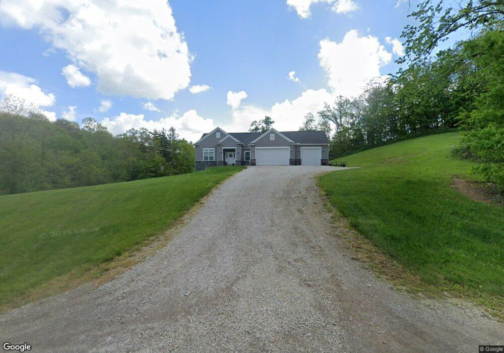
12780 Lookout Rd New Concord, OH 43762
Estimated Value: $317,000 - $452,891
3
Beds
2
Baths
1,928
Sq Ft
$209/Sq Ft
Est. Value
About This Home
This home is located at 12780 Lookout Rd, New Concord, OH 43762 and is currently estimated at $402,630, approximately $208 per square foot. 12780 Lookout Rd is a home with nearby schools including New Concord Elementary School, East Muskingum Middle School, and Larry Miller Intermediate Elementary School.
Ownership History
Date
Name
Owned For
Owner Type
Purchase Details
Closed on
Jun 7, 2016
Bought by
Kelsie Curry and Lance Curry
Current Estimated Value
Purchase Details
Closed on
May 31, 2007
Sold by
Barnett Michael A
Bought by
Barnett Patricia K
Home Financials for this Owner
Home Financials are based on the most recent Mortgage that was taken out on this home.
Original Mortgage
$107,500
Interest Rate
6.22%
Mortgage Type
New Conventional
Create a Home Valuation Report for This Property
The Home Valuation Report is an in-depth analysis detailing your home's value as well as a comparison with similar homes in the area
Home Values in the Area
Average Home Value in this Area
Purchase History
| Date | Buyer | Sale Price | Title Company |
|---|---|---|---|
| Kelsie Curry | -- | -- | |
| Barnett Patricia K | -- | Attorney |
Source: Public Records
Mortgage History
| Date | Status | Borrower | Loan Amount |
|---|---|---|---|
| Previous Owner | Barnett Patricia K | $107,500 |
Source: Public Records
Tax History Compared to Growth
Tax History
| Year | Tax Paid | Tax Assessment Tax Assessment Total Assessment is a certain percentage of the fair market value that is determined by local assessors to be the total taxable value of land and additions on the property. | Land | Improvement |
|---|---|---|---|---|
| 2024 | $4,012 | $121,415 | $12,915 | $108,500 |
| 2023 | $2,919 | $82,600 | $5,845 | $76,755 |
| 2022 | $2,856 | $82,600 | $5,845 | $76,755 |
| 2021 | $2,821 | $82,600 | $5,845 | $76,755 |
| 2020 | $2,638 | $75,075 | $5,320 | $69,755 |
| 2019 | $2,624 | $75,075 | $5,320 | $69,755 |
| 2018 | $1,347 | $75,075 | $5,320 | $69,755 |
| 2017 | $2,344 | $62,059 | $4,239 | $57,820 |
| 2016 | $139 | $3,330 | $3,330 | $0 |
| 2015 | $14 | $3,330 | $3,330 | $0 |
| 2013 | -- | $3,330 | $3,330 | $0 |
Source: Public Records
Map
Nearby Homes
- 2250 Indian Camp Run Rd
- 5580 Friendship Dr
- 6825 Barr Rd
- 68477 Geese Rd
- 67655 Geese Rd
- 0 Geese Rd
- 0 Norfield Unit 5124761
- 0 Norfield Unit 5113681
- 3688 Indian Camp Run Rd
- 64895 Lovers Lane Rd
- 0 Haught Rd Unit LOTWP001 24504411
- 0 Haught Rd
- 12985 John Glenn School Rd
- 2895 N Moose Eye Rd
- 14240 Cr 410 Lot# 58
- 1165 Friendship Dr
- 53 Paden Rd
- 930 Friendship Dr
- 760 Friendship Dr
- 7255 Mitchell Ln
- 12800 Lookout Rd
- 12870 Lookout Rd
- 13000 Lookout Rd
- 12830 Lookout Rd
- 8980 Hansel Rd
- 9400 Wharton Ln
- 8850 Hansel Rd
- 12360 Lookout Rd
- 9520 Dickson Rd
- 9480 Dickson Rd
- 9285 Dickson Rd
- 9460 Dickson Rd
- 10020 Dickson Rd
- 7905 Dickson Rd
- 9280 Dickson Rd
- 8670 Hansel Rd
- 0 Dickson Rd Unit 3273716
- 0 Dickson Rd Unit 3282168
- 12095 Lookout Rd
- 10310 Dickson Rd