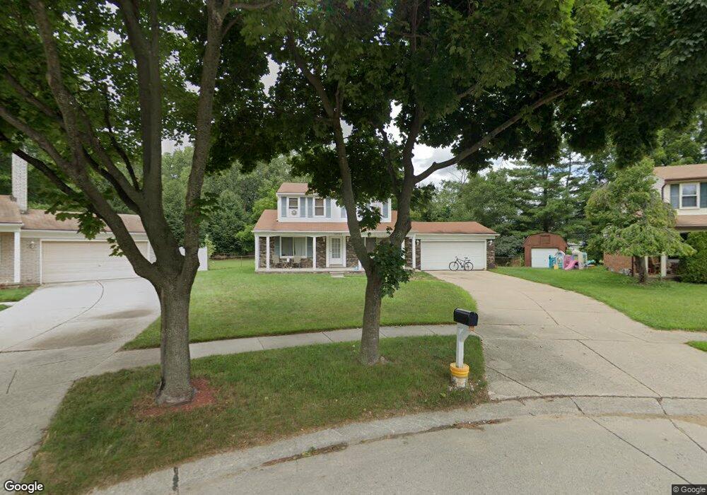
12785 Windsor Ct Sterling Heights, MI 48313
Estimated Value: $332,000 - $342,000
3
Beds
2
Baths
1,612
Sq Ft
$210/Sq Ft
Est. Value
About This Home
This home is located at 12785 Windsor Ct, Sterling Heights, MI 48313 and is currently estimated at $337,789, approximately $209 per square foot. 12785 Windsor Ct is a home located in Macomb County with nearby schools including Jack Harvey Elementary School, Bemis Junior High School, and Henry Ford II High School.
Ownership History
Date
Name
Owned For
Owner Type
Purchase Details
Closed on
Oct 21, 2009
Sold by
Indymac Federal Bank Fsb
Bought by
Us Bank National Association
Current Estimated Value
Home Financials for this Owner
Home Financials are based on the most recent Mortgage that was taken out on this home.
Original Mortgage
$112,917
Interest Rate
4.96%
Mortgage Type
FHA
Purchase Details
Closed on
Feb 27, 2009
Sold by
Arroyo Gricelda and Arroyo Roberto
Bought by
Indymac Federal Bank Fsb
Purchase Details
Closed on
Jun 9, 2004
Sold by
Primacy Closing Corp
Bought by
Arroyo Roberto and Arroyo Gricelda
Purchase Details
Closed on
May 17, 2004
Sold by
Gasparovich John M and Gasparovich Deborah A
Bought by
Primacy Closing Corp
Create a Home Valuation Report for This Property
The Home Valuation Report is an in-depth analysis detailing your home's value as well as a comparison with similar homes in the area
Home Values in the Area
Average Home Value in this Area
Purchase History
| Date | Buyer | Sale Price | Title Company |
|---|---|---|---|
| Us Bank National Association | -- | None Available | |
| Indymac Federal Bank Fsb | $135,935 | None Available | |
| Arroyo Roberto | $200,500 | First American Title | |
| Primacy Closing Corp | $200,500 | First American Title |
Source: Public Records
Mortgage History
| Date | Status | Borrower | Loan Amount |
|---|---|---|---|
| Previous Owner | Us Bank National Association | $112,917 |
Source: Public Records
Tax History Compared to Growth
Tax History
| Year | Tax Paid | Tax Assessment Tax Assessment Total Assessment is a certain percentage of the fair market value that is determined by local assessors to be the total taxable value of land and additions on the property. | Land | Improvement |
|---|---|---|---|---|
| 2025 | $4,077 | $165,200 | $0 | $0 |
| 2024 | $3,529 | $157,400 | $0 | $0 |
| 2023 | $3,363 | $143,700 | $0 | $0 |
| 2022 | $3,666 | $128,200 | $0 | $0 |
| 2021 | $3,554 | $118,500 | $0 | $0 |
| 2020 | $2,955 | $114,300 | $0 | $0 |
| 2019 | $3,210 | $109,800 | $0 | $0 |
| 2018 | $3,215 | $100,800 | $0 | $0 |
| 2017 | $3,123 | $97,400 | $17,000 | $80,400 |
| 2016 | $2,652 | $97,400 | $0 | $0 |
| 2015 | -- | $90,900 | $0 | $0 |
| 2014 | -- | $74,000 | $0 | $0 |
Source: Public Records
Map
Nearby Homes
- 12646 Bender Dr
- 41222 Paign Dr
- 13104 Carnaby Ct
- 41744 Mae Wood Dr
- 42153 Mac Rae Dr
- 13431 Melanie Dr
- 13374 Wessel Ct
- 13689 Ridgepoint Dr
- 39839 Utica Rd
- 42222 Mac Rae Dr
- 13722 Diversion Dr
- 13762 Halleck Dr
- 39400 Utica Rd
- 11716 Clinton River Rd
- 42049 Farm Lane Ct
- 42708 Wilmington Dr
- 13980 Amanda Dr
- 14160 Alpena Dr
- 11898 Lewlund Dr
- 42811 Wilmington Dr
- 12773 Windsor Ct
- 12797 Windsor Ct
- 12761 Windsor Ct
- 12815 Windsor Ct
- 12749 Windsor Ct
- 12730 Denoter Dr
- 12706 Denoter Dr
- 12827 Windsor Ct
- 12786 Windsor Ct
- 12754 Denoter Dr
- 12694 Denoter Dr
- 12737 Windsor Ct
- 12774 Windsor Ct
- 12818 Windsor Ct
- 12766 Denoter Dr
- 12682 Denoter Dr
- 12762 Windsor Ct
- 12725 Windsor Ct
- 12839 Windsor Ct
- 12830 Windsor Ct